Still here · DeKalb County · Dam inventory GA03679
Browns Mill Lake
A small private lake on Crooked Creek near Lithonia, with a 1975 dam date from the federal dam inventory and no documented builder.
From the air
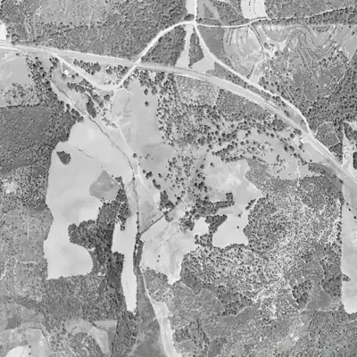
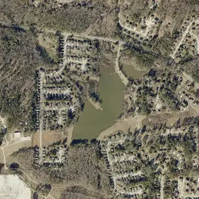
Browns Mill Lake did not exist in 1972 but is on the 1981 photo, matching its 1975 dam. No aerial from 1993 to 2026 shows it drawn down.
- First seen
- Absent in 1972 and present in 1981, which fits the 1975 dam date.
- Dam in the lidar
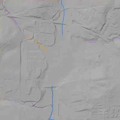
- A straight earth embankment at the south end, about 15 ft high at the center and about 465 ft long. Its crest is about 5 ft above the lake. The outlet stream leaves at the center. No breach and no separate spillway channel show on the lidar.
Read from aerial photos taken between 1940 and 2026 and from DeKalb County 2024 lidar, then checked by a second reading. How the photos were read.
Depth
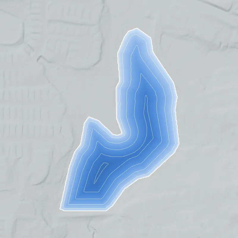
Modeled from the shoreline shape and the dam inventory’s average depth: deepest point about 10 ft. Treat it as an estimate; no survey of the lake bottom was found. How depth is estimated.
History
Browns Mill Lake is an 18-acre private lake on Crooked Creek in southeast DeKalb County, in the Lithonia/Stonecrest area. The National Inventory of Dams lists a 16-foot, 500-foot-long earth dam completed in 1975, Low hazard, last inspected in May 2005. Streets named Browns Mill Lake Road and Court serve a subdivision of the same name, whose listed homes date from 1976 onward, which is consistent with a mid-1970s lake-and-subdivision project. No builder, plat or permit was found. In August 2026 a diesel tanker overturned on nearby Browns Mill Road, and county officials reported no contamination in the lake or the South River. 123456
Who built it
Not documented. NID gives Crooked Creek as the impounded stream, a completion year of 1975, an earth dam of unknown designer, private ownership and recreation as the use. Listing data show homes in the 'Browns Mill Lake' subdivision built from 1976, so the lake and subdivision are probably from the same mid-1970s period. No developer, plat or dam permit was found, and who took the name from whom (a 'Brown's Mill' on the creek, the road, or the neighborhood) is unresolved. A Wikipedia list of historic Atlanta-area mills does not include a Brown's Mill in DeKalb. 145
Timeline
- 1975NID lists the dam as completed. NID years are often estimates, but a home in the Browns Mill Lake subdivision is recorded as built in 1976, which is consistent with a lake of about this date. Likely 145
- 1976-2000Listing data give 1976 to 2000 as the build years for homes in the Browns Mill Lake subdivision, both single-family houses and attached units. Real-estate data, not a plat or permit record. Likely 45
- May 1, 2005Most recent state inspection date recorded in the NID for the dam, on a five-year inspection cycle. No later inspection is listed. 1
- August 28, 2026A tanker carrying about 7,500 gallons of diesel overturned on Browns Mill Road at White Circle, about 0.7 km north of the dam point. Fox 5 reported stormwater there flows toward Browns Mill Lake and the South River, and that county fire officials found no contamination in the water. AJC and Atlanta News First reported most fuel stayed in the tanker and soil. WSB-TV reported fuel entering a storm drain. 6891011
Names
- Browns Mill Lake Dam
- The dam's name in the National Inventory of Dams. 1
- Browns Mill Lake (subdivision / neighborhood name)
- Listing data record 'BROWNS MILL LAKE' as the subdivision name, with Browns Mill Lake Rd (6742-6918) and Browns Mill Lake Ct (4610-4633), ZIP 30038. OpenStreetMap also labels the surrounding area 'Browns Mill Lake'. Which came first, the lake or the subdivision name, is not documented. 23411
- Browns Mill Estates
- A separate neighborhood label on a real-estate site. Its relationship to the lake is not established. 12
The dam
Per NID: earth dam, 16 ft high (15 ft hydraulic height), 500 ft long, uncontrolled spillway and outlet. Impounds about 18 surface acres (Lake-Link says 17), with 85 acre-feet normal and 163 acre-feet maximum storage. Private owner, Low hazard, condition Not Rated, no Emergency Action Plan required, designer unknown. Georgia lists it as a state-jurisdictional dam (state ID 044-055-00794); the last inspection recorded is May 1, 2005, on a five-year cycle, and the NID record was last updated April 2021. NID's drainage-area field (2,375 sq mi) is clearly an error and should be ignored. No rebuilds, repair contracts or spillway work were found. 17
- Year in the inventory
- 1975
- Dam height
- 16 ft
- Surface
- 18 acres
- Average depth
- about 4.7 ft
- Stream
- Crooked Creek
- Owner type
- Private
Figures from the U.S. Army Corps of Engineers’ National Inventory of Dams. Its “year” is often a rebuild or survey date, and average depth is storage divided by area.
Around the lake
Water
NID names Crooked Creek as the impounded stream, and an NHD-derived Crooked Creek (GNIS 325912) is mapped through the dam point. Fox 5 reported in Aug 2026 that stormwater from the Browns Mill Road area flows toward Browns Mill Lake and the South River.
Visiting
Getting there
Not confirmed as public. NID lists private ownership. The name is tied to a residential subdivision with Browns Mill Lake Road and Court, and Lake-Link lists the lake as a local fishing water without saying who may use it. Treat it as private or HOA-controlled. DeKalb's Browns Mill Park and Aquatic Center is a separate public facility on Browns Mill Road, and no source links it to the lake.
What you can see
Not verified. Browns Mill Road and neighborhood streets such as Browns Mill Lake Road are public roads near the lake, but whether the water or dam is visible from them was not checked. Stay on public streets and respect private property.
Look, don’t dig. Parks, cemeteries and preserves are off limits to digging and collecting, and private land needs the owner’s permission to enter.
Open questions
- Who built the dam and lake, when, and why: a subdivision amenity, a private estate, or something older?
- Is the 1975 NID year real? The 1976 build year of one lakeside subdivision home suggests it is close, but a plat or 1970s aerial would settle it. Was there an earlier pond or mill dam? Which Brown ran the mill the name suggests?
- Which plat created the Browns Mill Lake subdivision, and how does it relate to Browns Mill Estates?
- Who maintains the dam now (HOA or individual owner), and does Georgia EPD Safe Dams hold an inspection file newer than 2005?
- How much of the Aug 2026 diesel reached the storm drain and pond, given that reports conflict (WSB-TV and Hoodline say fuel entered a drain; AJC and Atlanta News First say it stayed in the tanker and soil)?
- Did the area's land or neighborhood history involve segregation or integration that shaped it? Nothing sourced was found.
Know something? Write to hello@historyunderfoot.org. Family papers, photos and deeds often settle these.
Where to look next
- Georgia EPD Safe Dams Program file for state ID 044-055-00794 (NID GA03679): permit, inspection reports since 2005, owner of record, any reclassification (Georgia EPD Safe Dams Program, open-records request)
- UGA 1938-40 DeKalb County historic aerials: check whether a pond or mill dam stood on Crooked Creek here before 1975 (University of Georgia Libraries, Map and Government Information Library)
- USGS topographic map editions covering this spot (GNIS places Browns Mill Lake on the Conyers quadrangle), pre-1975 versus late 1970s and 1980s, to bracket construction (USGS Historical Topographic Map Explorer (topoView))
- Subdivision plat for Browns Mill Lake and deeds for the lake parcel (DeKalb County Superior Court Clerk, Real Estate Records and plat books)
- 1970s newspaper notices of the subdivision, its developer or a mill on Browns Mill Road (Georgia Historic Newspapers (Digital Library of Georgia); DeKalb New Era and Atlanta Constitution archives)
- DeKalb County Fire Rescue and Watershed Management records of the Aug 28, 2026 diesel spill response and water testing near the lake (DeKalb County open-records request)
Sources
- National Inventory of Dams national CSV download, record GA03679 Browns Mill Lake Dam (data last updated 2026-9-23) U.S. Army Corps of Engineers, National Inventory of Dams
- Browns Mill Lake Rd, Stonecrest, Georgia (33 addresses, 6742-6918) Redfin
- Browns Mill Lake Ct, Stonecrest, Georgia (7 addresses, 4610-4633) Redfin
- 6821 Browns Mill Lake Rd, Lithonia, GA (subdivision BROWNS MILL LAKE, built 1976) Redfin
- Browns Mill Lake, Lithonia, GA neighborhood profile (homes built 1976 to 2000) neighborhoods.com
- Overturned tanker shuts down Browns Mill Road in Lithonia FOX 5 Atlanta
- Browns Mill Lake (GA) Fishing, Map and Access Lake-Link
- Tanker truck carrying 7,500 gallons of diesel overturns in DeKalb Atlanta Journal-Constitution
- Overturned tanker blocks DeKalb County road, leaks fuel into waterways Atlanta News First
- Tanker truck carrying 7500 gallons of fuel overturns, road may be closed all day WSB-TV
- White Circle, OpenStreetMap way 9170608, in the area labeled Browns Mill Lake OpenStreetMap contributors
- Browns Mill Estates, Lithonia, GA Homes for Sale Compass