Still here · DeKalb County · Dam inventory GA03927
Crooked Creek Lake
An earthen dam on Crooked Creek near Rockbridge Road that the National Inventory of Dams dates to 1987 and rated Poor, high hazard, in January 2021.
From the air
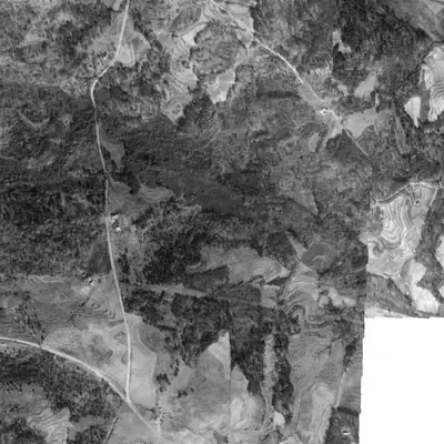
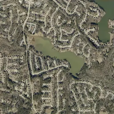
A forest valley in 1981 became a 45-acre lake with a 23-foot dam by 1993. Since 2021, a growing bar of sediment or rubble has been building where Crooked Creek enters the northwest corner.
- First seen
- The valley is forest with no lake in 1981, and a full lake with a dam shows in 1993. The state's dam inventory says 1987.
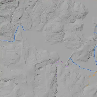
- Dam in the lidar
- A straight earthen dam along the southeast shore. The county's 2024 lidar puts the crest at about 774 feet elevation, roughly 19 to 23 feet above the ground below it. It runs about 750 to 785 feet long. No breach was found. A possible spillway, low confidence, lies around the south end.
Low water and drawdowns
- Winter 1993 (possible) possibly: The northwest end and a strip of the west shore look gray and mottled instead of open water. The pool may have been low, or that end may have been marsh or glare. Low confidence.
Read from aerial photos taken between 1940 and 2026 and from DeKalb County 2024 lidar, then checked by a second reading. How the photos were read.
Depth
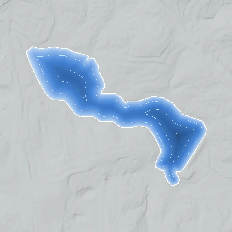
Modeled from the shoreline shape and the dam inventory’s average depth: deepest point about 16 ft. Treat it as an estimate; no survey of the lake bottom was found. How depth is estimated.
History
Crooked Creek Lake Dam is a 23-foot earthen dam on Crooked Creek in DeKalb County, a short distance from Rockbridge Road (SR 124). The National Inventory of Dams dates it to 1987, a year this project could not confirm. Georgia's Safe Dams Program regulates it. The last inventory inspection, on January 7, 2021, rated it Poor with a High hazard classification, and the inventory lists the owner type as local government. A nearby dam, Water's Edge Lake, has a similar designer entry and a 1988 date. No published history of this lake was found, so its builder, developer and any later repairs are unknown. 123
Who built it
Not documented in any source found. NID lists the primary purpose as recreation, the year completed as 1987, the dam type as earth, and the designer as WALDEN-ASHWORTH. The NID year is unverified and no builder or developer is named. A nearby dam, Water's Edge Lake (GA03928, on Mountain Creek), lists the designer as WALDON /ASHWORTH and a 1988 date, so the two may belong to one 1980s development effort. That is an inference from data patterns only, not sourced history. The dam impounds Crooked Creek (NID; the OSM stream data carries USGS GNIS id 325913). 123
Timeline
- 1987NID year completed for Crooked Creek Lake Dam. This is the inventory's stated year, not checked against any construction record, plat or permit. Uncertain 1
- 1988NID year completed for the nearby Water's Edge Lake Dam (GA03928) on Mountain Creek, about 0.4 mi northeast. Its designer entry is similar; whether both belong to one development is unverified. Uncertain 12
- January 7, 2021NID records the last inspection date and a condition assessment of Poor. The hazard classification is High and the inspection frequency is every 2 years. 1
- April 20, 2021NID data for this dam last updated. The record lists local government as owner type, recreation as purpose and the Georgia Safe Dams Program as regulator. 1
Names
The dam
NID lists an earth dam 23 ft high (hydraulic height 22 ft) and 760 ft long. It has an uncontrolled spillway and uncontrolled outlet, and a buttress core type. Maximum storage is 1,111 acre-feet, normal storage 358 acre-feet, and surface area 55 acres. For scale, an OpenStreetMap pond polygon imported from the National Hydrography Dataset, just west of the dam, measures roughly 45 acres by our calculation, so the 55-acre figure is plausible. The dam is state-regulated, permitted and inspected under the Georgia Safe Dams Program, is not federally regulated, and has a 2-year inspection frequency. NID records it as High hazard and Poor condition, with inspection and condition dates of Jan 7, 2021, and a data update on Apr 20, 2021. No rebuild, repair contract or engineering report was found. 134
- Year in the inventory
- 1987
- Dam height
- 23 ft
- Surface
- 55 acres
- Average depth
- about 6.5 ft
- Stream
- Crooked Creek
- Owner type
- Local Government
Figures from the U.S. Army Corps of Engineers’ National Inventory of Dams. Its “year” is often a rebuild or survey date, and average depth is storage divided by area.
Around the lake
Water
Crooked Creek (GNIS 325913 in OSM's NHD-derived data) runs through the site. Stone Mountain Creek (GNIS 326089) lies just east and north of the dam in the same data. The NHD reach codes for the nearby streams and pond begin 03070103.
Visiting
Getting there
Not established. NID lists local government as the owner type, which is unusual for a subdivision-style lake and was not verified. No park page, HOA page or public-access record was found. Assume no public access until confirmed with DeKalb County or the neighborhood association. The dam is in a residential area of ZIP 30058 near Fair Harbor Drive, about 0.25 mi from Rockbridge Road.
What you can see
Not verified, and nothing after the 2021 inventory update was checked. From public roads, OpenStreetMap street names such as North Shore Road, Shore Drive, Shore View and Fair Harbor Drive suggest lake-facing lots. No markers or ruins are known. Do not enter private property or walk on the dam embankment.
Look, don’t dig. Parks, cemeteries and preserves are off limits to digging and collecting, and private land needs the owner’s permission to enter.
Open questions
- Who built the dam and developed the surrounding subdivision, and when was it platted? Streets such as Stonebrook, Deshon Hills and Fair Harbor are in the area but were not tied to a plat.
- Is the 1987 NID year the construction year, the permit year or a database default?
- Why is the owner listed as local government when the nearby Water's Edge dam is private? Did DeKalb County take over the dam, or is this a data entry?
- What corrective work followed the 2021 Poor rating: a repair contract, a breach or a drawdown?
- Is the lake at its full NID extent today? The NHD pond polygon (about 45 acres) is smaller than the 55 acres in NID, and neither has been checked against recent imagery.
- Does the lake have a locally used name that differs from the NID name?
- Did the stream or the land have older mills, roads or farms before the 1980s? No source was found.
Know something? Write to hello@historyunderfoot.org. Family papers, photos and deeds often settle these.
Where to look next
- USGS topographic quads for this area (likely the Lithonia 7.5-minute quad, with Stone Mountain to the west), editions before and after 1987, to show when the pond first appears on Crooked Creek. (USGS Historical Topographic Map Collection (TopoView))
- DeKalb County plat and deed books for the subdivisions off Rockbridge Road and Fair Harbor Drive, to find the developer and the lake lot. (DeKalb County Superior Court clerk, real estate records)
- Late-1930s and 1940s aerial photography of DeKalb County, if held, to show Crooked Creek and the land use before the dam. (UGA Map and Government Information Library, historic aerial photography collection)
- Georgia EPD Safe Dams Program file for GA03927 (permit, inspection reports, emergency action plan, owner of record). (Georgia Environmental Protection Division, Safe Dams Program)
- DeKalb County Board of Commissioners agendas and contracts mentioning Crooked Creek Lake, Stonebrook or Fair Harbor dam repair. (DeKalb County Legistar and purchasing records)
- Newspaper coverage of the subdivision's opening or later dam repairs, 1985-1990 and 2020-2024. (Atlanta Journal-Constitution archive; DeKalb newspapers in Georgia Historic Newspapers, if covered)
Sources
- National Inventory of Dams record GA03927, Crooked Creek Lake Dam (FeatureServer query) US Army Corps of Engineers, National Inventory of Dams
- National Inventory of Dams record GA03928, Water's Edge Lake Dam (FeatureServer query) US Army Corps of Engineers, National Inventory of Dams
- OpenStreetMap dam way 1275458517 (Crooked Creek Lake Dam, ref:US:NID GA03927) OpenStreetMap contributors (NHD and TIGER import data)
- OpenStreetMap map data for bounding box near the dam (NHD LakePond polygon way 34441391, streams, street names, Rockbridge Road) OpenStreetMap contributors (NHD and TIGER import data)