Still here · DeKalb County · Dam inventory GA01320
Echo Lake
A 14-acre lake beside Briarcliff Road, dated to 1938, held by the Echo Lake homeowners association and repeatedly dredged to fight silt.
Watermark
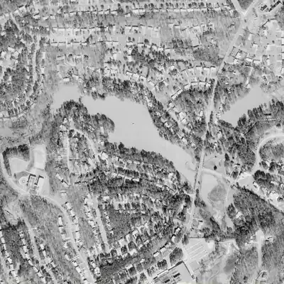
Upstream pond east of Briarcliff Road, full in 1972
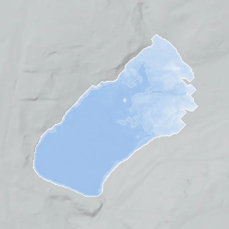
A small pond of about 5 acres held water behind a low earth embankment east of Briarcliff Road, feeding Echo Lake. Aerial photos show it open and full from 1955 through 1981, roughly 3 feet deep at its deepest.
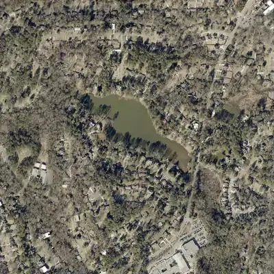
Today: Silt has turned most of the old pond into a flat marsh with only a small pond left. Echo Lake itself is still full at its old outline.
- Area
- 4.6 acres
- Deepest
- about 3 ft
- Method
- Refilled from lidar
- Checked against
- 1972 aerial
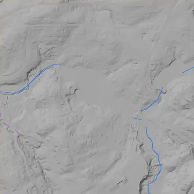
The old lakebed is still in the ground. The water was put back in the county’s lidar up to the old shoreline, with any broken dam patched, and checked against the 1972 aerial photo. Depth is only what the bare ground suggests; the buried mud bed was not measured, so the old pond may have been deeper. Its name is unconfirmed. The 1972 edges are approximate. How Watermarks work.
From the air
Echo Lake has kept the same outline since at least 1955 and probably 1940. In 1972 a second 2-acre pond sat just below the dam; by 1981 it was gone.
- First seen
- Probably present in 1940, two years after the listed 1938 dam, though that early photo is only medium confidence. Certainly present by 1955.
- Dam in the lidar
- The dam is at the northwest end of the lake, about 2,000 feet from Briarcliff Road. The county's 2024 lidar puts it roughly 15 to 16 feet high and 112 to 120 feet long. The downstream face is very steep. No breach shows, and the spillway is not distinct.
Read from aerial photos taken between 1940 and 2026 and from DeKalb County 2024 lidar, then checked by a second reading. How the photos were read.
History
Echo Lake is a roughly 14-acre impoundment on a small tributary of North Fork Peachtree Creek, next to Briarcliff Road in unincorporated DeKalb. The federal dam inventory dates the earth dam to 1938, and the homeowners' association says the Soil Conservation Service built it that year as one of five lakes. The association says it was a paid fishing lake before 1950s development, and that the lake was deeded to the community club in 1960 for ten dollars. Silt, worsened by the 1969 breach of the Simmons Lake dam upstream, has led to repeated dredging. The dam is rated High hazard, Satisfactory. 1234
Who built it
The NID lists the dam as completed in 1938, with an unknown designer and stream. The HOA's 2021 campaign document says 'Echo Lake was built in 1938 by the Soil Conservation Service' and that five lakes with earthen dams were built to control flooding and erosion in the North Fork Peachtree Creek tributary: Little Echo, Echo, Greely, Simmons and Doreen. It gives no date for the other four. That is a single, community-source claim, though the date matches the NID (which may be a guess) and the SCS existed by 1935. The HOA site says the lake was a paid fishing lake before 1950s residential development; a realtor blog adds an unsupported 'early 1900s summer retreat' story that nothing else corroborates. No plat, deed or newspaper record for construction was found. 13256
Timeline
- 1938NID lists Echo Lake Dam as completed. The HOA's 2021 campaign paper says the Soil Conservation Service built Echo Lake in 1938 as one of five earthen-dam lakes on a North Fork Peachtree Creek tributary. Likely 13
- c. 1940s-1950sThe HOA site says Echo Lake was a paid fishing lake before becoming a residential development in the 1950s. No dated newspaper or plat record was found. Uncertain 2
- 1958The Echo Lake Homeowners Association site says the association was established in 1958 and owns the lake. No founding document was seen. Likely 102
- 1960The lake was deeded to The Echo Lake Community Club, 'only ten dollars for a 16 acre lake' with the catch that it must be constantly cared for, per the HOA. The HOA says it was 20 acres then. Likely 34
- 1969The HOA says the Simmons Lake dam upstream breached in 1969, so erosion the chain of lakes was meant to contain now settles in Echo Lake. It also lists 1969 as the last big dredge, of the upper half. Likely 3
- 1976The HOA lists a dredge of 3,000 cubic yards, 300 to 400 feet from Briarcliff Road. Likely 3
- 1996The HOA lists a new dam built in 1996 with some dredging at the top of the lake. Its 2023 report says the 1996 dredge kept mud off the surface for about 20 years. Likely 34
- December 2015 and February 2016The HOA reports flooding at the Briarcliff and Briarlake intersection that stranded pedestrians and motorists and required rescue of school buses and vehicles. New flood maps put Echo Lake's whole shoreline in a high-risk zone. 11
- August 9, 2016North Briarlake Civic Association hosts a community meeting on watershed flooding with DeKalb's Planning and Sustainability director and chief engineer. The HOA post also mentions a Lakeside student earlier seriously injured by a displaced storm-drain cover in a flood. 12
- September 2016 to mid-2017Permitted three-phase dredging of the upper end and silt traps. About 10 days on site in September 2016, spoils taken as county landfill cover; final phase (about 2,300 cubic yards) was scheduled for March-April 2017 but in July 2017 the HOA was still $8,200 short of the cost. 1314
- April 7, 2017Georgia Safe Dams inspection recorded in the NID: hazard High, condition Satisfactory, two-year inspection cycle. 1
- September 20, 2017Dewberry Engineering presents the Echo Lake Sub-Basin Hydrology Study. Its three options include rebuilding the Simmons Lake dam as a dry retention area (about $955,000), against $1.4 million and $1.57 million culvert options. 15
- 2021The HOA campaign paper proposes a minimum $400,000 dredge of about 14,736 cubic yards, funded by three-year special assessments ($4,000 a year on-lake, $500 off-lake). It says the lake has lost 40 percent of its capacity since 1960. 3
- July to November 2022Dredging by Estate Management Services, Inc. removes about 9,756 cubic yards from a 4.6-acre area, then stops in November when funds run out, with about 4,000 cubic yards left. 4
Names
The dam
NID: earth dam, 13 ft high, 113 ft long, uncontrolled spillway, 147 acre-feet maximum and 100 acre-feet normal storage, 14.2 surface acres, drainage area not listed. State-regulated by Georgia Safe Dams (state ID 044-007-00172). Hazard High; condition Satisfactory as of the state inspection on April 7, 2017, on a two-year cycle; NID record updated April 20, 2021. Designer unknown. NID lists the owner type as Local Government, but the HOA site calls the lake private and says the association owns it; its 2021 paper says that over the past 25 years the county rebuilt the dam and maintained it, about a million dollars, and the campaign paper lists a 1996 new dam. No contract numbers were found. The HOA notes debris can block the spillway. 17389
- Year in the inventory
- 1938
- Dam height
- 13 ft
- Surface
- 14.2 acres
- Average depth
- about 7 ft
- Owner type
- Local Government
Figures from the U.S. Army Corps of Engineers’ National Inventory of Dams. Its “year” is often a rebuild or survey date, and average depth is storage divided by area.
Around the lake
Water
The lake sits on unnamed NHD stream segments in the North Fork Peachtree Creek tributary system, upper Chattahoochee basin. The HOA's 2017 study puts more than 1,400 acres above the lake (its 2016 post says 1,800). The Greely Lake marsh across from the lake flows into it, and the study blames heavy sediment from Simmons Lake.
Civil War
The state marker for Blake's Mill, on Shallowford Road near the North Fork of Peachtree Creek, says Blair's XVII Corps camped there on July 18, 1864, with McPherson and Blair headquartered there. Its distance from the lake was not measured, and no source ties the lake site to 1864.
Before 1861
The same marker records an antebellum mill run by John Blake (1798-1854) on the North Fork. No pre-1860 land lot, road or mill record for the lake site itself was found.
Visiting
Getting there
Private. The HOA site calls Echo Lake a private impoundment owned by the association, and there is no public access. Its directory is members-only. A 21-acre green space off Briarlake Road, bought by DeKalb County around 2016 per the HOA, is nearby; nothing sourced ties it to lake access. The HOA site was still active in 2026, but its latest dredge report is dated February 2023.
What you can see
The lake and its silted upper end can be seen from Briarcliff Road; the HOA says the silting is obvious to drivers. The dam, spillway and any old lake structures are on private ground; no marker was found.
Look, don’t dig. Parks, cemeteries and preserves are off limits to digging and collecting, and private land needs the owner’s permission to enter.
Open questions
- Who built the dam in 1938, and for whom? The HOA says the Soil Conservation Service, but no federal or county record was found.
- Where does the name Lake La Lera come from, and why does GNIS list two records for what may be one lake?
- Who owned the lake before the 1960 transfer? NID lists local government while the HOA calls it private.
- What did the 1996 dam work cost and who contracted it? No county contract number was found.
- Was the final 2017 dredge phase completed, and what happened after the 2022 stop?
- Has the county's Simmons Lake dam project, which the HOA's 2021 paper calls current, been built?
- Was there a paid fishing business, and what was its name?
Know something? Write to hello@historyunderfoot.org. Family papers, photos and deeds often settle these.
Where to look next
- DeKalb Superior Court plat and deed books: Echo Lake subdivision plats (1950s) and the 1960 lake deed to the community club (DeKalb County Clerk of Superior Court, Real Estate Division)
- 1938-40 UGA historic aerials of DeKalb County: check whether Echo Lake is already impounded and whether Simmons, Greely and Doreen lakes appear (UGA Libraries Map and Government Information Library / Digital Library of Georgia)
- Historic USGS topographic editions for the Chamblee quad, to date the lake and the neighboring chain (USGS TopoView)
- Unverified search hit: Griffin Daily News, Nov 8, 1977, page 5, returned for 'Echo Lake' and 'Simmons Lake' with DeKalb. Text unread; may not concern this lake (Georgia Historic Newspapers, Digital Library of Georgia)
- Unread search hits: The Champion (Decatur), June 2015, and Atlanta Intown, 2014, community-newspaper mentions of Echo Lake and Briarcliff (Georgia Historic Newspapers)
- Georgia Safe Dams permit and inspection file for state ID 044-007-00172, and the neighboring Simmons Lake Dam (NID GA01319, last inspected 1979), via an open records request (Georgia EPD Safe Dams Program)
- HOA's own archive, the 2021 campaign and 2023 dredge report PDFs, and the board's call for residents' photos and documents (Echo Lake HOA history page)
- Research files on north DeKalb neighborhoods, lakes and photographs (DeKalb History Center research archives)
- Soil Conservation Service records for DeKalb, 1935 to 1940 (to test the 1938 claim) (National Archives, USDA SCS records, and DeKalb Soil and Water Conservation District)
Sources
- National Inventory of Dams, GA01320 Echo Lake Dam and neighbouring record GA01319 (public FeatureServer query) U.S. Army Corps of Engineers
- History - Echo Lake Echo Lake Homeowners Association
- ELHA Campaign To Save Echo Lake (PDF, 2021) Echo Lake Homeowners Association
- Dredge Report 02-24-2023 (PDF) Echo Lake Homeowners Association
- Discover the Charm of Echo Lake (domoREALTY blog) domoREALTY
- Soil Conservation Service (Wikipedia) Wikipedia
- Maintaining Echo Lake: Leveraging the County's Support (PDF) Echo Lake Homeowners Association
- Community Collaboration to Reduce Dangerous Debris in Echo Lake (Nov 2016) Echo Lake Homeowners Association
- Safe Dams Program Georgia Environmental Protection Division
- Echo Lake (Echo Lake Homeowners Association home page) Echo Lake Homeowners Association
- County Meetings on Flooding (June 2016) Echo Lake Homeowners Association
- August community meeting about the Echo Lake watershed (flooding, storm water management) Echo Lake Homeowners Association
- Winter 2017 Newsletter (Feb 16, 2017) Echo Lake Homeowners Association
- Summer 2017 Newsletter (July 18, 2017) Echo Lake Homeowners Association
- Echo Lake Sub-Basin Hydrology Study, Community Presentation 09/20/2017 Echo Lake Homeowners Association
- Lake La Lera, GNIS feature 325975 (HometownLocator) HometownLocator (GNIS data)
- Echo Lake, GNIS feature 337896 (HometownLocator) HometownLocator (GNIS data)