Status unknown · DeKalb County · Dam inventory GA01310
Forest Lake
A privately owned, 14-acre recreation impoundment in DeKalb County, listed in the National Inventory of Dams as Forest Lake Dam, also 'Hutchins Lake'; no published history found.
From the air
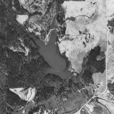
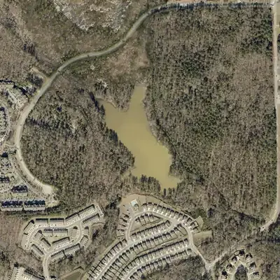
Forest Lake was already full in 1940, then shrank to mud flats in 1955 and refilled by 1968. No record of why was found.
- First seen
- Already built and full in the 1940 aerial, the earliest usable photo; the 1949 frame is blank, so nothing earlier can be checked.
- Dam in the lidar
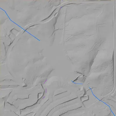
- A straight earth embankment on the southeast shore, about 250 feet along the crest (about 300 counting a broad spur to the east). The crest is about 828 feet, roughly 29 feet above the stream bed below at its tallest, but only about 16 feet at the southwest end. No breach is visible. A low saddle east of the dam may carry overflow.
Low water and drawdowns
- 1955: Pale mud flats spread across the middle and west parts, the north arm was dry except a small pool, and open water stayed near the dam and the west end. The pond upstream still held water. Whether this was a dry spell or a deliberate lowering cannot be told.
Read from aerial photos taken between 1940 and 2026 and from DeKalb County 2024 lidar, then checked by a second reading. How the photos were read.
Depth
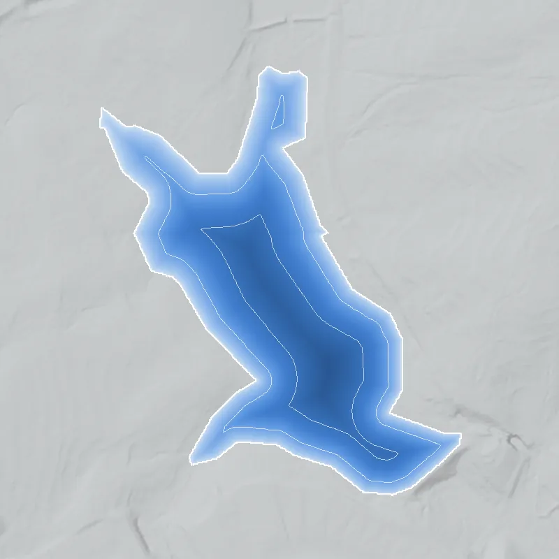
Modeled from the shoreline shape and the dam inventory’s average depth: deepest point about 15 ft. Treat it as an estimate; no survey of the lake bottom was found. How depth is estimated.
History
The National Inventory of Dams lists Forest Lake Dam (GA01310) as a privately owned earth dam in DeKalb County: 29 feet high, about 300 feet long, impounding roughly 14 surface acres and 91 acre-feet at normal pool, with an uncontrolled spillway. Its stream is recorded as Unknown, its completion year as 1912 (unverified), its hazard potential as Low and its condition as Not Rated. NID gives 'Hutchins Lake' as another name and 'MR. ADAMS' as designer. No plat, newspaper or repair record has been found, so the record is thin. 1
Who built it
Not documented beyond the NID fields: primary purpose Recreation, earth dam, completion year 1912, designer field 'MR. ADAMS', stream Unknown, drainage area about 600 acres. NID completion years are often estimates, so 1912 is unverified, and no narrative account of who built the lake or why was found. 1
Timeline
- 1912Completion year listed in the National Inventory of Dams. This is a database value, not corroborated by any document found, and may be an estimate. Uncertain 1
- May 1, 2005Last inspection date recorded in the National Inventory of Dams for Forest Lake Dam, on a listed 5-year inspection frequency. The inspection report itself was not found. 1
Names
The dam
NID: earth dam, 29 ft structural height (17 ft hydraulic height), about 300 ft long, Private owner, Low hazard potential, condition Not Rated. About 14 surface acres, 91 acre-feet normal storage, 127 acre-feet maximum storage, 600-acre drainage area. Spillway and outlet are listed as Uncontrolled. The state has jurisdiction and inspects, but the dam is not state-permitted per NID, and NID lists a last inspection of May 1, 2005 on a 5-year frequency. NID data were last updated April 20, 2021. No rebuild, drawdown or repair record was found. 1
- Year in the inventory
- 1912
- Dam height
- 29 ft
- Surface
- 14 acres
- Average depth
- about 6.5 ft
- Owner type
- Private
Figures from the U.S. Army Corps of Engineers’ National Inventory of Dams. Its “year” is often a rebuild or survey date, and average depth is storage divided by area.
Visiting
Getting there
NID lists the owner type as Private. No public access, park designation, or HOA or club ownership was confirmed. Treat it as private property unless a local source says otherwise.
What you can see
Unknown. Nothing documenting a public viewpoint, marker, spillway or ruins was found. Any view would have to be from public roads, if at all.
Look, don’t dig. Parks, cemeteries and preserves are off limits to digging and collecting, and private land needs the owner’s permission to enter.
Open questions
- Which stream does the dam impound? The NID lists it as Unknown.
- Is 1912 a real construction date or a placeholder? A 29-foot dam is sizeable for a private recreation lake, so an older mill or estate pond may have been enlarged.
- Who built it and what was it used for (club, resort, subdivision amenity, fishing)? Who is the 'MR. ADAMS' in the NID designer field?
- Where does the NID alternate name 'Hutchins Lake' come from, and was it a family or landowner name?
- Is the dam still in service, and does Georgia EPD Safe Dams hold inspection records after 2005?
- Was the lake ever tied to a segregated club or beach, or to neighborhood change nearby?
Know something? Write to hello@historyunderfoot.org. Family papers, photos and deeds often settle these.
Where to look next
- National Inventory of Dams record for GA01310, including owner, inspection dates, and any alternate names or stream field (USACE NID public viewer)
- Georgia EPD Safe Dams Program file for this dam: permit, inspection reports, hazard classification history (Georgia Environmental Protection Division, Safe Dams Program)
- UGA 1938-40 DeKalb County aerial photographs at the coordinates, to test whether a pond exists before 1940 (UGA Libraries, Map and Government Information Library, historic aerials)
- USGS topographic quadrangle editions covering the coordinates, to date when the lake first appears and what it was called (USGS historical topographic map collection)
- Deed and plat records for the parcel around the lake, to identify original builder, later owners, and any subdivision (DeKalb County Superior Court Clerk, Real Estate Division, and DeKalb County property records)
- Newspaper mentions of the lake, searched by name plus nearby road names (Georgia Historic Newspapers (Digital Library of Georgia); Atlanta Constitution archives)
- Local history collections on nearby communities and mills (DeKalb History Center archives)
Sources
- National Inventory of Dams record for GA01310 Forest Lake Dam (queried via the NID public FeatureServer, data updated 2021-04-20) U.S. Army Corps of Engineers, National Inventory of Dams
- USGS GNIS gazetteer (National Map geonames service) entries for Forest Lake and Hutchins Lake U.S. Geological Survey, The National Map