Status unknown · DeKalb County · Dam inventory GA01945
Harbin Lake
A privately owned 14-acre recreation impoundment on Johnson Creek east of Lithonia, listed in the National Inventory of Dams as Harbin Lake, also called Johnson Lake.
Watermark
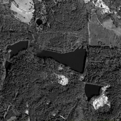
Harbin Lake, full in 1981
In 1981 Harbin Lake was a dark, full, roughly 12-acre pool behind a straight earth dam on its east side, with a long narrow arm reaching west into the woods. The dam stood about 17 feet high.
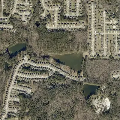
Today: Houses now line the south shore. The west arm, about 150 meters long, has silted up into a wetland. Open water is roughly 9 acres, and the dam still stands.
- Area
- 11.8 acres
- Method
- Traced from photos
- Checked against
- 1981 aerial
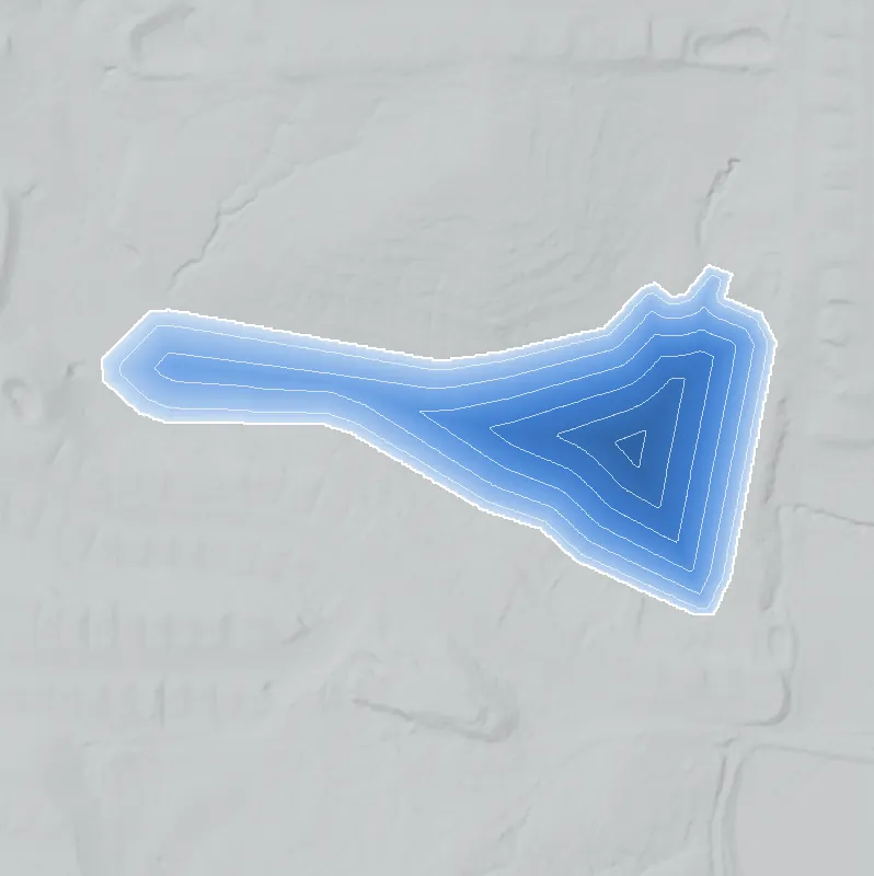
The lake was filled in or built over, so its shoreline was traced from the 1981 aerial photo. Traced from a 1981 aerial photo. Ground in the lost arm is now 3-5 feet higher, likely from silt after nearby 2000s grading. Depth was not measured. Photo edges are approximate. How Watermarks work.
From the air
In 1955 the dam already stood, but the basin looked drained or not yet filled. By 1968 it was full. Since 1972 the west end has shrunk about 500 feet into wetland.
- First seen
- In 1955 the dam and basin are already there, but the basin looks empty; the lake is first clearly full in 1968.
- Dam in the lidar
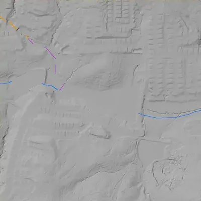
- The county's 2024 lidar survey shows an intact earth dam along the east shore. It is about 17 feet tall at its highest, with a crest near 767 to 768 feet, 3 to 4.5 feet above the lake. No breach or open spillway is visible. The outlet is probably a pipe.
Low water and drawdowns
- 1955: The basin floor looks pale, smooth and bare, with only two small pools. The lake was probably drained or drawn down, or the new dam had not yet filled (medium confidence).
Read from aerial photos taken between 1940 and 2026 and from DeKalb County 2024 lidar, then checked by a second reading. How the photos were read.
History
The National Inventory of Dams lists Harbin Lake (alternate name Johnson Lake) as a privately owned recreation dam on Johnson Creek in DeKalb County. The dam is 17 feet high and the lake covers about 14 acres, with 70 acre-feet of normal storage. The NID hazard class is Low and the condition is Not Rated. NID gives no completion year. The map point lies in the 30037 (Lithonia postal area) near Poplar Falls Avenue. No builder, date, or human history has been found in any source. 12
Who built it
Not documented. NID lists no year completed and no builder. The record gives the impounded stream as Johnson Creek and the primary use as Recreation, and it lists an owner type of Private. The original purpose, builder and date are unknown from the sources reached. 1
Names
- Johnson Lake
- Listed as the alternate name in the National Inventory of Dams record. The record does not say whether it is an older owner name, a stream-derived name, or a local usage. 1
The dam
NID lists a dam height of 17 ft, surface area of 14 acres and normal storage of 70 acre-feet. Owner type is Private, hazard potential is Low, and condition is Not Rated. NID gives no year completed, spillway details, rebuilds or contract numbers. No Georgia EPD Safe Dams file or county contract was found. 1
- Dam height
- 17 ft
- Surface
- 14 acres
- Average depth
- about 5 ft
- Stream
- Johnson Creek
- Owner type
- Private
Figures from the U.S. Army Corps of Engineers’ National Inventory of Dams. Its “year” is often a rebuild or survey date, and average depth is storage divided by area.
Around the lake
Water
NID records the stream as Johnson Creek. No source on the watershed or its receiving stream was reached, so no watershed link is stated.
Visiting
Getting there
Not verified. NID lists private ownership, which suggests no public access, but no source confirms the current owner, use or access as of 2026.
What you can see
Not verified. Nothing in the reached sources describes what can be seen from public roads. Check Poplar Falls Avenue and nearby streets on current aerial imagery, and do not enter private property.
Look, don’t dig. Parks, cemeteries and preserves are off limits to digging and collecting, and private land needs the owner’s permission to enter.
Open questions
- Who was Harbin, and who was Johnson? Which name is older, and is either a landowner, a family, or a subdivision name?
- When and by whom was the dam built, and for what purpose (farm pond, club, subdivision amenity, fishing)?
- Is the lake still full, and is it part of a subdivision common area or a single private parcel?
- Does Georgia EPD have a Safe Dams file for this dam, and why is its condition Not Rated?
- Is the creek's name tied to a Johnson family holding, and which land lot and district is the dam in?
Know something? Write to hello@historyunderfoot.org. Family papers, photos and deeds often settle these.
Where to look next
- Georgia EPD Safe Dams Program file for NID GA01945 (permit or classification records, inspection reports) (Georgia Environmental Protection Division, Safe Dams Program)
- National Inventory of Dams record for GA01945, to confirm the year completed, owner type, and any updated inspection date (USACE National Inventory of Dams)
- Earliest available aerial photography of DeKalb County (1930s-1940s): check whether a pond already exists on Johnson Creek at this point, which would place the dam before that date (University of Georgia Libraries, Map and Government Information Library, Georgia historic aerial photography)
- USGS 7.5-minute topographic editions (Lithonia and nearby quadrangles, 1950s to 1990s): compare for the first appearance of a lake symbol and any lake label (USGS Historical Topographic Map Collection (topoView))
- DeKalb County plats and deed records for the parcel, and the subdivision plat for the Poplar Falls Avenue area, to find the original tract owner and whether the lake is a common area (DeKalb County Clerk of Superior Court, real estate records)
- Georgia Historic Newspapers search for 'Harbin Lake' and 'Johnson Lake' with Lithonia or DeKalb County for club, fishing or sale notices (Digital Library of Georgia)
Sources
- National Inventory of Dams record GA01945 (Harbin Lake / Johnson Lake), as carried in the project's lake_units.json U.S. Army Corps of Engineers, National Inventory of Dams
- Nominatim reverse geocode for 33.72778, -84.07361 (Poplar Falls Avenue, DeKalb County, GA 30037) OpenStreetMap contributors