Status unknown · DeKalb County · Dam inventory GA06234
Houseworth Lake
A 14.5-acre lake behind a 21-foot dam in the Stonecrest area, listed in the National Inventory of Dams as owned by DeKalb County. Little else is documented in sources reached.

From the air
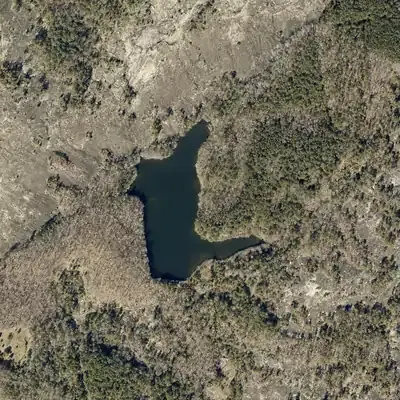
Houseworth Lake did not exist in 1993. Farm fields and woodlots filled the valley until a 22-foot dam and lake appeared between 1993 and 2001.
- First seen
- The lake first appears on the 2001 county aerial; it is absent from the 1993 photos.
- Dam in the lidar
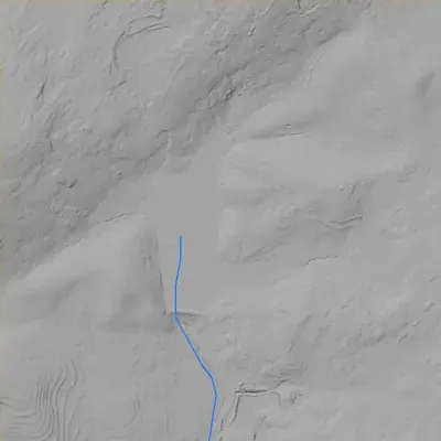
- The embankment at the south end is about 22 feet high and roughly 260 feet long. Its crest is about 787 feet above sea level, about 5 feet above the pool. It is lowest, about 3 feet above the pool, at a saddle on the east end. No breach is visible. The spillway or outlet type cannot be seen.
Read from aerial photos taken between 1940 and 2026 and from DeKalb County 2024 lidar, then checked by a second reading. How the photos were read.
Depth
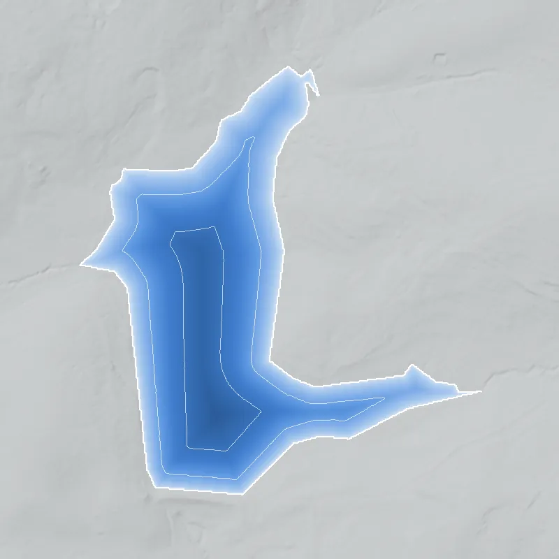
Modeled from the shoreline shape and the dam inventory’s average depth: deepest point about 14 ft. Treat it as an estimate; no survey of the lake bottom was found. How depth is estimated.
History
Houseworth Lake Dam is listed in the National Inventory of Dams (NID) at a Lithonia address in DeKalb County, with DeKalb County as owner, a 21-foot dam, a 14.5-acre surface, 87 acre-feet of normal storage and an uncontrolled spillway. NID rates it low hazard and 'Not Rated' for condition; the last recorded inspection was November 1, 2001. NID leaves the year built, stream, purpose and builder blank. Community map data (OpenStreetMap) puts the dam inside a polygon labelled 'DeKalb County greenspace' beside the Davidson-Arabia Mountain area. No newspaper, plat or county history was found, so the record is thin. 123
Who built it
Not documented in the sources reached. NID gives year completed as 'Undetermined' and leaves stream, primary purpose, designer and drainage area empty. Who built it and why is an open question. 1
Timeline
Names
The dam
NID lists a 21-foot dam and hydraulic height, with dam length recorded as 0 (no length entered). Storage is 87 acre-feet normal and 161 acre-feet maximum. Spillway and outlet are both 'Uncontrolled'; core type and foundation are 'Unlisted/Unknown'. Hazard is Low, condition is 'Not Rated', and no Emergency Action Plan is required. The record flags it as state jurisdictional with state inspection authority (5-year inspection frequency), though also 'State Regulated Dam = No'. State ID 044-110-04963. NID record last updated April 20, 2021; last inspection November 1, 2001. No rebuild, engineering work or contract records were found. 1
- Dam height
- 21 ft
- Surface
- 14.5 acres
- Average depth
- about 6 ft
- Owner type
- Local Government
Figures from the U.S. Army Corps of Engineers’ National Inventory of Dams. Its “year” is often a rebuild or survey date, and average depth is storage divided by area.
Visiting
Getting there
Not confirmed. NID lists DeKalb County (Local Government) as owner but says nothing about public access. OpenStreetMap maps the dam inside a 'DeKalb County greenspace' area, with the blue-blazed Mountain View Trail (foot only, per the map tags) within a few hundred feet, so it is likely on county open-space land. Confirm with DeKalb County before visiting.
What you can see
Not verified. OpenStreetMap shows a dam line here and older land-cover data shows a reservoir polygon, so the lake and dam likely still exist, but this was not confirmed in current imagery or on the ground. Check access with DeKalb County first.
Look, don’t dig. Parks, cemeteries and preserves are off limits to digging and collecting, and private land needs the owner’s permission to enter.
Open questions
- Who built the dam, in what year, and for what purpose (mill, farm pond, water supply, recreation, quarry or subdivision amenity)?
- What stream does it impound? NID lists none and gives a drainage area of 0.
- Who was 'Houseworth'? Was it a family, landowner, farm or subdivision, and when did DeKalb County acquire the lake?
- Is the lake part of the Davidson-Arabia Mountain Nature Preserve or separate county greenspace, and how did the county come to own it?
- Is the dam still in place, and has it been rebuilt, breached or drained? Its last recorded inspection is from 2001.
- Does the 1938-40 aerial series show a pond here, and how has the shoreline changed since?
Know something? Write to hello@historyunderfoot.org. Family papers, photos and deeds often settle these.
Where to look next
- Georgia EPD Safe Dams Program file for state dam ID 044-110-04963: inspection reports, classification history, any owner correspondence. Request through Georgia EPD. (Georgia Environmental Protection Division, Safe Dams Program; NID lists https://damsafety.org/georgia as the program site)
- UGA 1938-40 DeKalb County aerial photography, to see whether a pond existed at 33.6618, -84.1132 before county acquisition. (UGA Libraries / Digital Library of Georgia historic aerial collections)
- GSU 1949 Atlanta-area aerial series and USGS topographic map editions (Lithonia and Conyers-area quads), to date the first appearance of the impoundment and any road or building names. (Georgia State University Library aerial collection; USGS topoView)
- DeKalb County deed records and GIS parcel layer, to find the parcel's owner history and acquisition date. Use only public government records. (DeKalb County Clerk of Superior Court and DeKalb County GIS)
- DeKalb County Board of Commissioners agendas and minutes (Legistar) for acquisition, greenspace or dam maintenance actions. A title search of the Legistar API for 'Houseworth' returned nothing, so search body text and park or greenspace acquisition items instead. (DeKalb County Legistar)
- Georgia Historic Newspapers (Digital Library of Georgia) and the DeKalb History Center archives, searched for the surname Houseworth in the Lithonia, Klondike and Arabia Mountain area. (Digital Library of Georgia; DeKalb History Center)
Sources
- National Inventory of Dams full dataset (CSV export), record for Houseworth Lake Dam, NID ID GA06234; dataset last updated 2026-09-23 U.S. Army Corps of Engineers, National Inventory of Dams
- OpenStreetMap way 268795303, 'Houseworth Lake Dam' (ref:US:NID=GA06234, waterway=dam); community map data, lead only OpenStreetMap contributors
- OpenStreetMap way 362868268, 'DeKalb County greenspace' (leisure=nature_reserve), polygon that contains the dam point; community map data, lead only OpenStreetMap contributors