Still here · Fulton County · Dam inventory GA03832
Ibm Lake
A 4-acre private recreation lake with a 47-foot earthen dam in the Vinings area. The state last inspected it in 2017; the name's origin is undocumented.
From the air
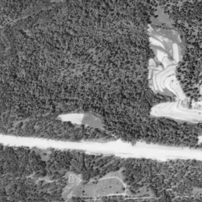
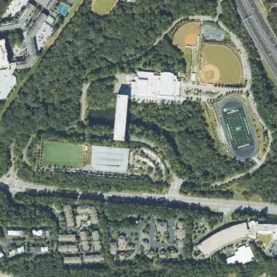
Ibm Lake did not exist in 1972. It was built by 1981 as part of a corporate campus, with a tall building put straight across the neck of the pond.
- First seen
- First seen in 1981 as a full pond; it was absent in 1972, so it was built between 1972 and 1981.
- Dam in the lidar
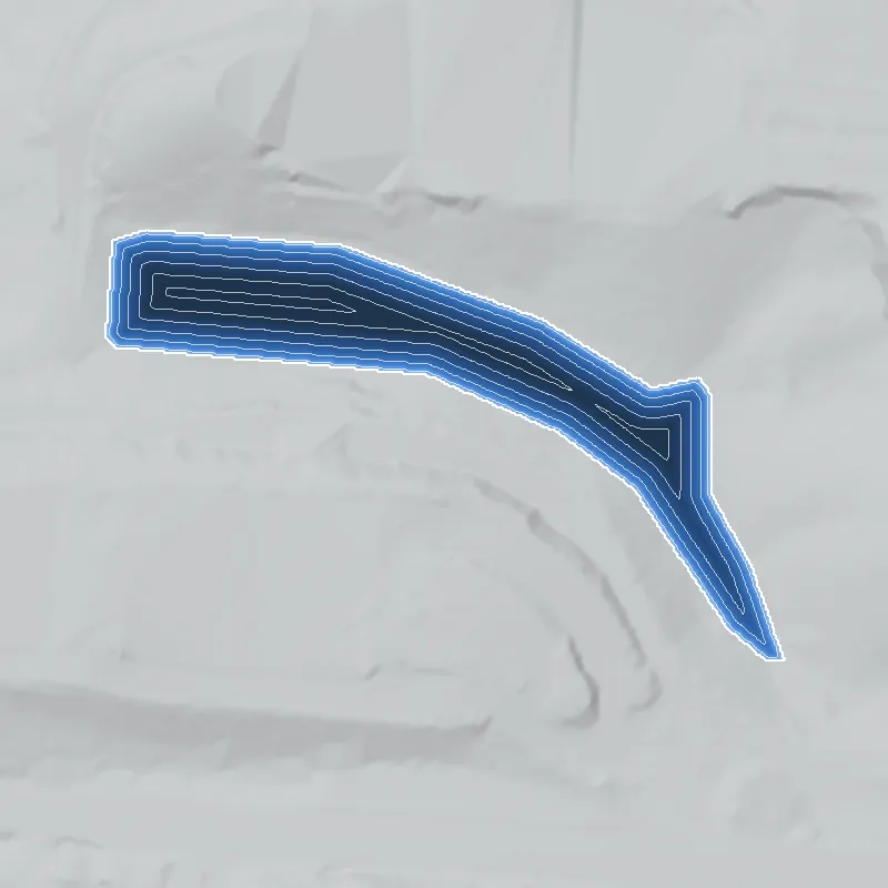
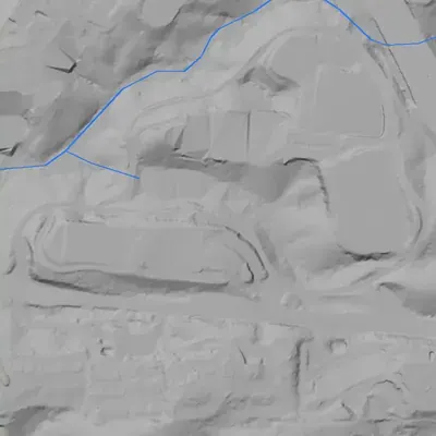
- A curved earthen dam at the west end carries the campus ring road. Its crest is about 6.6 feet above the lake. It stands roughly 40 feet above the end of its steep face and about 52 feet above the old stream channel. The crest is at least 210 feet long. No breach or open spillway shows; the outlet is probably a pipe.
Read from aerial photos taken between 1940 and 2026 and from USGS 3DEP lidar, then checked by a second reading. How the photos were read.
Depth
Modeled from the shoreline shape and the dam inventory’s average depth: deepest point about 32 ft. Treat it as an estimate; no survey of the lake bottom was found. How depth is estimated.
History
The National Inventory of Dams lists Ibm Lake Dam as a privately owned earthen recreation dam in Fulton County, with Vinings as the city. The dam is 47 feet high and 420 feet long. The lake covers about 4 acres and holds about 64 acre-feet at normal pool. The NID gives no completion year and no stream name. Hazard potential is Low and condition is Not Rated. Unlike many small ponds, it is a state-jurisdictional dam, and the NID records a state inspection on May 12, 2017. The name may point to an IBM-associated property, but no source was found for that or for who built the dam. 1
Who built it
Not documented. The NID gives no completion year (category Undetermined), lists Recreation as the only purpose and the designer as unknown. It names no impounded stream. The name Ibm Lake may refer to the IBM company, but that is unconfirmed. 1
Timeline
- May 12, 2017Most recent state inspection date recorded in the NID for this dam, which is on a 5-year inspection frequency. 1
The dam
NID data (record last updated April 20, 2021): earthen dam, 47 ft high (41 ft structural and hydraulic height), 420 ft long, about 4 surface acres, 64 acre-feet normal storage and 101 acre-feet maximum, uncontrolled spillway, Low hazard, condition Not Rated, no emergency action plan required. It is state-jurisdictional and inspected every 5 years, last on May 12, 2017. The owner is recorded as a private corporation. No rebuild history or public contract numbers were found. 1
- Dam height
- 47 ft
- Surface
- 4 acres
- Average depth
- about 16 ft
- Owner type
- Private
Figures from the U.S. Army Corps of Engineers’ National Inventory of Dams. Its “year” is often a rebuild or survey date, and average depth is storage divided by area.
Around the lake
Water
The NID lists the stream as Unknown. The pond's own drainage is unconfirmed.
Visiting
Getting there
Private ownership per the NID. Public access is not documented and none should be assumed.
What you can see
Not confirmed. No public vantage, marker or ruin is documented.
Look, don’t dig. Parks, cemeteries and preserves are off limits to digging and collecting, and private land needs the owner’s permission to enter.
Open questions
- Is Ibm Lake tied to an IBM facility or to a person or subdivision with that name?
- When was the dam built, and by whom?
- Why is a lake of about 4 acres held by a 47-foot dam?
- Which stream does it impound?
- Does it appear on the UGA 1938-40 aerials or on early USGS topo maps, and under what name?
Know something? Write to hello@historyunderfoot.org. Family papers, photos and deeds often settle these.
Where to look next
- Historic aerial photographs to see whether the lake exists before the 1950s or 1960s, and what surrounds it (USGS EarthExplorer historical aerials, and university aerial collections such as UGA's 1938-40 Georgia aerials)
- USGS topographic map editions to find when the lake first appears and whether any label names it (USGS Historical Topographic Map Collection (topoView))
- Fulton County deed, plat and corporate-property records for the parcel, to test whether IBM or another company ever held it (Fulton County Clerk of Superior Court real estate records)
- Georgia EPD Safe Dams Program file and inspection reports for state ID 060-169-04722 (Georgia Environmental Protection Division Safe Dams Program)
- Newspaper business and real-estate coverage of an IBM office, campus or recreation site in the Vinings area (Georgia Historic Newspapers (Digital Library of Georgia))
Sources
- National Inventory of Dams, national CSV export (data last updated 2026-9-23), records GA01953 and GA03832 U.S. Army Corps of Engineers, National Inventory of Dams