Still here · DeKalb County · Dam inventory GA01330
Joels Lake
A 23-acre private recreation lake at Klondike in southeast DeKalb County; the federal dam inventory lists an earth dam with a 1956 completion year.
From the air
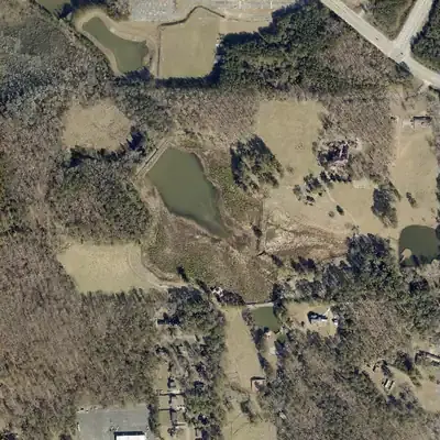
Joels Lake was drawn down about 15 feet below normal starting in winter 2022-23. By 2026 marsh plants cover much of its bed. The dam is intact.
- First seen
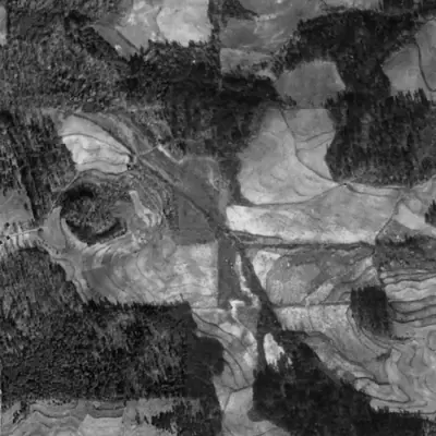
- The lake is not in the 1955 aerial, which shows a wooded valley and farm fields, but it is full in 1968.
- Dam in the lidar
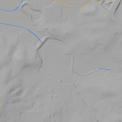
- Earth dam on the northwest shore, straight, with a level crest about 440 feet long and no breach. It is about 24 to 26 feet high at its tallest and tapers to 10 to 15 feet at the ends. The aerials show a pale slab or stone facing, probably. No spillway was found.
- Depth from the lidar
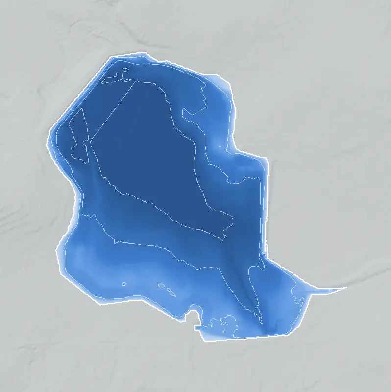
- The lidar caught the lake low, with water at about 787 feet. The bed lies at least 15 feet below the normal level of about 802 feet. That is a minimum, since the deepest parts were under water, and it depends on the normal level, which is inferred from the banks and dikes.
Low water and drawdowns
- Winter 2022-23, through at least 2026: The 2022 photo shows the main lake full. By the 2023 photo it had shrunk to a muddy pool in the northwest half, with a wide ring of bare lakebed. The Oct 2023 photo shows the deepest low, a small pool in the northwest and a dry east arm. The pool rose and fell with the seasons in 2024-2026 but never refilled. The county's 2024 lidar survey caught water about 15 feet below normal.
- Possibly 2022 (uncertain) possibly: The east arm shows a wider pale beach band and more exposed dike stones than in 2021. It may have sat a foot or two low, but no lakebed is clearly exposed.
Read from aerial photos taken between 1940 and 2026 and from DeKalb County 2024 lidar, then checked by a second reading. How the photos were read.
Depth
Measured from lidar flown while the lake was low: deepest point about 16 ft. How depth is estimated.
History
Joels Lake is a private recreation lake listed in the National Inventory of Dams (NID) as an earth dam, 27 ft high and 527 ft long, with a completion year of 1956. The NID gives about 23 surface acres and about 228 acre-feet at normal pool. The dam has an uncontrolled spillway and is rated low hazard, and Georgia lists it as a state-jurisdictional dam with inspection authority. The last inspection date on file is May 1, 2013. Only the NID record could be read, so the builders, name origin, use history and stream are unresearched. 1
Who built it
The NID gives a recreation purpose, an earth dam and a designer listed as Raymond Pitts, with 1956 as the completion year. NID completion years are often estimates, so treat 1956 as unconfirmed. The stream is recorded as 'Unknown'. The reason for building it, the builder, and where the name 'Joel' comes from were not established. 1
Timeline
Names
- Joels Lake Dam
- Structure name in the National Inventory of Dams (NID); the NID spells the lake name without an apostrophe. The NID 'Other Names' and 'Former Names' fields are blank. No other names found. 1
The dam
NID data: earth dam, 27 ft structural height, 24 ft hydraulic height, 527 ft long. Storage is 228 acre-ft normal and 250 acre-ft maximum, over about 23 acres. Spillway and outlet are both listed as uncontrolled. Hazard class is Low, condition 'Not Rated', and an emergency action plan is marked as prepared. The state is listed as having inspection authority (not permitting or enforcement authority); the last inspection on file is 05/01/2013 on a 5-year cycle, and the NID entry was last updated 04/20/2021. Georgia agency ID is 044-031-00471. The listed drainage area of 363 sq mi is implausible for a 23-acre lake and is probably a data-entry error; the true watershed size is not known. No rebuild, engineering contract or county record was looked for or found; nothing beyond the NID was searched. 1
- Year in the inventory
- 1956
- Dam height
- 27 ft
- Surface
- 23 acres
- Average depth
- about 9.9 ft
- Owner type
- Private
Figures from the U.S. Army Corps of Engineers’ National Inventory of Dams. Its “year” is often a rebuild or survey date, and average depth is storage divided by area.
Around the lake
Water
The NID lists the stream as 'Unknown', so the watershed could not be tied to a named creek from the record read. Not established.
Visiting
Getting there
Listed as privately owned in the NID, so presumably no public access. Access terms were not verified. Assume it is closed to the public and respect posted property.
What you can see
Unverified. Whether the water or dam can be seen from a public road was not checked.
Look, don’t dig. Parks, cemeteries and preserves are off limits to digging and collecting, and private land needs the owner’s permission to enter.
Open questions
- Who built the lake in the 1950s, and who was 'Joel'?
- Which stream does it impound? NID says Unknown.
- Was it a fishing, camping or swimming lake, or a club or church retreat, and did it serve a particular community?
- Is 1956 the real build year? Do 1938-40 aerials show a pond here, or 1950s and 1960s topo maps?
- What is the true drainage area? The 363 sq mi in the NID is not plausible.
Know something? Write to hello@historyunderfoot.org. Family papers, photos and deeds often settle these.
Where to look next
- UGA 1938-40 DeKalb County aerial photographs, to see whether a pond or stream valley existed before 1956 (UGA Libraries Map and Government Information Library historic aerials collection)
- USGS 7.5-minute topographic map editions covering this point (1950s-1970s), to see when the lake first appears and what it is called (USGS Historical Topographic Map Collection (topoView))
- DeKalb County plat and property records for the parcel, and any dam-construction or pond permit filings (DeKalb County Superior Court Clerk real estate records; Georgia EPD Safe Dams Program file for dam ID 044-031-00471)
- Newspaper mentions of the lake name in the 1950s-1970s, such as advertisements and church or club outings (Georgia Historic Newspapers (Digital Library of Georgia); DeKalb History Center archives)
- Community and church histories for the Klondike area (DeKalb History Center archives)
Sources
- National Inventory of Dams, national CSV export (record GA01330, Joels Lake Dam), data last updated 2026-09-23 U.S. Army Corps of Engineers, National Inventory of Dams