Still here · DeKalb County · Dam inventory GA03912
Kristina Lake
A 4-acre private lake behind a 30-foot earth dam just outside the southern edge of Stone Mountain Park, known mainly from dam-safety records.
From the air
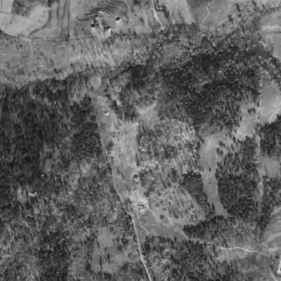
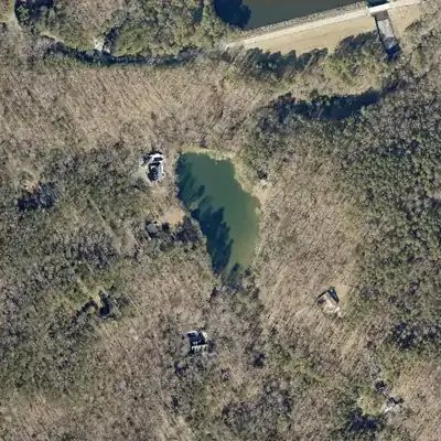
Kristina Lake was built between 1940 and 1955. It sits behind a dam about 24 to 34 feet high, just south of Stone Mountain Park's much larger dam.
- First seen
- First seen in 1955, with pale raw soil around the shore. The 1940 aerial shows only an open valley.
- Dam in the lidar
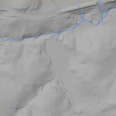
- An earth dam runs along the north shore, about 350 to 380 feet long. Its flat top is roughly 3 to 4 feet above the lake. Height is 24 to 34 feet, depending on where the base is measured; the 34-foot figure reaches down to the creek bed. No breach. An unlined spillway channel cuts the east end.
Read from aerial photos taken between 1940 and 2026 and from DeKalb County 2024 lidar, then checked by a second reading. How the photos were read.
Depth
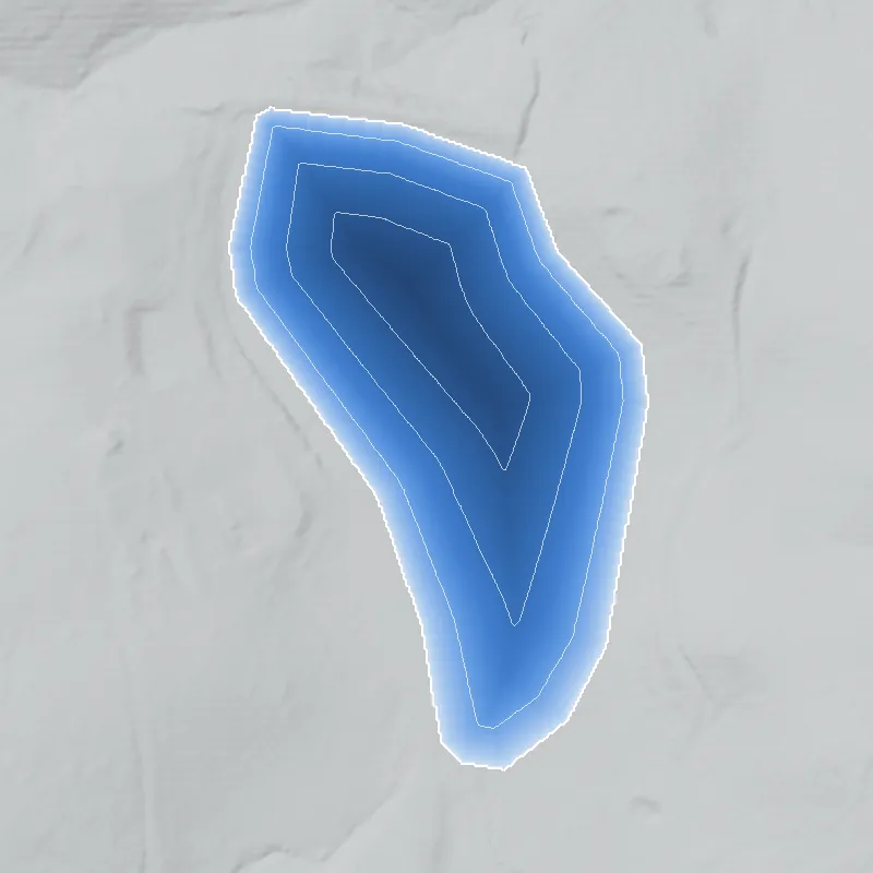
Modeled from the shoreline shape and the dam inventory’s average depth: deepest point about 19 ft. Treat it as an estimate; no survey of the lake bottom was found. How depth is estimated.
History
Kristina Lake is a roughly 4-acre impoundment with a 30-foot earth dam, mapped about 60 metres outside the southern boundary of Stone Mountain Park (by OpenStreetMap's park outline), in the Stone Mountain Creek watershed. The National Inventory of Dams lists it as private, with recreation as the purpose, no completion year or designer, and an alternate name, Cranford Lake Dam. Georgia classes it Category II, meaning no occupied structure was identified in the failure zone. The last inspection on file is May 1, 2005. I found no news story, plat, club record or engineering contract saying who built it or when. 123456
Who built it
Not documented in any source I could reach. NID lists the designer as unknown, gives no completion year, and lists recreation as the only purpose. The stream is listed as 'Unknown', but USGS watershed data place the lake in the Stone Mountain Creek subwatershed, and a named Stone Mountain Creek flowline lies within about 400 m in the NHD. Whether it began as a farm pond, an estate lake or a subdivision amenity is an open question. 146
Timeline
- May 1, 2005Most recent dam-safety inspection date recorded in the National Inventory of Dams for this dam (5-year inspection cycle). 1
- April 20, 2021NID record for the dam last updated; it still lists the condition as 'Not Rated' and hazard as Low. 1
- June 4, 2025Georgia EPD's dam inventory lists Kristina Lake Dam as Category II: 30 ft high, 53 acre-ft maximum storage. 23
Names
The dam
Earth dam, 30 ft high (23 ft hydraulic height), 360 ft long. NID storage is 35 acre-ft normal and 53 acre-ft maximum, over a 4-acre surface. Spillway and outlet are listed as uncontrolled. NID hazard class is Low and condition 'Not Rated'; the Georgia EPD inventory (June 2025) lists it as Category II. Last inspection on file is May 1, 2005, on a 5-year inspection cycle. The NID drainage area of 115 sq mi looks like a basin-scale figure, not the local catchment, and should not be relied on. The EPD inventory lists no owner name for this dam. No rebuilds or contracts found. 123
- Dam height
- 30 ft
- Surface
- 4 acres
- Average depth
- about 8.8 ft
- Owner type
- Private
Figures from the U.S. Army Corps of Engineers’ National Inventory of Dams. Its “year” is often a rebuild or survey date, and average depth is storage divided by area.
Around the lake
Water
USGS watershed data place the lake in the Stone Mountain Creek subwatershed (HUC-12 030701030306) of the Upper Yellow River, in the Upper Ocmulgee basin (HUC-8 03070103). NHDPlus tracing shows it lies downstream of both the Silver Ridge and Timber Trace lakes and runs southeast toward the Yellow River. It is within about half a kilometre of GNIS's 'Stone Mountain Park Lake'. The trace is a network snap, so treat the exact stream connection as likely.
Visiting
Getting there
Private (NID owner type 'Private'). No public access or viewing point is documented. The lake sits beside the southern edge of Stone Mountain Park, but I found nothing linking the park to this lake.
What you can see
Nothing documented for visitors. The lake is on private land near Stonewall Jackson Drive, where OpenStreetMap shows houses, so the most a visitor could do is look from a public street. I could not confirm that any part of the dam or lake is visible from one.
Look, don’t dig. Parks, cemeteries and preserves are off limits to digging and collecting, and private land needs the owner’s permission to enter.
Open questions
- Who built the dam and when? NID gives no year and no designer.
- Who was Cranford, and did the 'Cranford Lake' name come from an earlier owner or a subdivision?
- Is the lake on the Stone Mountain Creek main stem or on a small tributary? NID says the stream is 'Unknown'.
- Does the lake appear on the 1956 Stone Mountain 7.5-minute quadrangle or on 1930s-40s aerials?
- Why is the NID drainage area 115 sq mi when the local catchment must be far smaller?
Know something? Write to hello@historyunderfoot.org. Family papers, photos and deeds often settle these.
Where to look next
- USGS 1:24,000 Stone Mountain quadrangle editions (1956, 1992, 1997) to date the lake's first appearance (USGS TopoView / The National Map historical topo collection)
- 1930s-40s aerial photographs of DeKalb County, to check whether the lake existed before suburbanization (availability for DeKalb not verified; check UGA Libraries Map and Government Information and USGS EarthExplorer) (University of Georgia Libraries / USGS EarthExplorer)
- Georgia EPD Safe Dams file for state ID 044-091-00240 (construction plans, inspection reports); request through Georgia's open records process (Georgia EPD Safe Dams Program)
- DeKalb County Superior Court plat and deed records for the lake's parcel and adjacent subdivisions (DeKalb County Clerk of Superior Court, Real Estate Division)
Sources
- National Inventory of Dams: records GA03912, GA03926, GA03929, GA03930 (national CSV download, data updated 2026-09-23) U.S. Army Corps of Engineers
- Georgia Dam Inventory, updated June 4, 2025 (Excel) Georgia EPD, Safe Dams Program
- Safe Dams Program (Category I/II definitions, regulation thresholds) Georgia EPD
- National Hydrography Dataset MapServer (waterbody and flowline layers) USGS
- OpenStreetMap Nominatim geocoder (reverse and place search, incl. Stone Mountain Park outline) OpenStreetMap contributors
- Watershed Boundary Dataset MapServer (HUC-8, HUC-10, HUC-12 layers) USGS