Status unknown · DeKalb County · Dam inventory GA01315
Lower Crystal Lake
A privately owned earthen recreation dam on Snapfinger Creek in DeKalb, listed in the federal dam inventory as Lower Crystal Lake, also called Lake To-Lani.
Watermark
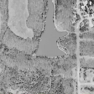
Lower Crystal Lake, full in 1972
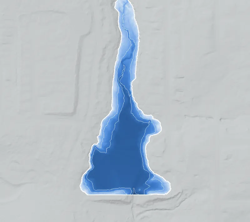
A long, narrow reservoir behind a 40-foot earthen dam on Snapfinger Creek, built about 1954. Within this frame it covered roughly 9 acres and was up to about 19 feet deep, running north past the top of the map.
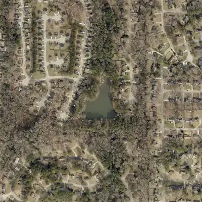
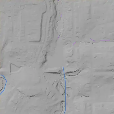
Today: The dam still stands, but a deep notch in its middle drained the reservoir by 1981. Today a shallow pond of about 2 acres sits behind it, beside a wooded, silted valley and homes.
- Area
- 9 acres
- Deepest
- about 20 ft
- Method
- Refilled from lidar
- Checked against
- 1972 aerial
The old lakebed is still in the ground. The water was put back in the county’s lidar up to the old shoreline, with any broken dam patched, and checked against the 1972 aerial photo. Pool level is estimated from the dam crest, not a recorded spillway. Shape is fitted to a 1972 photo. Regrading has changed the east shore. The lake extended beyond the map, so the acreage is a minimum. How Watermarks work.
From the air
Lower Crystal Lake was once a reservoir several times larger than today's pond. It drained between 1972 and 1981, and a roughly 40-foot dam with a deep notch in its middle still stands.
- First seen
- The 1955 aerial photo already shows a long, narrow reservoir behind a straight dam at the south end.
- Dam in the lidar
- A straight earthen dam runs east-west across the south end, about 770 feet long and roughly 40 feet high. Its crest sits near 883 to 888 feet above sea level. A V-shaped notch about 20 feet deep cuts through the center, and the outlet stream runs south through it.
Low water and drawdowns
- 1955 possibly: Pale bare bands of shore separate the water from the perimeter road, so the reservoir appears low. It may have been new and still filling. This is a medium-confidence reading.
- Between 1972 and 1981: The long reservoir seen in 1972 is gone by 1981. Only a small pool remains north of the dam, with a gullied, silty lakebed behind it. No photos in between narrow the date.
- 2005 (uncertain) possibly: Open water shows only in the south part of the outline and the rest is green. This could be a lowered pool, but an algae or plant mat fits equally well. It is not shown to be a drawdown.
Read from aerial photos taken between 1940 and 2026 and from DeKalb County 2024 lidar, then checked by a second reading. How the photos were read.
History
The National Inventory of Dams lists Lower Crystal Lake, also called Lake To-Lani, as a privately owned earthen recreation dam in DeKalb County on Snapfinger Creek. NID records a completion year of 1954, a height of 41 feet, a length of 795 feet, 104 acre-feet of storage and a 6-acre surface. Hazard potential is 'Undetermined' and condition 'Not Rated'. The name 'Lower' hints at an upper lake, but the inventory has no dam named Upper Crystal in DeKalb County. No article, plat, club history or dam contract was found, so the record supports only these inventory figures. 1
Who built it
Not documented in any source found. NID lists a private owner, recreation as the purpose, an earth dam, an unknown designer and a completion year of 1954. Who built it and why is unknown. Treat the year as approximate: 10 of 58 DeKalb dam records in NID show exactly 1950 and 5 show exactly 1960. 1
Timeline
- 1954 (per NID)National Inventory of Dams gives 1954 as the year the dam was completed. This is unverified and may be an estimate. Uncertain 1
Names
- Lake To-Lani
- Alternate name in the National Inventory of Dams (listed as 'Lake To-Lani Dam'). No historical source found explaining who used it or when. 1
The dam
NID: earth dam, 41 ft high, 795 ft long, 104 acre-ft storage, 6 surface acres, uncontrolled spillway, private owner, hazard potential 'Undetermined', condition 'Not Rated', not state regulated or jurisdictional, no inspection date and no emergency action plan required. NID's drainage-area figure (270 sq mi) is implausible for a creek dam and is not used. No rebuild or engineering records were found. 1
- Year in the inventory
- 1954
- Dam height
- 41 ft
- Surface
- 6 acres
- Stream
- Snapfinger Creek
- Owner type
- Private
Figures from the U.S. Army Corps of Engineers’ National Inventory of Dams. Its “year” is often a rebuild or survey date, and average depth is storage divided by area.
Around the lake
Water
NID lists the impounded stream as Snapfinger Creek, which flows to the South River, a tributary system that helps form the Ocmulgee River (Wikipedia, reference-level).
Visiting
Getting there
Listed as privately owned in NID (record last updated 2021). Not confirmed whether any public access exists; treat as private property unless a public source says otherwise.
What you can see
Not confirmed. The dam and lake may not be visible from public roads. Check current aerial imagery and view only from public roads.
Look, don’t dig. Parks, cemeteries and preserves are off limits to digging and collecting, and private land needs the owner’s permission to enter.
Open questions
- Who built the dam, and when? Is 1954 accurate?
- What is the story behind the name Lake To-Lani, and who used it?
- Is there an upper lake on the same creek under another name, and were the two built together?
- Did the lake serve a swim club, camp or subdivision, and what were its access rules in the segregation era?
- Has the state ever assigned the dam a hazard class?
Know something? Write to hello@historyunderfoot.org. Family papers, photos and deeds often settle these.
Where to look next
- Historic aerial photographs of DeKalb County (1930s-40s series; coverage to be confirmed), to see whether a lake existed before 1954 (UGA Libraries Map and Government Information Library / Digital Library of Georgia aerial collections)
- USGS topographic map editions, 1950s to 1970s, to date the lake and its name labels (USGS TopoView (likely Stone Mountain quadrangle))
- Newspaper searches for 'Lake To-Lani' (also try 'Tolani') and 'Crystal Lake' with Stone Mountain, Decatur or Snapfinger, 1950s onward. Note: a plain-text search of the site tokenizes the hyphenated name and returns unrelated hits, so use exact-phrase searching. (Georgia Historic Newspapers (Digital Library of Georgia))
- Deed and plat records for the parcel, to identify the developer and any club (DeKalb County Superior Court Clerk, plat and deed books)
- NID record and Georgia Safe Dams file (state ID 044-013-00359) (National Inventory of Dams; Georgia EPD Safe Dams Program)