Status unknown · DeKalb County · Dam inventory GA01957
McDaniel Lake
A 7-acre private recreation lake near Redan in DeKalb County, held by a 31-foot earth dam that NID dates to 1947 and formerly lists as Rice Lake.
From the air
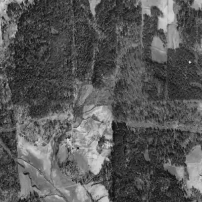
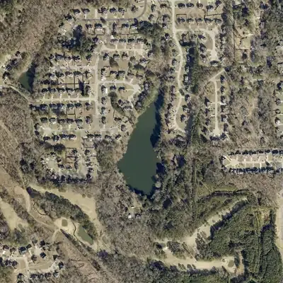
In 1940 this valley was pasture with no lake. By 1955 a 30-foot earth dam held one back, and the shoreline has barely changed since.
- First seen
- Not in the 1940 aerial; the 1955 aerial shows the lake with its dam and a track along the top.
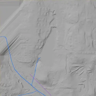
- Dam in the lidar
- An intact earth embankment at the southwest end, about 300 ft long. The top is about 874 ft above sea level, roughly 30 ft above the stream channel just below. It is lower toward the south end. No breach. A low spot at the northwest end probably serves as the overflow.
Low water and drawdowns
- 1955 possibly: Bare, gullied ground along the east and southeast shore may mean a low or not-yet-full pool. This is uncertain; it could also be new earthwork.
Read from aerial photos taken between 1940 and 2026 and from DeKalb County 2024 lidar, then checked by a second reading. How the photos were read.
Depth
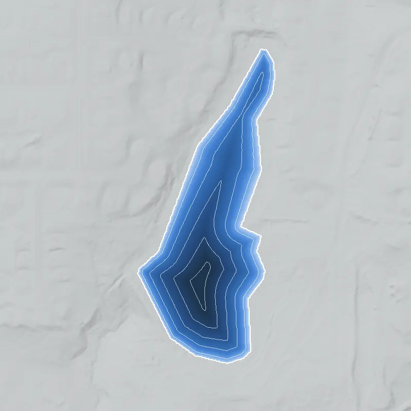
Modeled from the shoreline shape and the dam inventory’s average depth: deepest point about 28 ft. Treat it as an estimate; no survey of the lake bottom was found. How depth is estimated.
History
The only firm record is the National Inventory of Dams entry. It describes a privately owned 31-foot, 300-foot-long earth dam near Redan, dated 1947 by NID, built for recreation, impounding about 7 acres and 80 acre-feet, with an uncontrolled spillway. NID names the designer as 'Parrish & McDaniel', gives the former name as Rice Lake, and rates hazard potential Low. Condition is Not Rated, and the last listed inspection was May 2005. The stream, the builder's purpose beyond 'recreation', ownership history and present-day condition are not documented in any source reached so far. 1
Who built it
NID lists the dam as earth, completed 1947, for recreation, with 'Parrish & McDaniel' as designer, and privately owned. No source reached says who commissioned it or why, whether it was a family fishing pond, a club or a subdivision lake, or which stream it dams. NID gives the stream as 'Unknown' and the drainage area as 0, which means the field was never filled in. The 1947 year is an NID entry and could be an estimate. It should be checked against the 1949 aerials and topo maps before it is repeated as fact. 1
Timeline
- 1947NID gives 1947 as the completion year for the dam, listed under the former name Rice Lake Dam and now as McDaniel Lake Dam. Designer is given as 'Parrish & McDaniel'. NID completion years are often estimates; unverified. Uncertain 1
- May 1, 2005Last inspection date in the NID record for this dam. The condition rating is 'Not Rated' and no assessment date is given. 1
- April 20, 2021The NID record for this dam was last updated. It lists ownership as private and the dam's purpose as recreation. 1
Names
- Rice Lake (Rice Lake Dam)
- Listed as the former name (FORMER_NAMES field) in the National Inventory of Dams record for this dam. The record does not say when or why the name changed, or which name is older. 1
- McDaniel Lake Dam
- Current NID structure name, in the form used for the dam rather than the lake. 1
The dam
NID record (data updated April 20, 2021): earth dam, 31 ft high (hydraulic height 26 ft), 300 ft long. Normal storage 80 acre-feet, maximum storage 116 acre-feet, surface area 7 acres. Spillway and outlet are both 'Uncontrolled'. Hazard potential Low, condition Not Rated, inspection every 5 years, last listed inspection May 1, 2005. Georgia jurisdiction and inspection are flagged 'Yes'; state-regulated, permitting and enforcement are flagged 'No'. No rebuild years, engineering work or public contract numbers appear in the record. 1
- Year in the inventory
- 1947
- Dam height
- 31 ft
- Surface
- 7 acres
- Average depth
- about 11.4 ft
- Owner type
- Private
Figures from the U.S. Army Corps of Engineers’ National Inventory of Dams. Its “year” is often a rebuild or survey date, and average depth is storage divided by area.
Around the lake
Water
NID gives the stream as 'Unknown' and drainage area as 0, so the watershed link is unsourced. The point lies in the Redan area of DeKalb County. Which stream it feeds should be read off USGS topographic sheets.
Visiting
Getting there
Not documented. NID lists the owner type as Private, so treat it as private property with no public access unless a county or park source says otherwise.
What you can see
Unknown. The NID point is about 100 m from McDaniel Road, a public street, but no source confirms a public view of the lake or dam. Stay on public roads and do not enter private property.
Look, don’t dig. Parks, cemeteries and preserves are off limits to digging and collecting, and private land needs the owner’s permission to enter.
Open questions
- Which stream does the lake dam, and does it have a drainage area?
- Who built it in the 1940s, and was it a family pond, a club, a commercial fishing lake or a subdivision amenity? Who are Parrish and McDaniel?
- Was Rice Lake the original name, and who was Rice? When did the name change to McDaniel?
- Is 1947 the true construction date? The 1938-40 UGA DeKalb aerials and the 1949 aerials should show whether the pond existed by then.
- Does the lake and dam still exist in their NID form, and has it been inspected since 2005?
- Is McDaniel Road named for the same family as the lake, or for someone else?
Know something? Write to hello@historyunderfoot.org. Family papers, photos and deeds often settle these.
Where to look next
- 1938-40 aerial photographs of DeKalb County, to see whether the impoundment or its stream valley shows before the NID's 1947 date (UGA Map and Government Information Library / Digital Library of Georgia historic aerials)
- USGS topographic quadrangle editions covering the point (probably the Stone Mountain 7.5-minute sheet; confirm in topoView) to trace the pond's first appearance, name label and feeding stream (USGS Historical Topographic Map Collection (topoView))
- DeKalb County land plats and deed records for the parcels around McDaniel Road, giving owner names for Rice, Parrish and McDaniel (DeKalb County Clerk of Superior Court, real estate deed and plat records)
- Newspaper mentions of 'Rice Lake' or 'McDaniel Lake' near Redan (fishing, swimming, church picnics), 1940s to 1960s (Georgia Historic Newspapers at the Digital Library of Georgia; Atlanta History Center archives)
- Georgia Safe Dams Program file for state ID 044-084-01110, with inspection reports and hazard classification history (Georgia EPD Safe Dams Program, open records request)
- DeKalb History Center holdings on the Redan area and rural DeKalb ponds and mills (DeKalb History Center, Decatur)
Sources
- National Inventory of Dams, record GA01957 (Mcdaniel Lake Dam), public FeatureServer query U.S. Army Corps of Engineers