Still here · DeKalb County · Dam inventory GA03921
Mystery Valley Lake
Recreation lake with a 24-foot earth dam, locally government-owned, rated High hazard and Poor condition in its January 2021 state inspection.
From the air
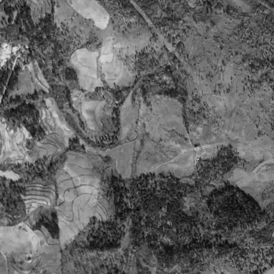
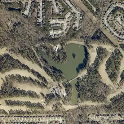
Mystery Valley Lake is older than its 1960 record suggests. It was already full in 1955, and a second pond was added below it by 1968 when the golf course went in.
- First seen
- No lake in 1940; the 1955 aerial already shows it full, so it was built in between.
- Dam in the lidar
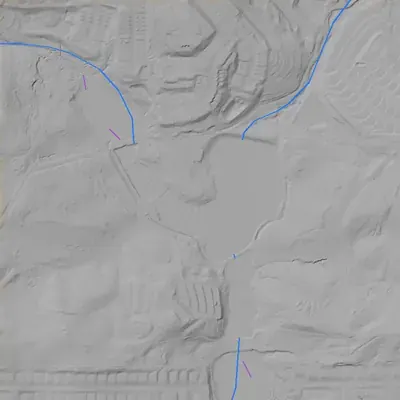
- The main dam is the straight north embankment, which carries a road. Its flat crest is about 400 feet long and roughly 12 feet above the lake. It stands about 24 feet above the ground on its north side, up to 27 feet near the east end. No breach. A spillway chute sits at its northeast end.
Read from aerial photos taken between 1940 and 2026 and from DeKalb County 2024 lidar, then checked by a second reading. How the photos were read.
Depth
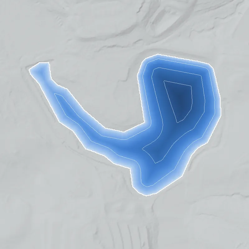
Modeled from the shoreline shape and the dam inventory’s average depth: deepest point about 19 ft. Treat it as an estimate; no survey of the lake bottom was found. How depth is estimated.
History
The public record found for Mystery Valley Lake is limited to the National Inventory of Dams (NID). It lists a 24-foot-high, 420-foot-long earth dam, an uncontrolled spillway, about 15 surface acres, 108 acre-feet of normal storage, a 1960 completion year, a designer entered as 'SCS' (probably the Soil Conservation Service), and a local-government owner. Georgia's Safe Dams Program regulates it. The last inspection and Poor condition rating listed in NID date to January 7, 2021; NID does not show any later inspection or repair. The impounded stream is recorded as 'Unknown'. No builder, club or later-work history could be sourced. 1
Who built it
NID gives 1960 as the completion year, recreation as the sole purpose, and 'SCS' as designer; that abbreviation is most likely the Soil Conservation Service but NID does not spell it out. Who built or financed the lake, and which stream it dams, are not in the record found (NID lists the stream as 'Unknown'). The completion year is an inventory entry and has not been checked against plats, aerials or newspapers. 1
Timeline
- 1960NID lists this year as the dam's completion date, with 'SCS' as designer. The year is an inventory entry, not a checked construction record. Uncertain 1
- January 7, 2021Last state inspection listed in NID, and the date of the Poor condition assessment. NID gives the inspection frequency for this High-hazard dam as every 2 years. 1
- May 13, 2024NID record for the dam last updated (source agency listed as Georgia). It still showed the January 2021 inspection as the latest. 1
Names
- Mystery Valley Lake Dam
- Name of the dam structure in the National Inventory of Dams. NID lists no other alternate names. 1
The dam
Earth dam, 24 ft high (20 ft hydraulic height), 420 ft long. Uncontrolled spillway and uncontrolled outlet. Normal storage 108 acre-ft, maximum 200 acre-ft, about 15 surface acres. Hazard class High; condition Poor, assessed January 7, 2021, on a 2-year inspection cycle. State ID 044-038-00703 under the Georgia Safe Dams Program. NID record last updated May 13, 2024. No rebuild, repair contract or engineering study was found. 1
- Year in the inventory
- 1960
- Dam height
- 24 ft
- Surface
- 15 acres
- Average depth
- about 7.2 ft
- Owner type
- Local Government
Figures from the U.S. Army Corps of Engineers’ National Inventory of Dams. Its “year” is often a rebuild or survey date, and average depth is storage divided by area.
Around the lake
Water
NID gives the stream as 'Unknown', so the watershed is not sourced here. The map's own water layer should be used for any stream link.
Visiting
Getting there
NID lists the owner type as 'Local Government' without naming the government; DeKalb County is likely but not confirmed. Public access to the shoreline or dam was not checked. If the lake is part of the Mystery Valley Golf Course, entry would likely be through the course. Confirm with DeKalb County Parks and Recreation before visiting, and stay on public land.
What you can see
Not verified. From the record alone one would expect an earth embankment about 420 ft long and an open spillway. Aerial and topo maps would show whether the lake sits beside the golf course, which the map's place-name layer suggests but does not prove.
Look, don’t dig. Parks, cemeteries and preserves are off limits to digging and collecting, and private land needs the owner’s permission to enter.
Open questions
- Is Mystery Valley Lake part of the Mystery Valley Golf Course property, and did the course and lake open together?
- Who commissioned the 1960 dam, and was the SCS role technical help to a private owner?
- When did DeKalb County (or another local government) take ownership, and by what deed or purchase?
- Which stream does the dam block, and what is the lake's watershed?
- What did the January 2021 Poor rating lead to: repairs, a drawdown, or a public contract?
- If the lake belongs to the golf course, did the course have any segregation-era policy or later integration story?
- Is 1960 the true completion date, or was the lake there earlier or later?
Know something? Write to hello@historyunderfoot.org. Family papers, photos and deeds often settle these.
Where to look next
- Georgia EPD Safe Dams Program file for dam 044-038-00703: inspection reports, permit, any Emergency Action Plan or repair order (Georgia EPD Safe Dams Program (open records request))
- 1938-40 DeKalb County aerial photographs, to check whether a pond or farm dam stood here before 1960 (UGA Map and Government Information Library, historic aerials collection)
- USGS 1:24,000 topographic map editions covering this location, before and after 1960, to date the lake (USGS Historical Topographic Map Collection)
- DeKalb County commission minutes and agendas on Mystery Valley Golf Course and Mystery Valley Lake Dam repairs, 2021 to the present (DeKalb County Legistar and Parks and Recreation)
- Newspaper coverage of the opening of Mystery Valley Golf Course and any 1960s lake, plus later county purchase (Digital Library of Georgia, Georgia Historic Newspapers; Atlanta Journal-Constitution archive)
- Plats and deeds for the tract, to trace ownership from the 1960 developer to the local government (DeKalb County Superior Court Clerk, real estate records)
- SCS/NRCS 1950s-60s conservation plans or farm-pond records for DeKalb County (NRCS Georgia or National Archives holdings on the Soil Conservation Service)
Sources
- National Inventory of Dams, record GA03921 (Mystery Valley Lake Dam), queried through the USACE public feature service U.S. Army Corps of Engineers, National Inventory of Dams