Still here · DeKalb County · Dam inventory GA03923
Norris Lake Shores
A private lake of about 107 acres on No Business Creek near the Yellow River, dug out of swampy woods by Clarence Norris and later developed by Al Corkin.
From the air
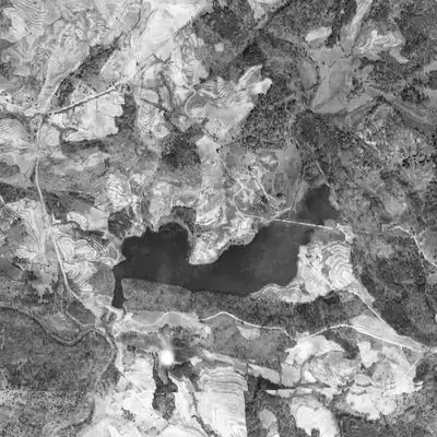
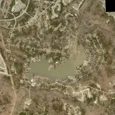
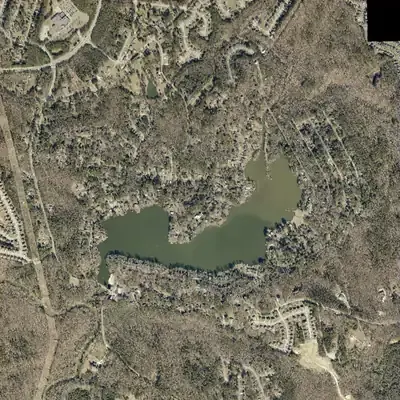
In 1955 part of the lake bed lay bare, with winding channels, just as new subdivision roads were being cut around the shore. The north end has since silted into a delta that shows in dry years.
- First seen
- A full lake with a dam at its southwest end is already visible in the 1940 aerial, ringed by plowed fields and pasture.
- Dam in the lidar
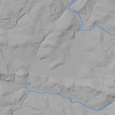
- The dam is at the southwest end. The 2024 county lidar shows a continuous crest of about 741 feet for roughly 330 feet, 6 to 7 feet above the pool. It is about 21 feet high, or 27 to 30 feet to the creek channel below. A spillway notch probably sits at the east end. No breach is visible.
Low water and drawdowns
- 1955: Pale exposed bed with meandering channels covered the central and southwest part of the west basin. Open water remained in the northwest, the east basin, the northeast cove and the southwest arm. New loop and lot roads were being cut around the lake at the same time.
- 2017 and 2025 (clearest); 2001 and winter 2023 (smaller) possibly: A mud and sand delta with a channel cut through it lay exposed across the north cove, while the main lake looked close to normal. The drop was probably a foot or two. It could be a seasonal or drought low, since no water-level records exist.
Read from aerial photos taken between 1940 and 2026 and from DeKalb County 2024 lidar, then checked by a second reading. How the photos were read.
Depth
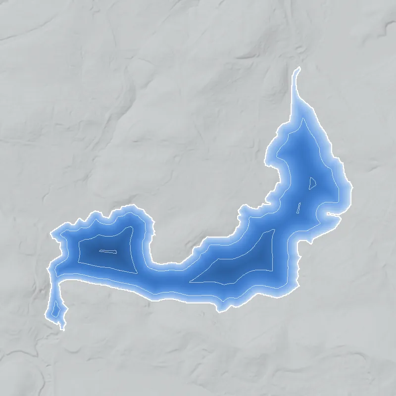
Modeled from the shoreline shape and the dam inventory’s average depth: deepest point about 15 ft. Treat it as an estimate; no survey of the lake bottom was found. How depth is estimated.
History
Norris Lake is a private lake community on No Business Creek near the Yellow River, on the DeKalb-Gwinnett line, with a Snellville mailing address. The community's own history says the site was swampy woods with a wagon road until Clarence Norris excavated it. A legacy community page says Boston businessman Al Corkin bought the lake in the early 1950s and built a residential community; Steve Freedman later handed the common property to the residents' association. The National Inventory of Dams lists a 21-foot, 291-foot-long recreation dam with no completion year. Almost nothing beyond the community's own account is in the public record I could reach. 12345
Who built it
Per the community history, the lake began as swampy terrain crossed by a wagon road down to Highway 124, and Clarence Norris excavated it, piling the dirt into a hill where the tennis courts now stand. No date for the excavation or dam is given; the legacy site places Corkin's purchase in the early 1950s, so the digging came earlier. The stream is No Business Creek, which Krakow says rises at Snellville in Gwinnett County and flows south into Norris Lake on the Yellow River. The NID leaves the completion year blank and lists recreation as the primary purpose. 1265
Timeline
- Undated, before the early 1950sClarence Norris excavates the swampy site, piling the spoil into a hill where the tennis courts now stand. A wagon road ran through the woods to Highway 124. The community history gives no year. Likely 12
- UndatedAn ice house is built near the dam, and water is supplied to the community at $10 per home, payable every three months. The well belonged to Col. Smith, per the community history. 12
- Early 1950s (the history says 'mid 20th century')Al Corkin, owner of a Boston, Massachusetts firm, buys the lake and surrounding land and develops it as a residential community, designating three lots for a church. 12
- October 25, 1964Founding service of Norris Lake Presbyterian Church, with 23 charter members, according to the legacy community website. The church was built on Corkin's designated lots plus three more bought for it. 2
- UndatedSteve Freedman develops the community further, then transfers ownership of the common property to the homeowners' association. 12
- May 23, 1998A new pool across Lake Drive opens, with a celebration on May 30. The original pool had been filled in and replaced by a toddlers' playground. 12
- January 1999Friends of Norris Lake, a volunteer nonprofit separate from the Community Benefits Corporation, is formed by homeowners seeking ways to fund lake maintenance. 4
- June 2025Georgia EPD's dam inventory lists Norris Lake Shores Dam as Category II, 21 ft high, 920 acre-feet maximum storage. 8
Names
- Norris Lake
- Name used by the community association and its history page. The project's unit data also carries it as the NID alternate name, though the raw NID extract field is blank. Local name for both the lake and the neighborhood. 135
- Norris Lake Shores Dam
- Official dam name in both the National Inventory of Dams and the Georgia EPD dam inventory (June 2025). 58
- Norris Lake Community Benefits Corporation
- Mandatory-membership community association that runs the shared property, including the lake. Not a lake name, but the body that carries the name today. 3
The dam
NID: Norris Lake Shores Dam, 21 ft high, 291 ft long, 111 surface acres, 920 acre-feet of maximum storage, private owner, recreation purpose, Low hazard potential, condition Not Rated, no year completed and no modification years. NID's drainage-area field reads 9,000, which cannot be square miles (NID's usual unit) and may be acres or a data-entry error, so it is not relied on. Georgia EPD's June 2025 inventory lists the dam as Category II (state ID 044-022-00660), which EPD defines as no occupied structure identified in the failure zone. EPD regulates dams at least 25 ft tall or storing at least 100 acre-feet; at 21 ft this one qualifies by storage. No rebuild, drawdown, spillway or engineering record was found in the sources I could reach. The lake is 111 acres in NID and 106.7 acres in the community's and FONL's descriptions. 34578
- Dam height
- 21 ft
- Surface
- 111 acres
- Stream
- No Business Creek
- Owner type
- Private
Figures from the U.S. Army Corps of Engineers’ National Inventory of Dams. Its “year” is often a rebuild or survey date, and average depth is storage divided by area.
Around the lake
Water
The lake impounds No Business Creek, which Krakow says rises at Snellville and flows south into Norris Lake on the Yellow River. Krakow quotes John Goff calling the name a very old 'po' mouthing' name. Wikipedia describes the Yellow River as a 76-mile Ocmulgee tributary and says tubing down the river to Norris Lake is not encouraged by Gwinnett County or Yellow River Regional Park.
Before 1861
Only the community's account of a wagon road to Highway 124 before the lake existed. No pre-1860 land-lot, mill or road link is sourced for this site.
Visiting
Getting there
Private. The association home page describes a private lake run by Norris Lake Community Benefits Corp., a mandatory-membership community association, at 8320 Norris Lake Road, Snellville. It lists a rentable clubhouse, Main Beach, Matheny Park with a boat ramp and fishing pier, Sunset Beach, two tennis courts and a seasonal pool. The guest policy was not confirmed, and no general public access is documented.
What you can see
The community history (undated) says Norris Lake Road runs along the water, the old boat ramp is still visible just past a bridge, and a large cement slab behind the clubhouse marks a wooden boat house. Whether any of this is visible from public roads is not documented. The dam is inside the private community.
Look, don’t dig. Parks, cemeteries and preserves are off limits to digging and collecting, and private land needs the owner’s permission to enter.
Open questions
- When was the dam built, and by whom besides Clarence Norris? NID lists no completion year and the community history gives none.
- Who was Clarence Norris, and when did he dig the lake? Was 'Norris Lake Shores' a developer's subdivision name or only the dam's registry name?
- When exactly did Al Corkin buy and plat the community? The legacy site says early 1950s and the church dates to 1964, but no plat or deed date was found.
- Has the dam been repaired, dredged, drawn down or rebuilt? No public record surfaced, and the NID condition is 'Not Rated'.
- The lake is given as 111 acres (NID) and 106.7 acres (community, FONL); which survey is right?
Know something? Write to hello@historyunderfoot.org. Family papers, photos and deeds often settle these.
Where to look next
- Georgia EPD Safe Dams file for state ID 044-022-00660: inspection reports, engineer of record, any repair permits (open records request). (Georgia EPD Safe Dams Program)
- Inventory of Dams (June 2025) spreadsheet, the row for Norris Lake Shores Dam. (Georgia EPD download)
- Recorded subdivision plats for Norris Lake, deeds from Clarence Norris to Al Corkin, and Freedman's transfer of common property to the association. (DeKalb County Clerk of Superior Court, real estate and plat records (and Gwinnett County, since the community straddles the line))
- Historic aerial photography of the Yellow River / No Business Creek valley before and after the lake, to date the excavation and dam. (UGA Map and Government Information Library and USGS EarthExplorer historical aerials (check coverage for this area))
- USGS topographic quadrangle editions covering the lake, to see when it first appears. (USGS Historical Topographic Map Collection (TopoView))
- Newspaper items on the development, the lake and Corkin, 1950s-70s. A Georgia Historic Newspapers search returned nothing usable; an Atlanta Constitution/Journal or DeKalb New Era archive search may work. (Georgia Historic Newspapers; ProQuest Atlanta Constitution (library access))
- Church founding records for how the community described itself in 1964. (Norris Lake Presbyterian Church)
- The community history and its legacy-site columns are written by residents and could point to longtime-resident recollections and older association minutes. (Norris Lake Community Benefits Corporation / Friends of Norris Lake)
Sources
- The History of Norris Lake, GA Norris Lake Community Benefits Corporation
- About Us (older Norris Lake community website; history and church notes) Norris Lake community (legacy site)
- Norris Lake, GA (community home page) Norris Lake Community Benefits Corporation
- Friends of Norris Lake, membership info Friends of Norris Lake (FONL)
- National Inventory of Dams record GA03923, Norris Lake Shores Dam (project extract nid_inside.json) U.S. Army Corps of Engineers
- Georgia Place-Names, N (entry: No Business Creek) Kenneth K. Krakow
- Georgia Safe Dams Program (categories and regulatory thresholds) Georgia Environmental Protection Division
- Inventory of Dams (updated June 4, 2025), spreadsheet Georgia Environmental Protection Division