Status unknown · DeKalb County · Dam inventory GA03924
O'Neal Lake
A small privately owned earthen recreation dam near Stone Mountain, listed in the federal dam inventory as O'Neal Lake, also called Lake Howell, with no completion year.
From the air
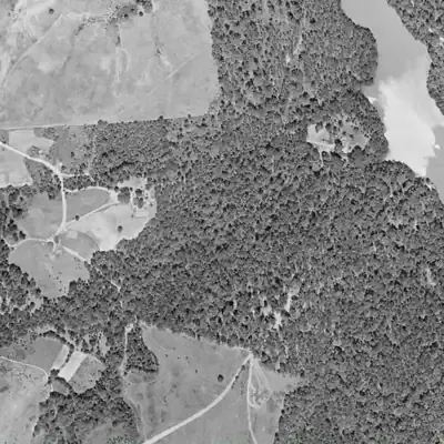
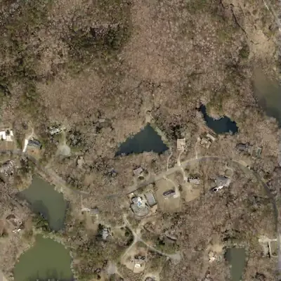
O'Neal Lake is a roughly 2-acre lake behind a 30-foot earth dam, built between 1955 and 1968, and it appears to have run slightly low at times from 1993 to 2005.
- First seen
- The 1955 aerial shows unbroken woods; by 1968 a finished triangular lake sits behind a straight fill dam.
- Dam in the lidar
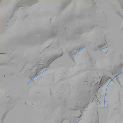
- A straight earth dam on the northeast side. Its flat crest is about 922 feet above sea level, roughly 3 feet above the lake. It is about 300 feet long, or 365 feet with the platform at its north end, and stands about 29 to 33 feet tall. The lidar shows no breach. A possible overflow bench sits near the north end.
Low water and drawdowns
- 1972 (possible) possibly: The northwest third of the lake looks gray and textured instead of bright water. Glare, an image that does not line up with today's map, or leafless woods could explain it. Very uncertain.
- 1993 to 2005, clearest in 2001: Water sits roughly 25 to 50 feet inside today's northwest shoreline, with pale or tan vegetated ground in between. By 2012 water reaches the shoreline again. This looks like a shallow flat or a slightly low pool, not a drained lake bed.
Read from aerial photos taken between 1940 and 2026 and from DeKalb County 2024 lidar, then checked by a second reading. How the photos were read.
Depth
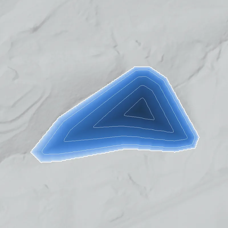
Modeled from the shoreline shape and the dam inventory’s average depth: deepest point about 23 ft. Treat it as an estimate; no survey of the lake bottom was found. How depth is estimated.
History
The National Inventory of Dams lists O'Neal Lake, alternate name Lake Howell, as a privately owned earthen recreation dam in DeKalb County near Stone Mountain. NID records a height of 30 feet, a length of 300 feet, a surface area of 2 acres and normal storage of 20 acre-feet, with hazard potential 'Low' and condition 'Not Rated'. It is one of the four in this group that the state treats as jurisdictional, with a last inspection dated May 1, 2005. The stream is 'Unknown' and no completion year is given. No newspaper or plat source was found. 1
Who built it
Not documented in any source found. NID lists a private owner and recreation use but gives no year completed, no designer and no impounded stream. 1
Timeline
- May 1, 2005National Inventory of Dams lists this as the date of the dam's last recorded state inspection, on a 5-year inspection frequency. No later inspection is recorded. 1
Names
- Lake Howell
- Alternate name in NID (listed as 'Lake Howell Dam'). NID also has a separate 'Howell Lake Dam' (GA01801, 1950, owned by the Stone Mountain Memorial Association) about 0.4 km east; whether these are one lake, two ponds or a duplicate record is unresolved. 1
The dam
NID: earth dam, 30 ft high (25 ft hydraulic height), 300 ft long, 2 surface acres, 20 acre-ft normal and 30 acre-ft maximum storage, uncontrolled spillway, hazard potential 'Low', condition 'Not Rated'. NID marks it state jurisdictional with a state inspection authority; last inspection May 1, 2005, on a 5-year cycle. NID's drainage-area figure (92 sq mi) is implausible for a 2-acre pond and is not used. 1
- Dam height
- 30 ft
- Surface
- 2 acres
- Average depth
- about 10 ft
- Owner type
- Private
Figures from the U.S. Army Corps of Engineers’ National Inventory of Dams. Its “year” is often a rebuild or survey date, and average depth is storage divided by area.
Around the lake
Water
NID does not record the stream. Watershed not confirmed by any source found.
Visiting
Getting there
Listed as privately owned in NID (record last updated 2021). Not confirmed whether any public access exists; treat as private property.
What you can see
Not confirmed. Check current imagery and view only from public roads.
Look, don’t dig. Parks, cemeteries and preserves are off limits to digging and collecting, and private land needs the owner’s permission to enter.
Open questions
- Who built the dam and when? NID gives no year.
- Which stream does it impound?
- Is this the same water body as the separate Howell Lake Dam (GA01801) about 0.4 km east, or a neighbor?
- Is the name from a family, a landowner or a subdivision?
- Does the lake appear on 1930s-40s aerials or 1950s-70s topo maps?
Know something? Write to hello@historyunderfoot.org. Family papers, photos and deeds often settle these.
Where to look next
- Historic aerial photographs of DeKalb County (1930s-40s series; coverage to be confirmed), to see whether a pond existed at this spot (UGA Libraries Map and Government Information Library / Digital Library of Georgia)
- USGS topographic map editions 1950s to 1990s for lake outline and labels (USGS TopoView (likely Stone Mountain quadrangle))
- Newspaper searches for 'O'Neal Lake' and 'Lake Howell' with DeKalb, Stone Mountain or Tucker (Georgia Historic Newspapers (Digital Library of Georgia))
- Deed and plat records for the parcel (DeKalb County Superior Court Clerk, plat and deed books)
- NID record and Georgia Safe Dams file (state ID 044-021-00360), including the 2005 inspection (National Inventory of Dams; Georgia EPD Safe Dams Program)