Still here · Fulton County · Dam inventory GA01521
Princeton Lake
A 15-acre private recreation lake in southwest Fulton County, listed in the dam inventory as Princeton Lake and formerly Bales Lake, with a long earthen dam.
From the air
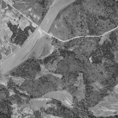
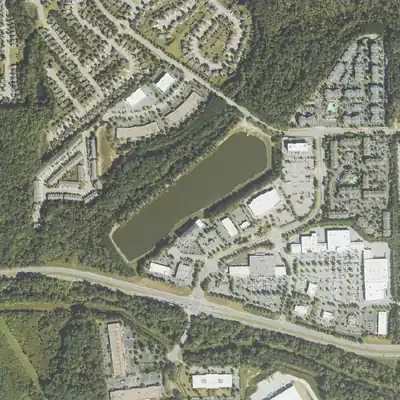
Princeton Lake did not exist in 1955. It was built by 1968 next to a creek-bottom field, held up by a roughly 1,700-foot embankment, and never drained in any aerial year.
- First seen
- Not in the 1955 photos; full in 1968, so it was built between those years.
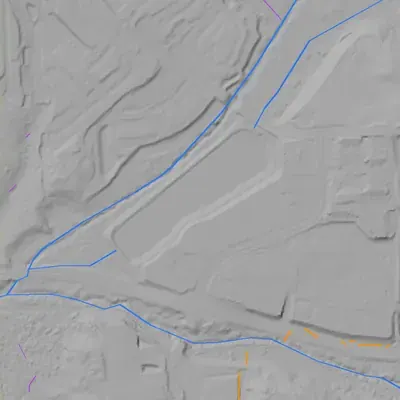
- Dam in the lidar
- A long earthen embankment runs about 1,700 feet along the northwest side. It stands roughly 19 to 21 feet above the creek ditch at its foot, and up to about 24 feet at the southwest end. Its crest is only 5 to 6 feet above the pool. No breach or spillway channel shows.
Read from aerial photos taken between 1940 and 2026 and from USGS 3DEP lidar, then checked by a second reading. How the photos were read.
Depth
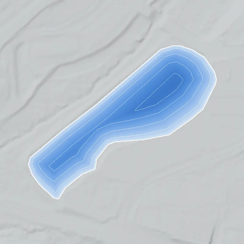
Modeled from the shoreline shape and the dam inventory’s average depth: deepest point about 9 ft. Treat it as an estimate; no survey of the lake bottom was found. How depth is estimated.
History
The National Inventory of Dams lists Princeton Lake Dam (formerly Bales Lake Dam) as a privately owned earthen dam in Fulton County, near Ben Hill, built for recreation and dated 1960. It is 17 ft high and recorded as about 1,800 ft long, holding about 65 acre-feet at normal pool over roughly 15 acres. NID gives a low hazard rating and state inspection; the last inspection on file is June 2017. The stream and designer are listed as unknown. Nothing beyond these inventory facts was found, so the builder, the origin of both names and the later history are unresolved. 1
Who built it
Not established. NID says the dam is earthen, privately owned, built for recreation, with year completed 1960 (a value NID often estimates). Builder, designer and stream are listed as unknown. The nearest mapped USGS flowline is an unnamed small stream. 12
Timeline
- 1960 (NID year completed)NID lists the dam as completed in 1960; NID year values are often estimates and no corroborating source was found. Uncertain 1
- June 19, 2017Most recent dam safety inspection date recorded in the NID entry (5-year inspection frequency, condition Not Rated). 1
- April 20, 2021NID record for the dam last updated; Georgia is the record's source agency. 1
Names
The dam
Earthen dam, 17 ft dam height, 13 ft hydraulic and structural height, recorded length about 1,800 ft. Uncontrolled spillway and outlet. Max storage 145 acre-feet, normal storage 65 acre-feet, surface area 15 acres. NID drainage area field reads 150, which cannot be square miles for a 15-acre lake and may be acres or an error. NID hazard potential: Low. Condition: Not Rated. State jurisdiction and inspection: yes; permitting: no; not federally regulated. Last inspection date 19 June 2017, inspection frequency 5 years, NID record updated 20 April 2021 (source agency: Georgia). State agency ID in the NID record: 060-087-00967. No rebuild or contract records were found. 1
- Year in the inventory
- 1960
- Dam height
- 17 ft
- Surface
- 15 acres
- Average depth
- about 4.3 ft
- Owner type
- Private
Figures from the U.S. Army Corps of Engineers’ National Inventory of Dams. Its “year” is often a rebuild or survey date, and average depth is storage divided by area.
Around the lake
Water
NID gives the stream as Unknown. The nearest USGS NHDPlus flowline (comid 3286294, unnamed) passes about 170 m north of the NID point and runs east-northeast to west-southwest. Whether the lake sits on that stream, and the receiving named creek, were not confirmed.
Visiting
Getting there
Listed as privately owned. Public access is not established; treat as private unless a public source says otherwise.
What you can see
Not verified. Aerial imagery would show the long earthen embankment; NID lists an uncontrolled spillway.
Look, don’t dig. Parks, cemeteries and preserves are off limits to digging and collecting, and private land needs the owner’s permission to enter.
Open questions
- Who was Bales, and was Bales Lake a family pond, farm lake or club lake before it became Princeton Lake?
- What subdivision or property is Princeton Lake named for, and when was the name adopted?
- Is the 1960 completion date real, or an NID estimate?
- Which named stream and watershed does the lake sit on, and is the NID point offset from the actual dam?
- Has the dam been repaired or rebuilt, and has it had an inspection since 2017?
- Are the 1,800 ft length and the drainage area value of 150 correct?
Know something? Write to hello@historyunderfoot.org. Family papers, photos and deeds often settle these.
Where to look next
- Historic aerial photography of the site to date the pond and dam (USGS EarthExplorer / Georgia historic aerials; UGA Map and Government Information Library aerial collections (Atlanta-area 1950s-60s coverage))
- USGS 7.5-minute topographic map editions for the area (look for a pond first appearing on 1950s-70s editions) (USGS Historical Topographic Map Collection (TopoView))
- Subdivision or land plats and deed records naming Bales or Princeton Lake (Fulton County Clerk of Superior Court real estate records and Georgia Virtual Vault / Digital Library of Georgia)
- Georgia EPD Safe Dams Program file for dam ID 060-087-00967 (inspection reports, ownership, classification); the program page lists a phone contact and mailing address (Georgia EPD Safe Dams Program, via records request)
- Newspaper mentions of Bales Lake or Princeton Lake (Georgia Historic Newspapers (Digital Library of Georgia) and Atlanta History Center archives)
Sources
- National Inventory of Dams record GA01521 (Princeton Lake Dam; former name Bales Lake Dam), REST query U.S. Army Corps of Engineers, National Inventory of Dams
- USGS NLDI / NHDPlus flowline lookup at 33.656722, -84.515028 (comid 3286294) U.S. Geological Survey