Still here · DeKalb County · Dam inventory GA03915
Robert Nash Lake
A 2-acre privately owned pond in Tucker with a 29-foot earthen dam; NID dates it to 1952 and Georgia rates it Category II, low hazard.
From the air
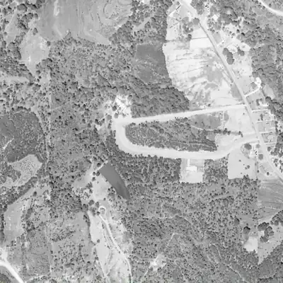
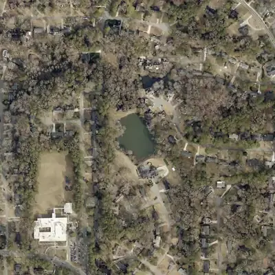
Robert Nash Lake is younger than the 1952 date in the dam inventory. The site was woods in 1955, a graded basin by 1968, and full of water by 1981.
- First seen
- In 1968 the site appears as a graded basin or a newly filled pool; water is certain by 1981.
- Dam in the lidar
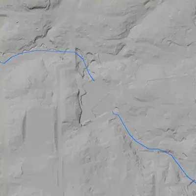
- A curved earth embankment at the north end. The crest is about 1,017.7 ft, roughly 2 to 3 ft above the pool. It stands about 31 ft above its base and about 34 ft above the creek channel below. The crest is about 165 to 205 ft long. There is no breach and no clear spillway notch.
Read from aerial photos taken between 1940 and 2026 and from DeKalb County 2024 lidar, then checked by a second reading. How the photos were read.
Depth
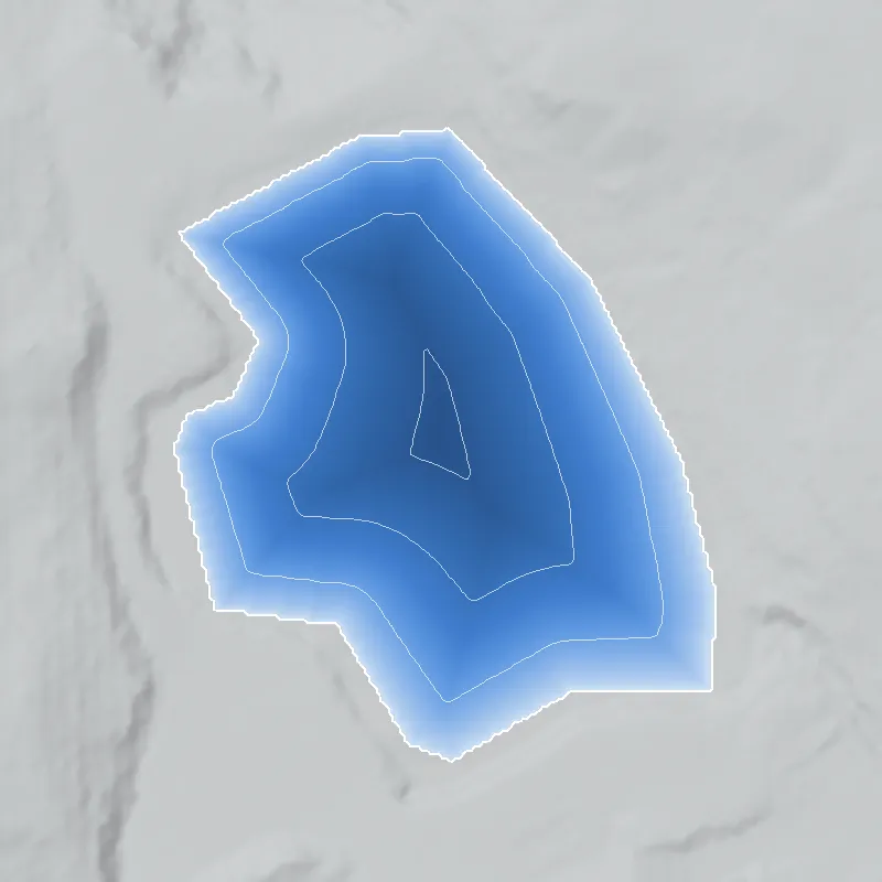
Modeled from the shoreline shape and the dam inventory’s average depth: deepest point about 16 ft. Treat it as an estimate; no survey of the lake bottom was found. How depth is estimated.
History
Robert Nash Lake is a small private pond near Gleneagles Drive in Tucker, about 1.1 miles east of the Henderson's Mill site. NID gives 1952 as the completion year without stating a source. A pond appears at this spot on the USGS Stone Mountain quad, titled 1956 but photorevised in 1982, drawn in standard blue rather than the purple used for 1981-photo revisions. The 29-foot earthen dam is about 144 feet long. Georgia lists it as Category II, meaning no occupied structure was identified in the failure zone; NID shows low hazard and a 2005 inspection with no condition rating. Who Robert Nash was is not settled in the record. 12345
Who built it
Not documented beyond NID's 1952 completion year and 'Recreation' purpose. NID lists the designer as 'Haines' and the stream as 'Unknown'; NHD maps unnamed stream lines and a second small pond within 150 m, suggesting a chain of ponds. The name presumably honors a Nash who owned the land or built the pond; streets named Robert Nash Court and Dedee Court lie just south, and a Tucker Civic Association list places a Nash family among Tucker's founding families. No source ties any Nash to this pond, so the naming is unconfirmed. 1467
Timeline
- 1952NID lists this as the completion year for the dam; the source of the date is not stated and NID dates are often estimates. Likely 1
- 1956 (edition photorevised 1982)A blue-water pond appears at this spot on the USGS Stone Mountain quad, titled 1956 but revised in 1982 from 1981 photos. The pond is blue, not revision purple, which suggests the 1956 base, but this is not certain. Likely 3
- May 1, 2005Last inspection recorded in NID for this dam, on a 5-year inspection cycle; condition was never rated. 1
- April 20, 2021NID record last updated: Low hazard, Not Rated, Emergency Action Plan not required. 1
- June 4, 2025Georgia EPD's dam inventory lists Robert Nash Lake Dam as Category II with a private owner, with an unexplained 'Y' in its TBS column. 2
Names
The dam
Earth dam, 29 ft high (17 ft hydraulic height), 144 ft long, uncontrolled spillway and outlet. Normal storage 15 acre-ft, max 25, surface 2 acres. Georgia Safe Dams Category II (NID: Low hazard); condition 'Not Rated'; last inspection 05/01/2005 on a 5-year cycle; Emergency Action Plan not required. Georgia counts a structure as a dam if it is at least 25 ft tall or stores 100 acre-ft; NID flags this one as state jurisdictional with inspection authority but no permitting or regulatory authority. NID's 144 sq mi drainage area is clearly a data error (it repeats the dam length). EPD lists private individuals as owners; not named here. No rebuilds or public contract numbers found. 125
- Year in the inventory
- 1952
- Dam height
- 29 ft
- Surface
- 2 acres
- Average depth
- about 7.5 ft
- Owner type
- Private
Figures from the U.S. Army Corps of Engineers’ National Inventory of Dams. Its “year” is often a rebuild or survey date, and average depth is storage divided by area.
Around the lake
Water
NID gives the stream as 'Unknown'. NHD shows unnamed stream lines and small ponds nearby; named streams within about 2.5 km include Henderson Mill Creek, Burnt Fork Creek, Lucky Shoals Creek and South Fork Peachtree Creek, so the ridge here may be a drainage divide. Which creek this pond feeds was not confirmed.
Civil War
About 1.1 miles west, Logan's 15th Army Corps camped at Henderson's Mill on July 18, 1864 (HMDB marker). No 1864 line or camp is documented at the pond itself.
Before 1861
Greenville Henderson's reported holdings (over 2,600 acres from Evans Road to Northlake Mall, per a blog) lay in this part of DeKalb; whether they reached this parcel is unverified. A Nash family is among Tucker's founding families buried at Gresham and Weed Cemetery, but no source links them to this lake.
Visiting
Getting there
Private property. EPD lists private owners (not named here). No public park or trail found. Any viewing must be from public roads, without entering.
What you can see
Nothing public documented. Records describe a 2-acre pond with a 144-foot earthen dam and an open spillway, in a Tucker neighborhood of Gleneagles, Dedee and Robert Nash streets. No markers or ruins are recorded.
Look, don’t dig. Parks, cemeteries and preserves are off limits to digging and collecting, and private land needs the owner’s permission to enter.
Open questions
- Which Nash built or owned the pond, and is 'Robert Nash Lake' named for the same man as Robert Nash Court?
- Was the dam really built in 1952 (NID does not say), and by whom (designer 'Haines')?
- Which creek does it drain to, and are the other nearby NHD ponds part of the same original chain?
- What does the 'Y' in EPD's TBS column mean for this dam, and why has NID shown no inspection since 2005?
- Was the land ever platted as part of a Nash family subdivision before the Gleneagles neighborhood?
Know something? Write to hello@historyunderfoot.org. Family papers, photos and deeds often settle these.
Where to look next
- USGS Stone Mountain 1:24,000 quad editions: 1956 base, 1982 photorevision, and later sheets, to check when the pond first appears and how it changes (USGS Historical Topographic Map Collection (TopoView))
- Georgia EPD Safe Dams file for state ID 044-076-00899 (inspection reports, any 1950s construction data); request via Open Records (Georgia EPD Safe Dams Program)
- Plats for Robert Nash Court, Dedee Court and Gleneagles Drive, and deed chain for the pond tract (DeKalb County Superior Court Clerk plat books and deed records; DeKalb GIS parcel layer)
- 1938-40 UGA DeKalb aerials to see the tract before the pond, and 1970s-80s aerials to see the pond's form (UGA Libraries Map and Government Information Library; USGS EarthExplorer)
- Nash family history in Tucker (Gresham and Weed Cemetery, founding families) and any oral histories (Tucker Civic Association, Tucker Historical Society, DeKalb History Center)
- Georgia Historic Newspapers search for 'Nash' pond/lake, Midvale Road and Tucker items in the 1950s (Digital Library of Georgia, Georgia Historic Newspapers)
Sources
- National Inventory of Dams: records GA03913 (Kings Cliff Lake Dam), GA03915 (Robert Nash Lake Dam) and GA02051 (North Lake Dam), national CSV data last updated 2026-9-23 U.S. Army Corps of Engineers
- Dam Inventory (Safe Dams Program), updated June 4, 2025 Georgia Environmental Protection Division
- USGS 1:24000 Quadrangle for Stone Mountain, GA 1956 (photorevised 1982 from 1981 photos) U.S. Geological Survey
- National Hydrography Dataset services (large-scale waterbody and flowline queries at both dam points) U.S. Geological Survey
- Safe Dams Program Georgia Environmental Protection Division
- OpenStreetMap geocoding (Nominatim) for Kings Arms Court, Kingscliff Drive/Way, Gleneagles Drive, Dedee Court, Robert Nash Court OpenStreetMap contributors
- Tucker, GA Self-Guided Cemetery Tour: Founding Families Tucker Civic Association