Still here · DeKalb County · Dam inventory GA01797
Rockbridge Lake
A 7-acre private recreation lake on a 27-foot earthen dam near Stone Mountain, listed in the National Inventory of Dams as high hazard and in poor condition as of June 2026.
From the air
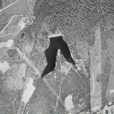
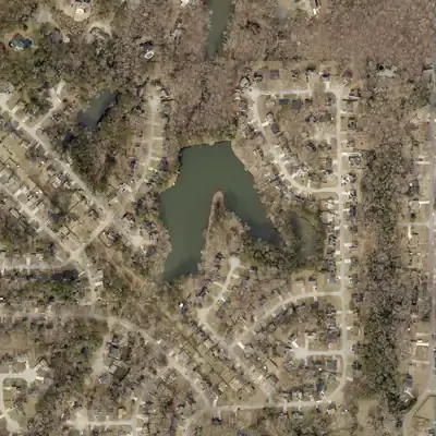
Rockbridge Lake has kept its boot-shaped outline since at least 1955, while a whole subdivision grew up around it.
- First seen
- In 1955, the earliest usable aerial, the lake is already full behind a pale, freshly bare dam.
- Dam in the lidar
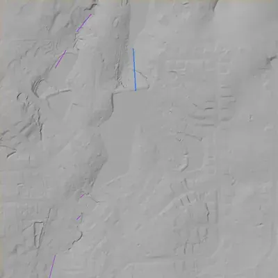
- The earthen dam at the north end is about 28 feet high and 340 to 350 feet long, with a crest about 2 feet above the lake. It is intact. Overflow appears to leave through a channel at the east end of the dam, with no gates visible.
Read from aerial photos taken between 1940 and 2026 and from DeKalb County 2024 lidar, then checked by a second reading. How the photos were read.
Depth
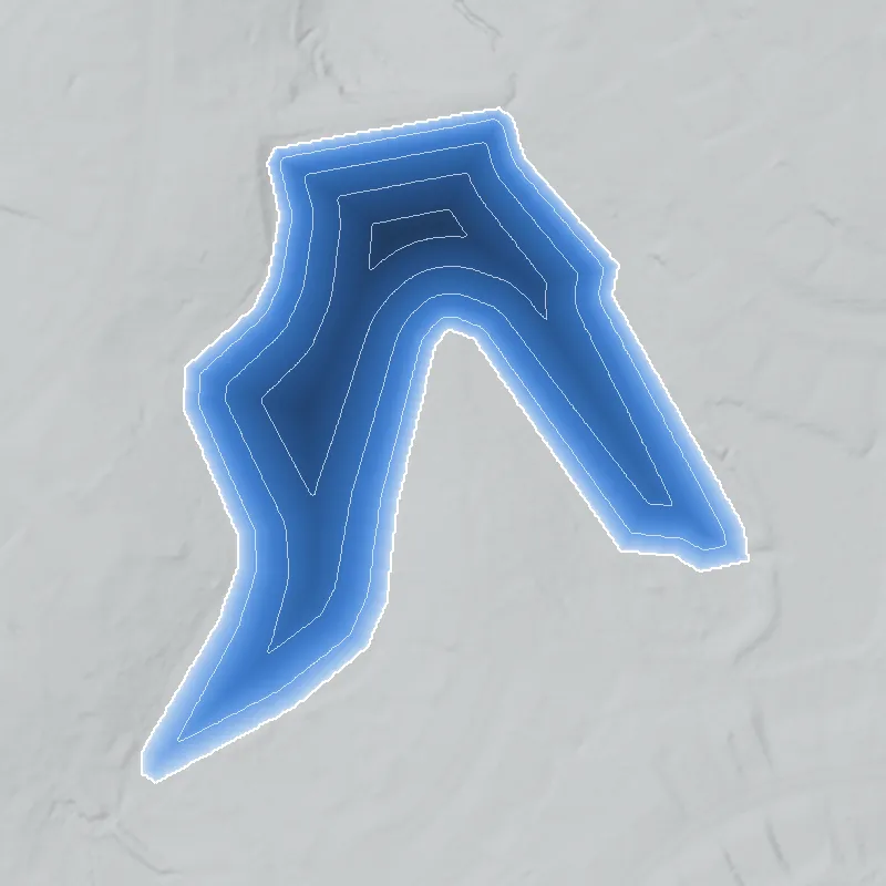
Modeled from the shoreline shape and the dam inventory’s average depth: deepest point about 22 ft. Treat it as an estimate; no survey of the lake bottom was found. How depth is estimated.
History
Rockbridge Lake is a small privately owned recreation lake behind a 27-foot earthen dam in DeKalb County, near Stone Mountain. The National Inventory of Dams (NID) also lists it as Johnson Lake Dam and gives a completion year of 1950, which is unverified and may be an estimate. Georgia regulates the dam, and the NID classes it high hazard. Its condition is listed as Poor, assessed June 30, 2026, after a state inspection on February 20, 2025. The NID shows no emergency action plan. The builder, the stream and the lake's history were not found in the sources reached. 1
Who built it
Not documented in the sources reached. The NID lists the dam as earth, 27 ft high and 320 ft long, with recreation as its only purpose, designer unknown, and stream name 'Unknown'. Its completion year is given as 1950, but NID completion years are often estimates. Builder, motive and impounded stream remain to be found. 1
Timeline
- 1950 (NID; unverified, likely an estimate)The National Inventory of Dams lists the dam as completed in 1950. It names no builder, and NID completion years are frequently approximate. Uncertain 1
- February 20, 2025Most recent state dam safety inspection date recorded in the NID for this dam. The inspection frequency is listed as every 2 years. 1
- June 30, 2026The NID lists the dam's condition assessment as Poor and its hazard class as High. It shows no emergency action plan and no inundation map. 1
Names
The dam
NID record (dam data dated June 30, 2026): earth dam, 27 ft high, 320 ft long. Surface area 7 acres. Normal storage 66 acre-feet, maximum storage 120 acre-feet. Spillway and outlet are both listed as uncontrolled. Drainage area is listed as 0, which reads as not reported. Hazard class High. Condition Poor, assessed June 30, 2026. Last inspection February 20, 2025, on a 2-year cycle. Emergency action plan not prepared; no inundation map in the NID. Designer unknown. No rebuild, drawdown or repair contract was found. 1
- Year in the inventory
- 1950
- Dam height
- 27 ft
- Surface
- 7 acres
- Average depth
- about 9.4 ft
- Owner type
- Private
Figures from the U.S. Army Corps of Engineers’ National Inventory of Dams. Its “year” is often a rebuild or survey date, and average depth is storage divided by area.
Around the lake
Water
The NID gives the stream as 'Unknown' and drainage area as 0, so the watershed cannot be confirmed from this source.
Visiting
Getting there
Private. The NID classes ownership as private, so it is not a public park. Whether the public has any access has not been confirmed; the Georgia EPD Safe Dams file and DeKalb County GIS parcel data would settle it.
What you can see
Unknown. It was not verified whether the dam or lake can be seen from a public road. Stay off private property.
Look, don’t dig. Parks, cemeteries and preserves are off limits to digging and collecting, and private land needs the owner’s permission to enter.
Open questions
- Who built the dam and lake, and when? Is 1950 right, or does the lake show up earlier or later on aerials and topo maps?
- Which stream does it impound? The NID says 'Unknown' and lists drainage area as 0.
- What is the origin of the 'Johnson Lake' name, and was it an earlier or parallel name?
- Was it ever a fishing club, swim club or subdivision amenity, and does it have a segregation-era history?
- Is any repair, breach or drawdown order on record with Georgia EPD after the Poor rating?
- Why does the NID city field say 'Stone Mountain Park' for a privately owned lake?
Know something? Write to hello@historyunderfoot.org. Family papers, photos and deeds often settle these.
Where to look next
- Georgia EPD Safe Dams Program file for state dam ID 044-008-00065: inspection reports, permit history, any consent or repair orders (open records request). The URL is the website link given in the NID record. (Georgia Environmental Protection Division, Safe Dams Program)
- Historic aerial photography of Georgia from the 1930s-1950s, to check whether a pond exists before the NID's 1950 date (UGA Libraries, Map and Government Information Library, historic aerial photography)
- USGS historical topographic quadrangle editions covering the Stone Mountain area, to date the lake and show the feeding stream (USGS historical topographic map collection (topoView))
- DeKalb County deed and plat records for the parcel(s), and the subdivision plat if the lake was a neighborhood amenity (DeKalb County Superior Court Clerk, real estate records and plat books)
- Search for 'Rockbridge Lake' and 'Johnson Lake' in Georgia Historic Newspapers (DeKalb-area papers, 1940s-1960s) for club, fishing or swimming notices (Digital Library of Georgia, Georgia Historic Newspapers)
- Check DeKalb History Center material on Rockbridge Road for the origin of the 'rock bridge' name and any early route context. No source for this was reached, so no link between the road and the lake is asserted. (DeKalb History Center, Decatur)
Sources
- National Inventory of Dams: nationwide CSV export (record GA01797, Rockbridge Lake Dam; data updated 2026-9-23) U.S. Army Corps of Engineers, National Inventory of Dams