Still here · DeKalb County · Dam inventory GA03919
Simpson Lake
A privately owned 6-acre recreation lake in south DeKalb County. Public records give only its dam specifications, and no historical account of it turned up.
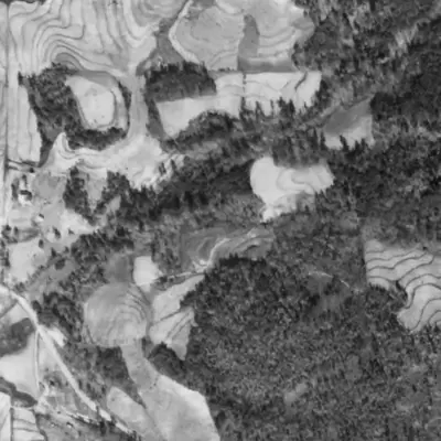
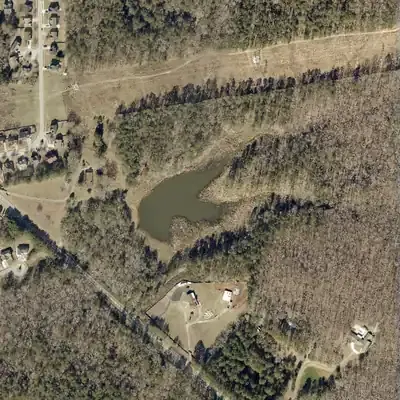
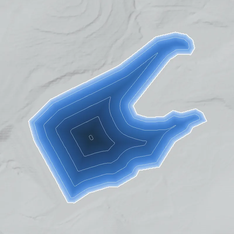
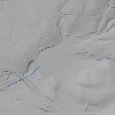
From the air
Simpson Lake was full in early 2023 and mostly drained by October 2023. Three years later it is still low, with a pool covering about 40 percent of its old outline.
- First seen
- No lake in 1940 or 1955; it is on the 1968 aerial, so it was built between those dates.
- Dam in the lidar
- A straight earthen dam runs along the west and southwest shore. It is about 31 feet tall and about 387 feet long. The crest is at 738 to 739 feet, 2 to 3 feet above the 736-foot normal pool. No breach shows in the county's 2024 lidar or in the aerials.
Low water and drawdowns
- Between early 2023 and October 2023, still in effect in 2026: A winter 2023 aerial shows a full lake. By October 2023 the basin is mostly mud flats with a small pool near the dam. The dam looks intact.
- Winter 2024 to winter 2026: The pool slowly refills: about 1 to 1.5 acres in 2024, 2 acres in 2025, and 2.7 to 3 acres in 2026. The full outline is 6.9 acres. Grass and reeds grow on the exposed bed.
Read from aerial photos taken between 1940 and 2026 and from DeKalb County 2024 lidar, then checked by a second reading. How the photos were read.
Depth
Modeled from the shoreline shape and the dam inventory’s average depth: deepest point about 25 ft. Treat it as an estimate; no survey of the lake bottom was found. How depth is estimated.
History
Simpson Lake is a small private lake in south DeKalb County, listed in the National Inventory of Dams as a 31-foot earthen dam, 390 feet long, holding about 6 acres and 62 acre-feet. NID gives 1960 as its completion year but cites no source for it, so treat it as unverified. The owner of record (NID data last updated 2021) is the Estate of Catherine Simpson, and the stated use is recreation. NID's last recorded Georgia inspection was in 2005; it is classed Low hazard and Not Rated. No builder, original purpose or club history was found, so the record is thin. 1
Who built it
Not established. NID records the designer as unknown, the stream as unknown and the completion year as 1960, and lists the Estate of Catherine Simpson as owner of record. That may point to a family-held recreation pond, but this is inference: no source confirms who built it or why. NHD shows an unnamed stream reach near the site, within the Camp Creek-South River watershed. 123
Timeline
- 1960 (per NID)NID gives 1960 as the completion year. NID 'year completed' values are often estimates and no supporting source was found, so this date is unverified. Uncertain 1
- May 1, 2005Most recent Georgia dam inspection recorded in NID. The dam is rated Low hazard, condition Not Rated, on a 5-year inspection cycle. 1
- April 20, 2021NID record last updated. It lists the owner as the Estate of Catherine Simpson and the primary use as recreation. 1
Names
- Simpson Lake Dam
- Dam name used in the National Inventory of Dams (NID); the record lists no alternate or former names. 1
The dam
NID: earthen dam, 31 ft high (25 ft hydraulic height), 390 ft long, with an uncontrolled spillway and uncontrolled outlet. Normal storage is 62 acre-feet, maximum 90, and surface area 6 acres. Hazard is Low and condition is Not Rated. It is state jurisdictional but not state regulated, and no emergency action plan is required. Last inspection recorded in NID: May 1, 2005, on a 5-year inspection frequency. NID record last updated April 20, 2021. No rebuild or engineering contract was found. 1
- Year in the inventory
- 1960
- Dam height
- 31 ft
- Surface
- 6 acres
- Average depth
- about 10.3 ft
- Owner type
- Private
Figures from the U.S. Army Corps of Engineers’ National Inventory of Dams. Its “year” is often a rebuild or survey date, and average depth is storage divided by area.
Around the lake
Water
NID lists the stream as unknown. NHD shows an unnamed stream reach (reach code 03070103005692) within 400 m, in the Camp Creek-South River watershed (HUC12 030701030107). Named streams within about 2.5 km include Honey Creek, Crooked Creek, Buck Branch and South River, all in the South River drainage. The nearest named NHD pond is Browns Mill Lake, about 1.1 km away.
Visiting
Getting there
Private. NID lists the owner as an estate (as of its 2021 update), and no public access, park designation or HOA was found in the sources reached.
What you can see
Nothing confirmed. Viewing from public roads was not checked. County GIS parcel lines and current aerials would show whether the dam and pond are visible from a right-of-way.
Look, don’t dig. Parks, cemeteries and preserves are off limits to digging and collecting, and private land needs the owner’s permission to enter.
Open questions
- Who built the dam and when? NID's 1960 date is unverified.
- Which stream does it impound? NID says unknown and NHD shows only an unnamed reach.
- What was the lake used for: family fishing pond, club or boating lake, or farm pond?
- Who owns the property now, and has the dam been inspected since 2005?
- Does the lake appear in the 1938-40 UGA DeKalb aerials, or first show up on later USGS topo sheets covering this spot?
Know something? Write to hello@historyunderfoot.org. Family papers, photos and deeds often settle these.
Where to look next
- USGS historic topographic maps (topoView): check each edition covering the coordinates to see when the pond first appears (USGS topoView, 7.5-minute and earlier 15-minute sheets covering 33.639, -84.106)
- UGA 1938-40 DeKalb County aerial photography, to see whether a pond or farm dam existed before 1960 (Digital Library of Georgia / UGA Map and Government Information Library)
- Georgia EPD Safe Dams Program file for dam ID 044-056-00795, including any inspection reports and ownership history (Georgia Environmental Protection Division, Safe Dams Program (open-records request))
- DeKalb County deed and plat records for the parcel, to trace when the lake was created and how the land passed (DeKalb County Clerk of Superior Court, real estate records)
Sources
- National Inventory of Dams, bulk CSV export (data last updated 2026-9-23), records GA03919 and GA06147 U.S. Army Corps of Engineers, National Inventory of Dams
- USGS National Hydrography Dataset (NHD) MapServer, flowline and waterbody queries at NID coordinates U.S. Geological Survey, The National Map
- USGS Watershed Boundary Dataset (WBD) MapServer, HUC12 query at NID coordinates U.S. Geological Survey, The National Map