Status unknown · DeKalb County · Dam inventory GA01328
Southland Lake
A 20-acre private recreation lake in DeKalb County with a 43-foot earth dam, listed in the state dam inventory as high hazard and in poor condition.
From the air
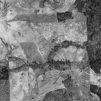
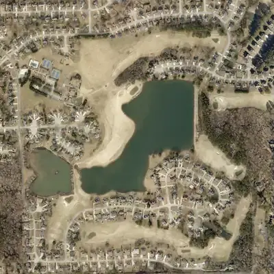
Southland Lake was a farm ravine in 1940. A roughly 43-foot dam built by 1955 turned it into a lake whose outline has barely changed since 1968.
- First seen
- Between 1940 and 1955. The 1955 photo already shows the dam, with a road on top and the pool only partly full.
- Dam in the lidar
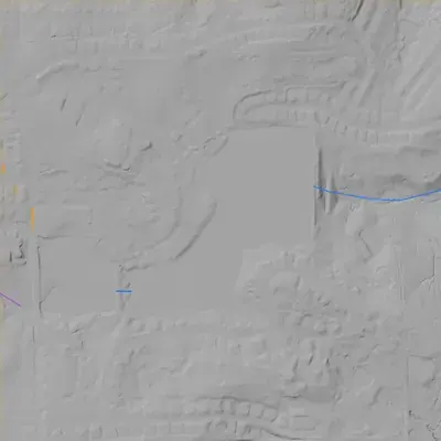
- A straight earth embankment at the east end, about 830 to 850 feet long, with a level crest near 946.5 feet and a narrow path on top. It stands roughly 43 feet high to the foot of the slope, and taller near the outlet. No breach is visible. The crest is only about 2 feet above the water.
Low water and drawdowns
- 1955 (exact photo date unknown) possibly: Water fills only the south and east part, and the northwest half of the basin looks pale and bare. The pond upstream looks the same. This could be a drawdown or dry spell, or two new ponds still filling. One photo cannot tell which.
- 1981 (minor, uncertain) possibly: The water's edge is pulled back in the southwest cove only, by about 115 feet along the west edge and up to about 330 feet at the corner. It may be a slightly low pool. It could also be wetland or silt. The cove was full again by 1993.
Read from aerial photos taken between 1940 and 2026 and from DeKalb County 2024 lidar, then checked by a second reading. How the photos were read.
Depth
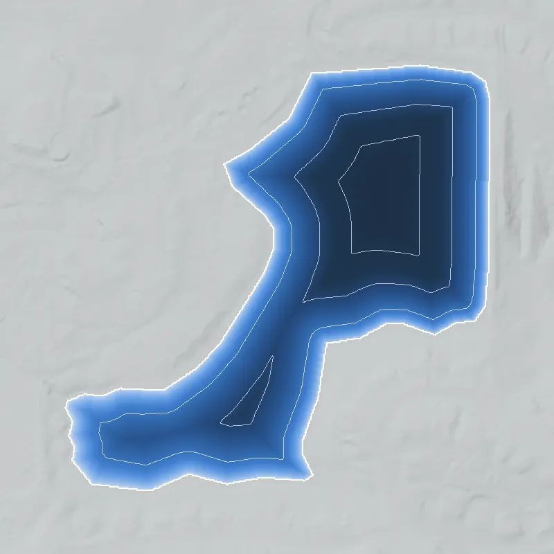
Modeled from the shoreline shape and the dam inventory’s average depth: deepest point about 40 ft. Treat it as an estimate; no survey of the lake bottom was found. How depth is estimated.
History
The only record found for this lake is its National Inventory of Dams entry. It lists a 43-foot-high, 865-foot-long earth dam, 20 surface acres and 313 acre-feet of normal storage, privately owned and used for recreation, with an uncontrolled spillway. Georgia's Safe Dams Program regulates it as high hazard, and its last recorded inspection (January 2021) rated it poor. NID shows no emergency action plan prepared. NID lists 1950 as the completion year, but that date is unsourced and may be an estimate. The stream, builder, original purpose and any club or subdivision history are not established here. 12
Who built it
Not established. NID lists a completion year of 1950, purpose 'Recreation', designer 'UNKNOWN', and the stream as 'Unknown'. No source found says who built the dam, why, or which creek it impounds. 12
Timeline
- 1950 (per NID; unverified)Year the National Inventory of Dams lists for completion of the dam. NID completion years are often estimates, and no source confirms this one. Uncertain 12
- January 7, 2021Last inspection and condition assessment recorded in NID: hazard potential High, condition Poor. 12
- May 13, 2024Date the NID entry for this dam was last updated by the Georgia state source agency. The record was unchanged in the September 2026 NID export. 12
Names
The dam
Earth embankment, 43 ft high (38 ft hydraulic height), 865 ft long. Uncontrolled spillway and outlet. Normal storage 313 acre-feet, maximum storage 457 acre-feet, 20 surface acres. Owned by a private company, per the NID. Regulated by the Georgia Safe Dams Program under state ID 044-046-00782, with a two-year inspection frequency. High hazard potential; condition rated Poor on the January 7, 2021 inspection; NID shows no emergency action plan prepared. No rebuild, repair contract or engineering report was found. 12
- Year in the inventory
- 1950
- Dam height
- 43 ft
- Surface
- 20 acres
- Average depth
- about 15.7 ft
- Owner type
- Private
Figures from the U.S. Army Corps of Engineers’ National Inventory of Dams. Its “year” is often a rebuild or survey date, and average depth is storage divided by area.
Around the lake
Water
NID gives the stream as 'Unknown', so the watershed is not established from this record. Determining it needs the USGS topographic map or DeKalb GIS stream layers.
Visiting
Getting there
Listed as privately owned. Whether any public access, HOA or club use applies is not established. Treat it as private property unless a public body is shown to own it.
What you can see
Not established. Whether the dam or spillway is visible from a public road was not checked. Do not enter the property without permission.
Look, don’t dig. Parks, cemeteries and preserves are off limits to digging and collecting, and private land needs the owner’s permission to enter.
Open questions
- Which stream does the lake impound, and is it the same water as any nearby named creek?
- Who built the dam c. 1950 (if that date is right) and for what: private club, subdivision amenity or fishing lake?
- Is 'Greenwood Lakes' a real alternate name or a stray data entry? It is absent from the current NID record.
- OpenStreetMap shows streets named Southland Drive, Southland Way and Southland Walk about a third of a mile west of the dam. Do they share a subdivision or name origin with the lake? Unchecked.
- Does the lake still hold water at the NID coordinates? The NID still lists the dam, but no aerial or site check was done.
- What repair or breach-mitigation work followed the 2021 Poor rating, and is the state's classification still current?
- Was the lake ever used by segregated clubs or beaches, or by a Black-owned recreation enterprise? Nothing was found either way.
Know something? Write to hello@historyunderfoot.org. Family papers, photos and deeds often settle these.
Where to look next
- Georgia EPD Safe Dams Program file for dam ID 044-046-00782: inspection reports, owner correspondence, any Corrective Action or Emergency Action Plan (Georgia EPD Safe Dams Program (open records request))
- 1938-40 UGA DeKalb County aerial photographs, to see whether a pond or creek existed at this site before the c. 1950 date (UGA Libraries / Digital Library of Georgia aerial collections)
- USGS topographic map editions covering this location (1950s to 1970s), to see when the lake first appears and what it is labelled (USGS Historical Topographic Map Collection (topoView))
- Subdivision plats and deed records for the parcels around the lake (DeKalb County Superior Court Clerk, real estate and plat records)
- Newspaper mentions of 'Southland Lake' or 'Greenwood Lakes' (club, fishing or swimming notices, dam safety coverage) (Georgia Historic Newspapers (Digital Library of Georgia) and Atlanta Journal-Constitution archives)
- Oral history or local knowledge from nearby neighborhood associations and the DeKalb History Center (DeKalb History Center, Decatur)
Sources
- National Inventory of Dams, record GA01328 (Southland Lake Dam), REST query U.S. Army Corps of Engineers, National Inventory of Dams
- National Inventory of Dams national CSV export (data last updated 2026-9-23), row GA01328 U.S. Army Corps of Engineers, National Inventory of Dams