Status unknown · DeKalb County · Dam inventory GA01946
Sterling Lake
A privately owned earthen recreation dam in DeKalb County, listed in the federal dam inventory as Sterling Lake, also called Chapel Hill Lake, with sparse records.
From the air
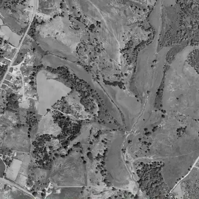
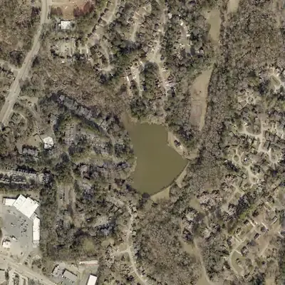
Federal records date this dam to 1950, but aerials from 1955 to 1972 show only pasture and a stream valley. Sterling Lake was built between 1972 and 1981.
- First seen
- The lake first appears in the 1981 aerial and is not in the 1972 aerial.
- Dam in the lidar
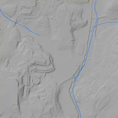
- A curved earthen dam along the southeast edge, about 580 feet long. It stands roughly 9 to 10 feet above the ground just downstream, and up to about 17 feet above the creek bed beside it. The grassy crest peaks near 848 feet elevation, with a footpath on top. No breach. A spillway chute at the northeast end drops toward the creek.
Read from aerial photos taken between 1940 and 2026 and from DeKalb County 2024 lidar, then checked by a second reading. How the photos were read.
Depth
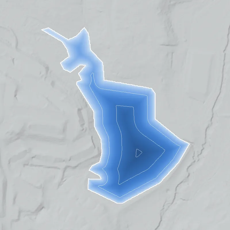
Modeled from the shoreline shape and the dam inventory’s average depth: deepest point about 16 ft. Treat it as an estimate; no survey of the lake bottom was found. How depth is estimated.
History
The National Inventory of Dams lists Sterling Lake, alternate name Chapel Hill Lake, as a privately owned earthen recreation dam in DeKalb County. NID gives a completion year of 1950, a height of 21 feet, a length of 370 feet and 59.4 acre-feet of storage, with hazard potential 'Low' and condition 'Not Rated'. The stream is recorded as 'Unknown' and surface area as 0 acres. Because a storage volume is recorded, the 0 acres is probably a blank field rather than a dry lake. No newspaper, plat or engineering source explaining its origin or names was found. 1
Who built it
Not documented in any source found. NID lists a private owner, recreation use, an earth dam, an unknown designer and a completion year of 1950. That year is probably approximate: 10 of 58 DeKalb dam records show exactly 1950. The builder and purpose are unknown. 1
Timeline
- 1950 (per NID)National Inventory of Dams gives 1950 as the year the dam was completed. This is unverified and may be an approximate figure. Uncertain 1
Names
- Chapel Hill Lake
- Alternate name in NID (listed as 'Chapel Hill Lake Dam'). Not the same as the separate 'Chapel Hill Park Lake Dam' (GA01335) in south DeKalb at 33.673, -84.226. Origin of the name unexplained. 1
The dam
NID: earth dam, 21 ft high, 370 ft long, 59.4 acre-ft storage, uncontrolled spillway, private owner, hazard potential 'Low', condition 'Not Rated', not state regulated or jurisdictional. Stream and surface area are not recorded. No rebuild or inspection records were found. 1
- Year in the inventory
- 1950
- Dam height
- 21 ft
- Owner type
- Private
Figures from the U.S. Army Corps of Engineers’ National Inventory of Dams. Its “year” is often a rebuild or survey date, and average depth is storage divided by area.
Around the lake
Water
NID does not record the stream. Watershed not confirmed by any source found.
Visiting
Getting there
Listed as privately owned in NID (record last updated 2021). Not confirmed whether any public access exists; treat as private property.
What you can see
Not confirmed. Check current imagery and view only from public roads.
Look, don’t dig. Parks, cemeteries and preserves are off limits to digging and collecting, and private land needs the owner’s permission to enter.
Open questions
- Which stream feeds the lake, and does it still hold water? NID lists 0 surface acres but 59.4 acre-ft of storage.
- Why is it also called Chapel Hill Lake, and which name came first?
- Who built the dam in about 1950, and for what purpose (subdivision amenity, club, private estate)?
- Does a plat or subdivision map show the lake by either name?
Know something? Write to hello@historyunderfoot.org. Family papers, photos and deeds often settle these.
Where to look next
- Historic aerial photographs of DeKalb County (1930s-40s series; coverage to be confirmed), to see whether a pond predates 1950 (UGA Libraries Map and Government Information Library / Digital Library of Georgia)
- USGS topographic map editions 1950s to 1970s for name labels and lake outline (USGS TopoView (likely Stone Mountain quadrangle))
- Newspaper searches for 'Sterling Lake' and 'Chapel Hill Lake' with DeKalb, Stone Mountain or Snapfinger (Georgia Historic Newspapers (Digital Library of Georgia))
- Subdivision plats and deeds for the parcel (DeKalb County Superior Court Clerk, plat and deed books)
- NID record and Georgia Safe Dams file (state ID 044-115-05917) (National Inventory of Dams; Georgia EPD Safe Dams Program)