Drained · DeKalb County · Dam inventory GA01960
Stewarts Lake
A 13-acre recreation impoundment listed in the National Inventory of Dams southwest of Lithonia; its builder, stream and history are not yet documented.

Watermark
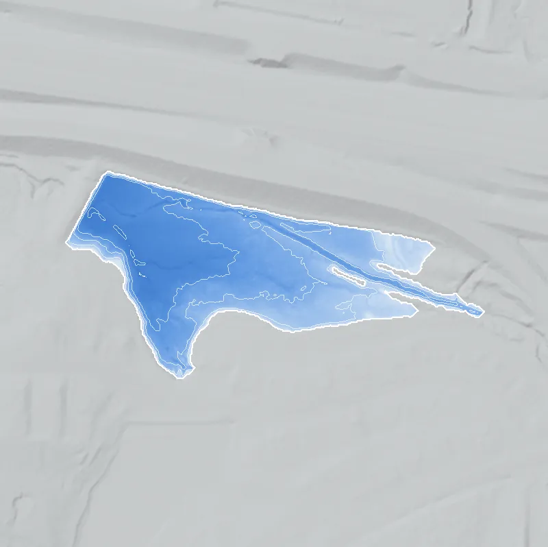
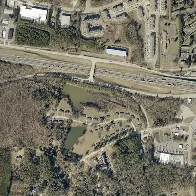
Stewarts Lake, full in 2001
A dam about 20 feet tall held back a lake of roughly 9 to 12 acres, up to about 9 feet deep. Aerial photos show it full from 1955 through 2001, then empty by 2005.
Today: The dam still stands. The old lakebed is a meadow and marsh with a stream winding across it, and a shallow pond of about 3.5 acres has returned at the west end since 2025.
- Area
- 8.2 acres
- Deepest
- about 9 ft
- Method
- Refilled from lidar
- Checked against
- 2001 aerial
The old lakebed is still in the ground. The water was put back in the county’s lidar up to the old shoreline, with any broken dam patched, and checked against the 2001 aerial photo. Pool level is estimated just under the dam's low spot. The north shore is uncertain because road work has reshaped the ground. Why the lake drained is not shown in the photos. How Watermarks work.
From the air
Stewarts Lake was a full 12-acre lake until about 2001-2005, when it lost its water around the time a new I-20 interchange went in beside it. Today it is a meadow, with a small pond back at the west end.
- First seen
- Not there in 1940 (farm fields and a wooded stream); the lake appears in the 1955 aerial photo.
- Gone
- Drained between 2001 and 2005; by 2005 the lakebed was a grassy meadow with no open water.
- Dam in the lidar
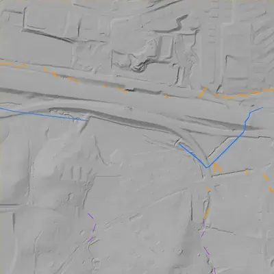
- An earthen dam closes the west end, running about 330 feet from the northwest corner near the I-20 frontage road toward the south-southwest. Its crest is about 814 feet above sea level and it stands about 22 feet tall at the stream channel. No breach shows. A dip about 2 feet below the crest may be a low spot or an outlet cut (uncertain).
- Depth from the lidar
- The county's 2024 lidar survey caught the lakebed dry. If the normal water level was about 811 feet, which is an assumption, the lake was at least 7.9 feet deep near the dam. At that level it would cover about 7.8 acres and hold about 29 acre-feet. These figures are approximate.
Low water and drawdowns
- Between 2001 and 2005: A full, dark lake in 2001 became a grassy meadow in 2005. It never refilled to full size. This coincides with interchange construction nearby, but that is timing only.
- 2013 to 2024: Wet meadow in 2013, then a dry sediment flat with a winding stream channel in the winter photos of 2017 and 2021 to 2024.
- Possibly 1981 possibly: A dark, low-contrast photo hints at low water, but the outline is unchanged and no mud ring shows. This is only a possibility, and the lake was full again by 1993.
Read from aerial photos taken between 1940 and 2026 and from DeKalb County 2024 lidar, then checked by a second reading. How the photos were read.
History
The National Inventory of Dams lists Stewarts Lake (GA01960) in DeKalb County as a 19-foot dam impounding about 13 surface acres and 60 acre-feet, for recreation, low hazard, not rated, with a listed completion year of 1950 and the owner type 'State'. The stream is 'Unknown' in NID. It lies about 2 km southwest of Lithonia. No web source that names this lake could be found, so no builder, name origin, timeline, or access information is verified. The 1950 date and 'State' ownership are single-source entries and should be treated as unconfirmed. 1
Who built it
Not documented. NID gives a completion year of 1950 and a recreation use, but no builder, purpose narrative, or impounded stream. The NID year is often an estimate, so it is not used as a construction date here. 1
Timeline
- 1950 (per NID)National Inventory of Dams lists 1950 as the year completed. NID years are frequently estimates, and no independent record was found to confirm construction. Uncertain 1
The dam
NID lists a dam height of 19 ft, about 13 surface acres, 60 acre-feet of normal storage, Low hazard potential and condition 'Not Rated'. Rebuilds, spillway type, and engineering contracts could not be checked; the Georgia EPD Safe Dams file would be the place to look. 1
- Year in the inventory
- 1950
- Dam height
- 19 ft
- Surface
- 13 acres
- Average depth
- about 4.6 ft
- Owner type
- State
Figures from the U.S. Army Corps of Engineers’ National Inventory of Dams. Its “year” is often a rebuild or survey date, and average depth is storage divided by area.
Around the lake
Civil War
No sourced link to this lake. A Union cavalry report in the Official Records describes the column returning to Union lines near Decatur by way of Lithonia on August 21-22, 1864, about 2 km northeast of the lake; nothing places them at this site.
Segregation
No sourced link to this lake. Lithonia's Bruce Street School, opened in 1938 and described on its historical marker as the first public school for Black students in DeKalb County, is about 3 km northeast. That is neighborhood context only.
Before 1861
No sourced link to this lake. The National Park Service's Lithonia Historic District nomination says the area was settled in the 1830s, the Georgia Railroad arrived in 1845, and the town was incorporated in 1856. Which pre-1860 land lots and roads cover this dam site has not been checked.
Visiting
Getting there
Unknown. NID lists the owner type as 'State', which may mean a state agency or may be a data-entry artifact. Public access could not be confirmed. Check DeKalb County GIS parcel ownership and Georgia DNR property lists before visiting, and stay off private land.
What you can see
Unknown. Nothing has been verified about a visible dam, spillway, or markers.
Look, don’t dig. Parks, cemeteries and preserves are off limits to digging and collecting, and private land needs the owner’s permission to enter.
Open questions
- Who built the dam, and was it in 1950 or another year?
- What stream does it impound? NID says 'Unknown'.
- Is the owner really a State agency, or is 'State' a data-entry artifact?
- Is Stewarts a family surname, a farm name, or a subdivision name?
- Is the lake public, and can it be seen from any public road or trail?
- How does it relate to the nearby Joels Lake (GA01330, about 1.5 km away, listed in NID as privately owned), and is it part of a larger property or park?
Know something? Write to hello@historyunderfoot.org. Family papers, photos and deeds often settle these.
Where to look next
- UGA 1938-40 DeKalb County aerial photographs. They would show whether the pond exists before 1950 and what the surrounding land lots looked like. (University of Georgia Libraries, Map and Government Information Library, historic aerial collection)
- USGS 1:24,000 Lithonia quadrangle editions, 1950s to 1970s, to date first appearance of the water body and its stream (USGS Historical Topographic Map Explorer / Georgia topo collections)
- Georgia EPD Safe Dams Program file for GA01960 (inspection reports, ownership, permit) (Georgia EPD Safe Dams Program)
- DeKalb County GIS parcel and ownership layer, and deed records, to identify the owner and any plat (DeKalb County GIS / Clerk of Superior Court)
- Lithonia and southeast DeKalb newspaper coverage under 'Stewart Lake' and 'Stewarts Lake' (Georgia Historic Newspapers, Digital Library of Georgia)