Still here · DeKalb County · Dam inventory GA03914
Stn Mtn Pk Golf Course Lake
A 4-acre pond behind a 26-foot earth dam on the Stone Mountain Golf Club grounds, with no known stream, builder or completion year.
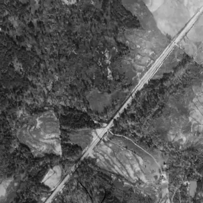
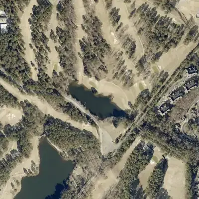
From the air
This golf course lake did not exist in 1955. It was built around 1968 to 1972 with the course, and the aerials caught it drawn down in 2005.
- First seen
- First seen full in 1972, after the basin was bare graded ground in 1968.
- Dam in the lidar
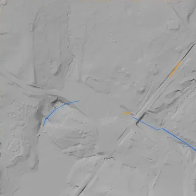
- The dam is the park road embankment on the southwest shore. Its crest is about 879 feet, only 4 to 5 feet above the pond. Ground on the downstream side drops about 33 to 36 feet at the tallest point. No breach or clear spillway shows. The county's older record of 26 feet high is only matched if measured from higher up the slope.
Low water and drawdowns
- 2005: The north and northeast shore sat about 90 feet inward, leaving a wide pale band, and the southeast tail was dry. It was full again by 2012. The cause is unknown.
Read from aerial photos taken between 1940 and 2026 and from DeKalb County 2024 lidar, then checked by a second reading. How the photos were read.
Depth
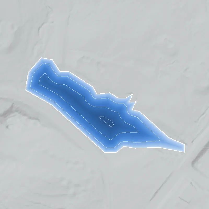
Modeled from the shoreline shape and the dam inventory’s average depth: deepest point about 16 ft. Treat it as an estimate; no survey of the lake bottom was found. How depth is estimated.
History
The National Inventory of Dams lists an earth dam 26 feet high and 600 feet long, impounding a 4-acre pond used for recreation. Normal storage is 29 acre-feet and maximum storage 47. The spillway is uncontrolled. Georgia's Safe Dams program rates hazard Low and the condition 'Not Rated'. NID leaves the stream, drainage area, designer and completion year unknown or blank. The park's golf club has two courses, Stonemont and Lakemont. No history of this pond or of the course layout was found, so its age, builder and any later changes remain undocumented here. 12
Who built it
Not documented in any source reached. NID lists the purpose as Recreation and the name ties it to the park's golf course. The designer is 'UNKNOWN', the stream 'Unknown' and no completion year is given. It is probably a golf-course water feature, but that is inference only. 13
Timeline
- 1958Georgia buys the mountain and forms the Stone Mountain Memorial Association, the state authority that oversees the park. 45
- 1998The Memorial Association enters a public-private partnership with Herschend Family Entertainment for the park's commercial operations. Herschend ended its lease early, in 2018. 5
- May 1, 2005Last inspection date recorded in NID for this dam. 1
- April 20, 2021NID record for this dam last updated; hazard Low, condition Not Rated. 1
Names
- Stn Mtn Pk Golf Course Lake Dam
- Structure name in NID. The lake is unnamed elsewhere in the sources reached. 1
The dam
Earth embankment with a buttress core type. NID lists structural height 26 ft, hydraulic height 19 ft, length 600 ft, uncontrolled spillway and outlet, and no drainage area. Regulation: state jurisdiction and state inspection, no state permitting. Hazard is Low and condition Not Rated. The last NID-recorded inspection was May 1, 2005, on a 5-year frequency; the record was last updated April 20, 2021. No rebuild or contract was found. 1
- Dam height
- 26 ft
- Surface
- 4 acres
- Average depth
- about 7.2 ft
- Owner type
- Private
Figures from the U.S. Army Corps of Engineers’ National Inventory of Dams. Its “year” is often a rebuild or survey date, and average depth is storage divided by area.
Around the lake
Water
NID lists the stream as 'Unknown'. The pond may be fed by park drainage or a tributary of Stone Mountain Creek; this was not checked.
Segregation
Context only: the 1958 law designated the park 'a perpetual memorial to the Confederacy' (Atlanta History Center). No source reached covers golf or lake access by race.
Before 1861
Archaeological evidence indicates Early Archaic people first visited Stone Mountain about 9,000 years ago (New Georgia Encyclopedia). No record ties this pond to any earlier mill, road or land lot.
Visiting
Getting there
Inside Stone Mountain Park, where vehicles need a parking pass (listed at $20 daily or $40 annual). Stone Mountain Golf Club takes public tee-time bookings, but the pond's visibility from public areas was not established. NID lists the owner type as Private, which is unresolved for a park run by a state authority.
What you can see
Not established. Likely an earth dam and an uncontrolled spillway on the golf course. Do not enter play areas without a tee time; the park is no-dig.
Look, don’t dig. Parks, cemeteries and preserves are off limits to digging and collecting, and private land needs the owner’s permission to enter.
Open questions
- Which golf course and which hole does the pond serve, and when was it dug?
- What stream, if any, feeds it? NID says 'Unknown'.
- Who designed and built the dam?
- Why is NID ownership 'Private' for a park on state-created land?
- Has the dam been repaired or inspected since 2005?
Know something? Write to hello@historyunderfoot.org. Family papers, photos and deeds often settle these.
Where to look next
- Georgia EPD Safe Dams file for state ID 044-083-01108 (inspection reports). (Georgia EPD Safe Dams Program, via open records request)
- USGS Stone Mountain 7.5-minute quadrangle editions, to date the pond and any course expansion. (USGS Historical Topographic Map Collection)
- Historical aerial photography of this part of DeKalb County (1930s-40s onward), to see pre-park land use. UGA Libraries' map library is a likely holder; not verified. (UGA Libraries Map and Government Information Library)
- Stone Mountain Golf Club history and course design records, and Memorial Association minutes. (Georgia Archives, Stone Mountain Memorial Association, Atlanta History Center)
Sources
- National Inventory of Dams, GA03914 Stn Mtn Pk Golf Course Lake Dam (feature service record) U.S. Army Corps of Engineers
- Stone Mountain Golf Club Stone Mountain Golf Club
- OpenStreetMap polygons for Stone Mountain Park and Stone Mountain Golf Club (via Nominatim) OpenStreetMap contributors
- Condensed history of Stone Mountain Atlanta History Center
- Stone Mountain Park (New Georgia Encyclopedia) Georgia Humanities / University of Georgia Press