Status unknown · DeKalb County · Dam inventory GA01793
Stoneleigh Lake
A small privately owned recreation lake near Lithonia, DeKalb County, with a 27-foot earth dam listed in the National Inventory of Dams; its history has not been found.
From the air
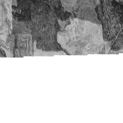
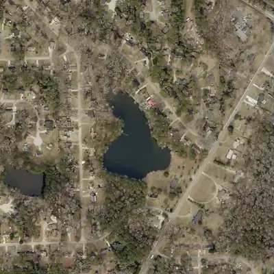
Stoneleigh Lake and its dam are already in a 1955 aerial photo, at least ten years before the 1965 date in the dam inventory. Woods and a creek gully stood there in 1940.
- First seen
- The 1955 aerial already shows the lake and its dam, and the lake probably was still filling.
- Dam in the lidar
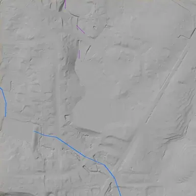
- A straight earth-and-soil embankment at the south end, about 27 feet high and about 375 feet long. The top sits near 927.7 feet, only a few tenths of a foot above the water. No breach, spillway notch or channel shows in the lidar.
Read from aerial photos taken between 1940 and 2026 and from DeKalb County 2024 lidar, then checked by a second reading. How the photos were read.
Depth
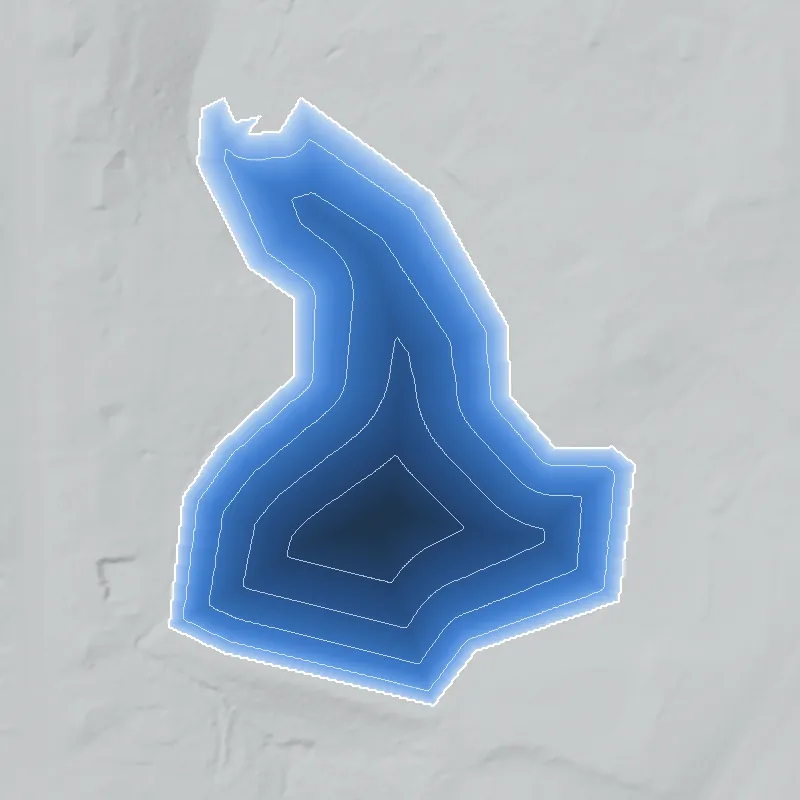
Modeled from the shoreline shape and the dam inventory’s average depth: deepest point about 24 ft. Treat it as an estimate; no survey of the lake bottom was found. How depth is estimated.
History
The National Inventory of Dams lists Stoneleigh Lake Dam as a privately owned earth dam used for recreation, with the city given as Lithonia. NID records a 27-foot dam height, a 387-foot dam length, about 8 surface acres and 83 acre-feet of normal storage. Hazard potential is Low and condition is Not Rated. The stream is listed as Unknown, and the record is state-inspected, with the last inspection dated November 2001. NID gives 1965 as the completion year, but NID years are often estimates. No builder, plat or dam history was found. 1
Who built it
Not established. NID lists the year completed as 1965, the owner type as Private, the primary use as Recreation and the designer as Unknown. The impounded stream is Unknown. The builder, the purpose and any link to a subdivision or club could not be verified. 1
Timeline
The dam
NID lists an earth dam 27 feet high (hydraulic height 11 feet) and 387 feet long, with an uncontrolled spillway and outlet, 8 surface acres and 83 acre-feet of normal storage. Hazard potential is Low; condition is Not Rated; the last state inspection is dated 11/01/2001 with a 5-year frequency. Some fields disagree: max storage (44.5 acre-ft) is below normal storage and drainage area is 0, so the numbers are rough. No rebuild or contract records were found. 1
- Year in the inventory
- 1965
- Dam height
- 27 ft
- Surface
- 8 acres
- Average depth
- about 10.4 ft
- Owner type
- Private
Figures from the U.S. Army Corps of Engineers’ National Inventory of Dams. Its “year” is often a rebuild or survey date, and average depth is storage divided by area.
Visiting
Getting there
Unknown. NID lists private ownership and recreation use, so treat the lake as private unless a county parcel or neighborhood record shows otherwise.
What you can see
Unknown. Nothing has been confirmed about a public viewpoint, spillway or markers. The NID coordinates could be checked against current aerial imagery and county GIS parcel data.
Look, don’t dig. Parks, cemeteries and preserves are off limits to digging and collecting, and private land needs the owner’s permission to enter.
Open questions
- Which subdivision, club or estate does the name Stoneleigh belong to, and when was it platted?
- Which stream does the lake impound? NID lists it as Unknown.
- Was the dam built around 1965, or earlier or later? Historic aerials and topo maps would show.
- Who built the dam and why, and who owns it now (HOA, club or single owner)?
- Has the dam had a Georgia EPD Safe Dams inspection, permit or rebuild since 2001? (Georgia state dam ID in NID: 044-050-01657.)
- Are there any neighborhood-transition or integration stories tied to the lake or its subdivision?
Know something? Write to hello@historyunderfoot.org. Family papers, photos and deeds often settle these.
Where to look next
- 1938-40 UGA DeKalb County aerials, to see whether a pond or stream valley existed before 1965 (UGA Libraries Map and Government Information Library, DeKalb historic aerials)
- USGS topographic map editions (1950s to 1970s) covering the NID coordinates, to date when the lake first appears (USGS Historical Topographic Map Collection (topoView))
- Subdivision plat for Stoneleigh and any lake or dam easement (DeKalb County Superior Court Clerk plat records)
- Georgia EPD Safe Dams Program file for the dam, covering permit, inspection and classification history (Georgia EPD Safe Dams Program)
- Newspaper mentions of the lake or subdivision (Georgia Historic Newspapers (Digital Library of Georgia) and the Atlanta Constitution archive)
- Local history of the neighborhood (DeKalb History Center)
Sources
- National Inventory of Dams record for GA01793 (Stoneleigh Lake Dam), from the NID national CSV download U.S. Army Corps of Engineers, National Inventory of Dams