Still here · Fulton County · Dam inventory GA01953
Sturm and Early Pond
A 5-acre private recreation pond with a 22-foot earthen dam in Atlanta's Fulton County. The NID gives 1956, but no history was found.
From the air
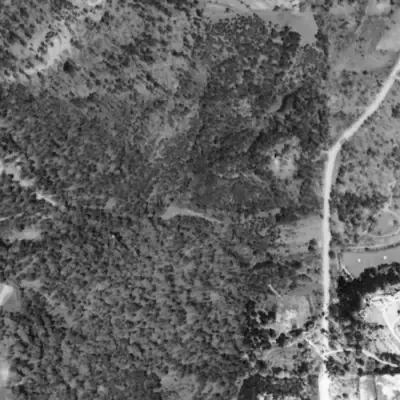
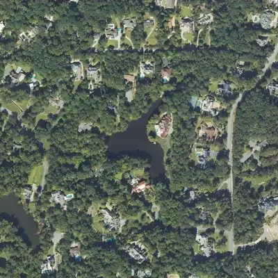
A 22-foot-high earthen dam holds this small pond, which looks the same in every aerial from 1968 to 2023. In 1955 the site was only a graded pad and woods.
- First seen
- The 1955 aerial shows no water, only a bare graded pad beside today's dam line; the full pond is there in 1968.
- Dam in the lidar
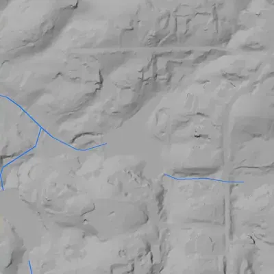
- An earthen dam on the west shore, about 22 feet high and 195 to 215 feet long. The crest is about 3 feet above the pond at its highest and dips to about 1 foot above the pond near the south end. No breach. A groove at the north end might carry overflow, but that is uncertain.
Read from aerial photos taken between 1940 and 2026 and from USGS 3DEP lidar, then checked by a second reading. How the photos were read.
Depth
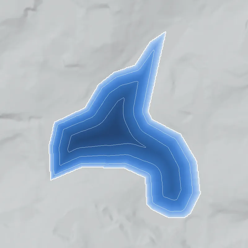
Modeled from the shoreline shape and the dam inventory’s average depth: deepest point about 19 ft. Treat it as an estimate; no survey of the lake bottom was found. How depth is estimated.
History
The National Inventory of Dams lists Sturm and Early Pond as a privately owned earthen recreation dam in Fulton County, with Atlanta as the city. The dam is 22 feet high and 200 feet long. The pond covers about 5 acres and holds about 45 acre-feet at normal pool. The NID gives 1956 as the completion year, which the record does not confirm. Hazard potential is Low and condition is Not Rated. The record lists no stream and no designer, and the state does not treat the dam as jurisdictional. No published history was found, so the builders, purpose and later use are unsettled. 1
Who built it
Not documented. The NID gives 1956 as the completion year and Recreation as the only purpose. It names no impounded stream and lists the designer as unknown. NID completion years are often estimates, so 1956 should be treated as unverified. 1
Timeline
- 1956 (per NID)Completion year recorded in the NID. This is an unverified inventory field and no construction record was found. Uncertain 1
Names
- Elarbee Lake
- Recorded as an alternate name in the project's earlier NID extract (lake_units.json). It does not appear in the current national NID file (updated Sept. 23, 2026), so it is unconfirmed. No source found for who Elarbee was. 1
The dam
NID data (record last updated April 20, 2021): earthen dam, 22 ft high, 200 ft long, about 5 surface acres, 45 acre-feet normal storage and 54 acre-feet maximum, uncontrolled spillway, private owner, Low hazard, condition Not Rated. The NID lists a drainage area of 58 square miles, which is implausible for a pond this size and is probably a data error. The state is recorded as having no jurisdiction, so no state inspection history is expected. No rebuild history or public contract numbers were found. 1
- Year in the inventory
- 1956
- Dam height
- 22 ft
- Surface
- 5 acres
- Average depth
- about 9 ft
- Owner type
- Private
Figures from the U.S. Army Corps of Engineers’ National Inventory of Dams. Its “year” is often a rebuild or survey date, and average depth is storage divided by area.
Around the lake
Water
The NID lists the stream as Unknown. Which watershed drains this pond is unconfirmed.
Visiting
Getting there
Private ownership per the NID. Public access is not documented and none should be assumed.
What you can see
Not confirmed. No public vantage, marker or ruin is documented.
Look, don’t dig. Parks, cemeteries and preserves are off limits to digging and collecting, and private land needs the owner’s permission to enter.
Open questions
- Who were Sturm and Early, and who was Elarbee?
- Was the pond built in 1956, or earlier or later?
- Which stream, if any, does the dam impound?
- Is it an estate or club pond, or a subdivision amenity?
- Does it appear on the UGA 1938-40 aerials or on the 1950s and 1960s USGS topo sheets?
Know something? Write to hello@historyunderfoot.org. Family papers, photos and deeds often settle these.
Where to look next
- Historic aerial photographs for this part of Fulton County, to check whether the pond exists before or after 1956 (USGS EarthExplorer historical aerial collections, and university aerial collections such as UGA's 1938-40 Georgia aerials)
- USGS 1:24,000 topographic map editions covering the coordinates, to compare pond outlines and any named stream (USGS Historical Topographic Map Collection (topoView))
- Fulton County deed and plat records for the parcel, to find subdivision plats or owners' names tied to the pond (Fulton County Clerk of Superior Court real estate records)
- Georgia EPD Safe Dams Program, to ask whether any file exists for a dam the state lists as non-jurisdictional (Georgia Environmental Protection Division Safe Dams Program)
- Newspaper mentions of the surnames plus a pond or lake in northwest Atlanta (Georgia Historic Newspapers (Digital Library of Georgia))
Sources
- National Inventory of Dams, national CSV export (data last updated 2026-9-23), records GA01953 and GA03832 U.S. Army Corps of Engineers, National Inventory of Dams