Status unknown · DeKalb County · Dam inventory GA06147
Turner Hill Lake
A 31-foot dam near Honey Creek with no normal pool, recorded as flood-risk reduction, rated High hazard and owned by a private LLC.

From the air
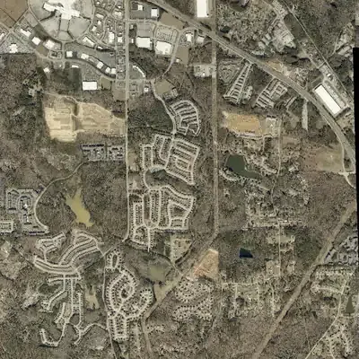
Turner Hill Lake is not a lake. It is a dry flood-control basin behind a 31-foot dam, and it has looked like a marsh or wet meadow in every modern aerial photo.
- First seen
- No true lake ever appears. The first sign of water is a shallow brown patch in the 2005 photo, probably muddy ponding, though it is uncertain.
- Dam in the lidar
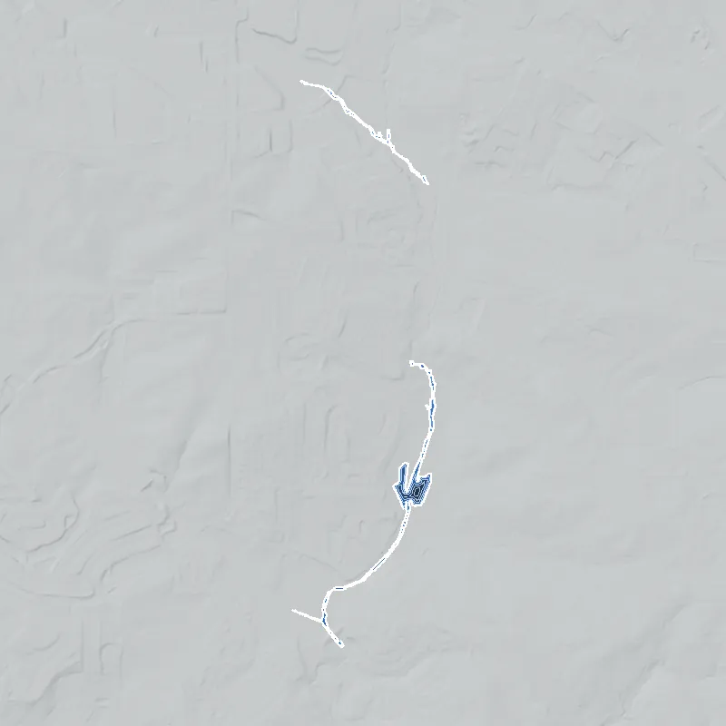
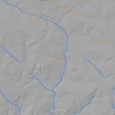
- An earthen dam crosses the valley at the south end of the basin. The crest is about 795 feet above sea level and the creek channel below is about 764 feet, so it stands roughly 31 feet high. It is about 430 to 450 feet long and unbroken. There is no sign of a breach.
Read from aerial photos taken between 1940 and 2026 and from DeKalb County 2024 lidar, then checked by a second reading. How the photos were read.
Depth
Modeled from the shoreline shape and the dam inventory’s average depth: deepest point about 28 ft. Treat it as an estimate; no survey of the lake bottom was found. How depth is estimated.
History
Turner Hill Lake Dam is a 31-foot earthen embankment, 450 feet long, near Honey Creek in DeKalb County. NID gives 1990 as the completion year, Pharr Engineering as designer and flood risk reduction as the sole purpose. It reports zero normal storage and surface area but 1,331 acre-feet of maximum storage, which suggests a mostly dry detention basin. Georgia classes it High hazard and Satisfactory as of a March 2017 inspection, and an emergency action plan has been prepared. The owner of record (NID, 2021) is Allen Family Stonecrest LLC. Nothing on its history or naming was found beyond these records. 12
Who built it
Not fully documented. NID records the dam as completed in 1990 and designed by Pharr Engineering, with flood risk reduction as its purpose. The zero normal pool and 1,331 acre-feet of maximum storage suggest a detention structure, possibly built to control runoff from development, but that is inference. Nothing in the sources reached says who built it or why the name 'Turner Hill' was used. 12
Timeline
- 1990 (per NID)NID gives 1990 as the completion year, with Pharr Engineering as designer. This is a state-file value and is unverified. Uncertain 1
- March 16, 2017Georgia Safe Dams inspection recorded in NID, rating condition Satisfactory for a High-hazard dam with an emergency action plan. The inspection cycle is 2 years. 1
- April 20, 2021NID record last updated. The owner is listed as Allen Family Stonecrest LLC and the purpose as flood risk reduction. 1
Names
- Turner Hill Lake Dam
- Dam name in the National Inventory of Dams (NID). 1
The dam
NID: earthen dam, 31 ft high, 450 ft long, with an uncontrolled spillway and outlet. Maximum storage is 1,331 acre-feet, normal storage and surface area are 0, and the NID drainage area of 3,520 sq mi is implausible for a creek this size. Hazard is High and condition is Satisfactory (March 16, 2017). It is state regulated by the Georgia Safe Dams Program, is inspected every 2 years, and has an emergency action plan prepared, but no inundation maps in NID. Owner of record is Allen Family Stonecrest LLC. The 1990 completion date may not be reliable. No rebuild or contract numbers were found. 1
- Year in the inventory
- 1990
- Dam height
- 31 ft
- Owner type
- Private
Figures from the U.S. Army Corps of Engineers’ National Inventory of Dams. Its “year” is often a rebuild or survey date, and average depth is storage divided by area.
Around the lake
Water
NHD places Honey Creek within about 400 m of the dam, in the Honey Creek watershed (HUC12 030701030106, about 73 sq km). Soggy Bottom Creek also lies within 2.5 km. Named NHD ponds within 2.5 km are Turner Lake (about 0.9 km), Hurst Lake, Forest Lake and Abbot Lake. Honey Creek is in the South River drainage of the Ocmulgee basin.
Visiting
Getting there
Private. The owner of record is a limited liability company, and no public park, trail or viewing access was found in the sources reached.
What you can see
Unconfirmed. Because normal storage is zero, a visitor may see only an embankment and outlet structure, not a lake. Public-road views of the dam were not checked.
Look, don’t dig. Parks, cemeteries and preserves are off limits to digging and collecting, and private land needs the owner’s permission to enter.
Open questions
- Is Turner Hill Lake a standing lake, a dry flood-control basin or a former pond? NID shows zero normal storage and NHD shows no polygon at the point.
- What development or road project prompted the 1990 dam, and does the 1990 date hold up?
- Which stream, if any, does the dam cross? The current NID record names none; NHD shows Honey Creek nearby.
- What is the correct drainage area? NID's 3,520 sq mi is clearly wrong and may be 3,520 acres.
- Where does the 'Turner Hill' name come from: a family, a community, or a road?
- Is the site inside the City of Stonecrest? This was not checked.
Know something? Write to hello@historyunderfoot.org. Family papers, photos and deeds often settle these.
Where to look next
- USGS historic topo editions for the area around Honey Creek at 33.673, -84.085, to see what stood at this site before and after 1990 (USGS topoView)
- UGA 1938-40 DeKalb aerials of the Honey Creek valley, to see pre-development land use, mills or farm ponds (Digital Library of Georgia / UGA Map and Government Information Library)
- Georgia EPD Safe Dams file for dam ID 044-107-04563: permit, engineering design, emergency action plan and inspection reports (Georgia EPD Safe Dams Program (open-records request))
- DeKalb County development permits, stormwater plans and final plats for the parcel, plus any Pharr Engineering plans filed for it (DeKalb County Planning and Development, Land Development records; DeKalb Clerk of Superior Court plat books)
- Zoning cases and county commission agendas mentioning 'Turner Hill' and the owning LLC (DeKalb County Board of Commissioners minutes and agendas; City of Stonecrest records if the parcel is inside city limits)
Sources
- National Inventory of Dams, bulk CSV export (data last updated 2026-9-23), records GA03919 and GA06147 U.S. Army Corps of Engineers, National Inventory of Dams
- USGS National Hydrography Dataset (NHD) MapServer, flowline and waterbody queries at NID coordinates U.S. Geological Survey, The National Map