Still here · DeKalb County · Dam inventory GA01958
Walden Lake
An 11-acre private recreation lake behind a 25-foot earth dam near Snapfinger in DeKalb County; the National Inventory of Dams gives 1975 as the completion year.
From the air
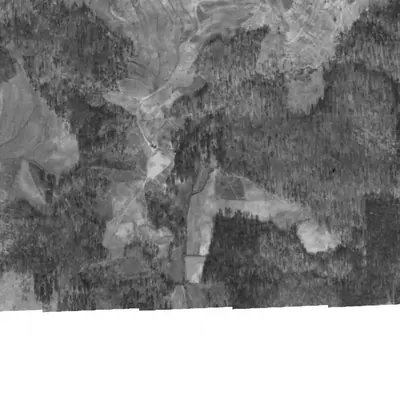
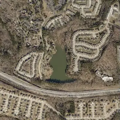
Walden Lake did not exist in 1972. It appeared by 1981 with apartments on its west shore, and its north end has been silting into marsh since the early 1990s.
- First seen
- First seen in 1981, full, so the dam was built between 1972 and 1981.
- Dam in the lidar
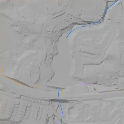
- An earth dam about 565 feet long runs along the south end, between the lake and Interstate 20. Its crest is about 806 feet above sea level, and it stands roughly 25 feet high at its tallest. No breach is visible. The spillway is not visible and may be a pipe or riser.
Read from aerial photos taken between 1940 and 2026 and from DeKalb County 2024 lidar, then checked by a second reading. How the photos were read.
Depth
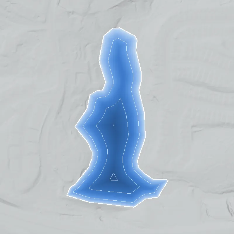
Modeled from the shoreline shape and the dam inventory’s average depth: deepest point about 16 ft. Treat it as an estimate; no survey of the lake bottom was found. How depth is estimated.
History
Walden Lake is a private recreation lake in DeKalb County. The National Inventory of Dams (NID) lists a 25-foot, 600-foot-long earth dam with an uncontrolled spillway, about 11 surface acres, 77 acre-feet of normal storage and 147 acre-feet at maximum. The owner of record is Agapes Safe Haven Inc, and the designer is listed as McGill & Grogan. NID gives 1975 as the completion year, which may be an estimate. Hazard potential is Low, condition is Not Rated, and the last recorded inspection was May 1, 2005. The impounded stream is listed as Unknown. No narrative history was found. 1
Who built it
Not established. NID lists the dam as Earth, designed by McGill & Grogan, with recreation as the sole purpose and 1975 as year completed. The impounded stream is 'Unknown' and drainage area is recorded as 0, so the stream is unrecorded. Who commissioned it, and whether it served a subdivision, camp or club, is unknown. 1
Timeline
- 1975NID lists the year completed as 1975. This field is often an estimate and was not checked against any construction record. Uncertain 1
- May 1, 2005Last inspection date in the NID record. The record lists a 5-year inspection frequency; no later inspection date is listed. 1
- April 20, 2021The NID record for the dam was last updated. It shows hazard potential Low and condition Not Rated. 1
Names
- Walden Lake Dam
- The dam's name in the National Inventory of Dams record. The NID 'Other Names' and 'Former Names' fields are both empty. 1
The dam
Earth dam, 25 ft high (21 ft hydraulic height), 600 ft long. Uncontrolled spillway and uncontrolled outlet. 11 surface acres; 77 acre-ft normal storage, 147 acre-ft maximum. NID flags it as a state jurisdictional dam with state inspection authority (state regulated: No; permitting authority: No). Georgia dam ID 044-043-00707. Hazard potential: Low. Condition: Not Rated. Last inspection: 05/01/2005 (5-year frequency). Emergency action plan: not required. NID record last updated 04/20/2021. No rebuilds or contract numbers were found. 1
- Year in the inventory
- 1975
- Dam height
- 25 ft
- Surface
- 11 acres
- Average depth
- about 7 ft
- Owner type
- Private
Figures from the U.S. Army Corps of Engineers’ National Inventory of Dams. Its “year” is often a rebuild or survey date, and average depth is storage divided by area.
Around the lake
Water
NID lists the stream as Unknown and drainage area as 0, so the watershed is unconfirmed. The NID city field reads 'Snapfinger (Environs)', which only suggests the Snapfinger Creek area; no source links the lake to that creek (likely only).
Visiting
Getting there
NID lists the owner as Agapes Safe Haven Inc, a private owner. Public access is not documented. Treat it as private property unless a source says otherwise.
What you can see
Not verified. NID lists a 25-ft, 600-ft earth dam with an uncontrolled spillway. Visibility from public roads was not checked.
Look, don’t dig. Parks, cemeteries and preserves are off limits to digging and collecting, and private land needs the owner’s permission to enter.
Open questions
- Who built the dam, for what purpose, and was 1975 the real completion date?
- Which stream does it impound? NID says Unknown and drainage area is 0.
- What is the lake's connection to Agapes Safe Haven Inc, and what were the earlier owners or uses?
- Has the dam been inspected or repaired since May 2005?
- Was the site a farm pond, subdivision amenity or camp lake before or after 1975?
Know something? Write to hello@historyunderfoot.org. Family papers, photos and deeds often settle these.
Where to look next
- Historic aerial photographs of DeKalb County from the late 1930s onward, if the collection covers this area, would show the valley before any dam. Compare with later aerials to date the lake. (University of Georgia Libraries, Map and Government Information Library, historic aerial collection)
- USGS 7.5-minute topo editions before and after 1975 for the quad covering this point. First appearance of a blue lake symbol would bracket the construction date. (USGS Historical Topographic Map Collection (TopoView))
- Georgia EPD Safe Dams file for dam ID 044-043-00707, possibly including original plans and the 2005 inspection report. (Georgia EPD Safe Dams Program (open records request))
- DeKalb County plats and deeds for the parcel, to identify the owner or developer in 1975 and earlier. Search for McGill & Grogan project records. (DeKalb County Superior Court Clerk real estate records; DeKalb History Center)
- Georgia Historic Newspapers search for 'Walden Lake' with DeKalb and Snapfinger, 1970s to 1990s. (Digital Library of Georgia, Georgia Historic Newspapers)
Sources
- National Inventory of Dams, national CSV export (record GA01958, Walden Lake Dam; data last updated 2026-9-23) U.S. Army Corps of Engineers, National Inventory of Dams