Still here · DeKalb County · Dam inventory GA01317
Ward Lake
An 18-acre, locally owned recreation dam near Snapfinger in DeKalb County, listed since about 1950. Only dam-safety and map records were found; no narrative history.
From the air
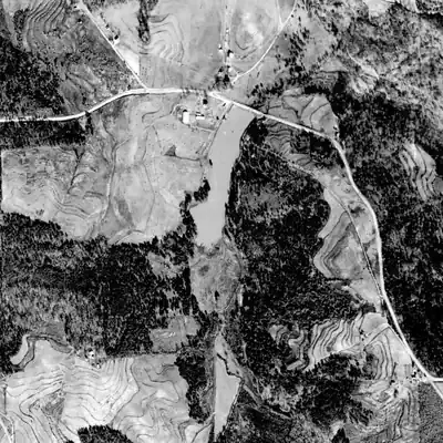
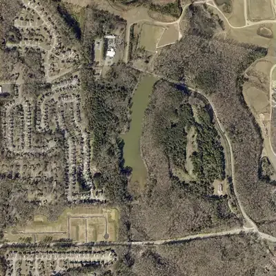
Ward Lake was probably only a small pond at its north end in 1940 and 1955. By 1968 it had grown to full length, and the dam was probably raised or rebuilt.
- First seen
- In 1940 a smooth pond appears against the road at the north end, about 60% of today's length, with marsh to the south.
- Dam in the lidar
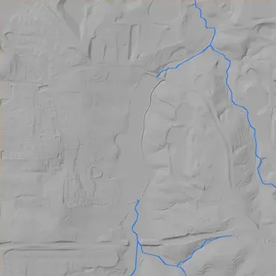
- An earth dam at the north end carries a road across the valley. It is about 25 feet high at its tallest and roughly 300 to 420 feet long. The crest sits about 6 to 7 feet above the lake. No breach is visible. The spillway cannot be identified.
Read from aerial photos taken between 1940 and 2026 and from DeKalb County 2024 lidar, then checked by a second reading. How the photos were read.
Depth
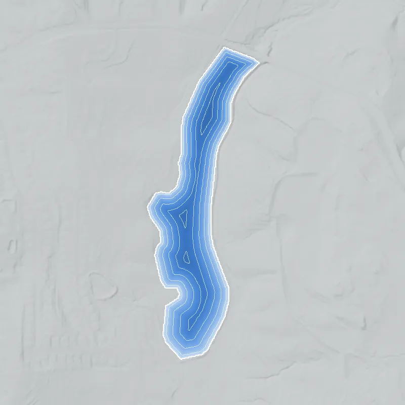
Modeled from the shoreline shape and the dam inventory’s average depth: deepest point about 11 ft. Treat it as an estimate; no survey of the lake bottom was found. How depth is estimated.
History
Ward Lake is an 18-acre impoundment in DeKalb County. The National Inventory of Dams lists an earth dam 25 feet high and 300 feet long, owned by a local government, used for recreation, with 'Low' hazard and 'Not Rated' condition. The NID gives a completion year of 1950 and 'DeKalb Co.' as designer, but the stream field reads 'Unknown'. USGS hydrography names the lake and shows it on an unnamed stream that drains to Conley Creek, then the South River. No history of who built it, its namesake, or any club use could be found; this dossier is a set of record facts and leads. 12
Who built it
Not documented in the sources reached. The NID lists DeKalb Co. as designer, 'Recreation' as the only purpose, a local-government owner and a 1950 completion year. NID years are often estimates, and no primary record confirms 1950. The builder, the reason for the dam, and the person or family behind the name 'Ward' are unknown. 1
Timeline
- c. 1950NID year completed for Ward Lake Dam, with DeKalb Co. listed as designer. Treat the year as an unverified estimate. Uncertain 1
- July 7, 1999Feature date of the medium-resolution USGS hydrography polygon named 'Ward Lake', about 0.071 sq km (about 17.5 acres). The map source behind it was not checked. 2
- November 19, 2004Feature date of the high-resolution hydrography record for Ward Lake: a perennial lake at normal pool, about 0.065 sq km (about 16 acres). 2
- May 2005Last inspection date recorded in the NID for the dam. 1
- February 28, 2012USGS links a dam point at this spot to NID ID GA01317 in the hydrography network, by photo interpretation. 2
- April 20, 2021NID record last updated; hazard 'Low', condition 'Not Rated', no federal regulation. 1
Names
- Ward Lake Dam
- Name of the structure in the National Inventory of Dams; NID lists no other or former names. 1
The dam
NID: earth dam, 25 ft high (17 ft hydraulic height), 300 ft long. Uncontrolled spillway and outlet. Normal storage 99 acre-ft, maximum 187 acre-ft, surface area 18 acres. State ID 044-041-00705; NID flags it as state-jurisdictional and state-inspected on a 5-year cycle (but not 'state regulated'); last inspection date in NID is May 2005. Hazard Low; condition Not Rated. NID drainage area is 0.0, which is missing data; USGS NHDPlus flowline attributes give about 4.6 sq km (about 1.8 sq mi) draining to the lake. No rebuild or contract records found. 12
- Year in the inventory
- 1950
- Dam height
- 25 ft
- Surface
- 18 acres
- Average depth
- about 5.5 ft
- Owner type
- Local Government
Figures from the U.S. Army Corps of Engineers’ National Inventory of Dams. Its “year” is often a rebuild or survey date, and average depth is storage divided by area.
Around the lake
Water
NID gives the stream as 'Unknown' and the nearest place as Snapfinger. In the USGS NHDPlus flowlines, an unnamed artificial path runs through the lake (about 4.6 sq km upstream) into an unnamed stream (about 6.1 sq km), which joins Conley Creek and then the South River. That is the lake's stream in the hydrography data; no source names it. The reach code 03070103004384 sits in the 03070103 subbasin, which as far as I know is the Upper Ocmulgee.
Visiting
Getting there
NID lists the owner type as Local Government. Whether the shore is open to the public, a county park, or closed utility or county land was not confirmed; DeKalb parks pages and GIS records could not be reached.
What you can see
Unknown. NID lists an earth embankment with an uncontrolled spillway. Current aerial imagery, public viewpoints and signs were not checked, so the lake's existence rests on the 2004 hydrography and the 2021 NID update.
Look, don’t dig. Parks, cemeteries and preserves are off limits to digging and collecting, and private land needs the owner’s permission to enter.
Open questions
- Who built Ward Lake and when? NID says c. 1950 with DeKalb Co. as designer, but no primary record was found.
- Who was 'Ward'? A family, landowner, developer or official?
- Is the lake open to the public, a county-managed property, or closed land?
- Did it host a swim club, fishing lake or segregation-era recreation use? Nothing was found either way.
- Was any repair or spillway work done after the May 2005 inspection?
Know something? Write to hello@historyunderfoot.org. Family papers, photos and deeds often settle these.
Where to look next
- Georgia EPD Safe Dams file for state ID 044-041-00705: inspection reports, owner history, repair orders. The program page lists contacts; use a Georgia Open Records request if needed. (Georgia EPD Watershed Protection Branch, Safe Dams Program)
- Historical aerial photographs of DeKalb County from the UGA Libraries map collections (1930s-40s coverage, if held): would show whether the valley was farmland before the dam. (Digital Library of Georgia / UGA Libraries map collections)
- USGS topographic quadrangle editions covering this area (1950s to 1970s): first appearance of the lake symbol would bracket the construction date. (USGS Historical Topographic Map Collection (topoView))
- Georgia Historic Newspapers full-text search for 'Ward Lake' with DeKalb terms, 1945-1975 (Decatur and DeKalb papers). (Georgia Historic Newspapers)
- DeKalb County deed and plat records, parks and public works property files, and commission minutes for the parcel and any acquisition of the lake tract. (DeKalb County Clerk of Superior Court / DeKalb Parks and Recreation)