Still here · DeKalb County · Dam inventory GA03920
Exchange Park Lake (Upper)
A 2-acre, 26-foot earth dam at DeKalb County's Exchange Park in Panthersville; the History Center's park folder runs 1961-1989, but the lake's origin is unrecorded.
From the air
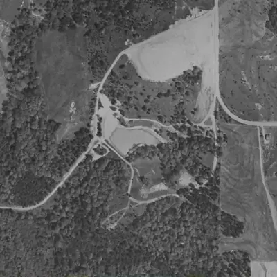
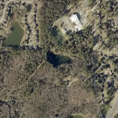
This small lake's dam and basin already stand in a 1955 aerial photo. The 1955 pool looks smaller than today's, and the lake has kept one outline since 1981.
- First seen
- The dam road and basin, and probably a pool, appear in the 1955 aerial, the earliest usable photo.
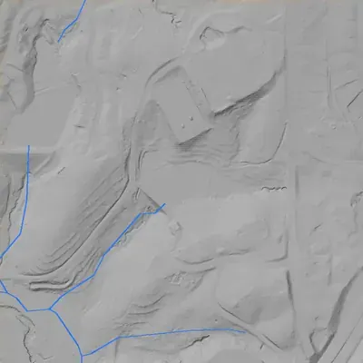
- Dam in the lidar
- An earth dam runs along the southwest shore. It is about 28 to 30 feet high at the southeast end, where the outlet stream starts, and shorter toward the northwest. The visible crest is about 235 feet long. It sits only 1 to 2 feet above the water. No breach and no cut spillway are visible.
Low water and drawdowns
- 1955 (possible) possibly: The pool sat 25 to 50 feet inside today's north shore and lacked the northwest corner and east tail. It may be low water or a new pond still filling. Low confidence.
- 1968 (possible) possibly: A dark shoreline ran roughly 50 to 80 feet inside today's north shore, with no east tail. It looks larger again by 1972. Low confidence.
Read from aerial photos taken between 1940 and 2026 and from DeKalb County 2024 lidar, then checked by a second reading. How the photos were read.
Depth
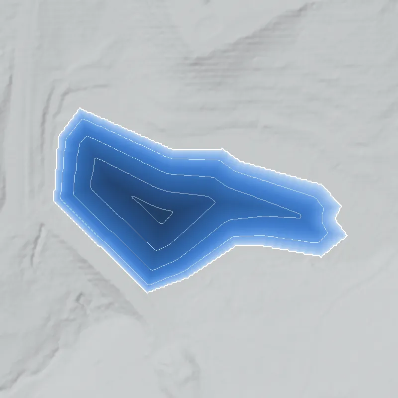
Modeled from the shoreline shape and the dam inventory’s average depth: deepest point about 21 ft. Treat it as an estimate; no survey of the lake bottom was found. How depth is estimated.
History
The NID lists Exchange Park Lake as a county-owned recreation dam: earth, 26 feet high, 300 feet long, 2 surface acres, low hazard, completion year undetermined. It sits near Exchange Recreation Center at 2771 Columbia Drive, whose county page lists a lake and trails, multi-use fields, tennis courts, and a gymnasium. The DeKalb History Center holds an 'Exchange park 1961-1989' folder in its parks collection. Who built the lake, when, and where the park's name came from is not established. 1234
Who built it
Not documented. NID lists designer 'Unknown' and no completion year. The county parks department was formally begun in 1955, and the History Center's parks-collection folder for Exchange Park is dated 1961-1989, so the county's park records probably start in the early 1960s, but the lake could be older or newer than the park. The stream is 'Unknown' in the NID; USGS NHD shows unnamed flowlines within about 250 m and Shoal Creek within about 400 m. 135
Timeline
- 1955DeKalb County's parks and recreation department is formally begun (a bond program started the process in 1952), according to the DeKalb History Center finding aid for its parks collection (1952-1995). 3
- 1961-1989Date range of the DeKalb History Center parks-collection folder 'Exchange park' (Box 6, Folder 4). Contents not yet examined. 3
- September 1, 2005Last recorded state inspection of the dam in the NID. 1
- April 20, 2021NID record for the dam last updated; it still shows no completion year. 1
Names
The dam
NID: earth dam, 26 ft high (hydraulic height 17 ft), 300 ft long, 2 surface acres, 19 acre-ft normal and 21 acre-ft maximum storage, uncontrolled spillway and outlet. Owner DeKalb County (Local Government), hazard Low, condition 'Not Rated', state-jurisdictional (not state-regulated), last inspected 09/01/2005, record updated 04/20/2021. At 26 ft it meets Georgia's 25-ft-or-more definition of a dam; the state says Category II dams have no regulatory requirements but are re-inventoried at least every 5 years (NID's Low hazard suggests Category II; that mapping is an inference). No rebuild or contract records found. 16
- Dam height
- 26 ft
- Surface
- 2 acres
- Average depth
- about 9.5 ft
- Owner type
- Local Government
Figures from the U.S. Army Corps of Engineers’ National Inventory of Dams. Its “year” is often a rebuild or survey date, and average depth is storage divided by area.
Around the lake
Water
Small park pond in the Shoal Creek area of south DeKalb per USGS NHD; NID lists the stream as 'Unknown'. A neighboring pond (Mathis Lake) is about 240 m west.
Visiting
Getting there
Public. Exchange Recreation Center, 2771 Columbia Drive, Decatur, is a DeKalb County park; the county page lists multi-use fields, tennis courts, playground, lake and trails, picnic area, gymnasium and multi-purpose rooms. Center hours are posted on the county page.
What you can see
The county lists a lake and trails in the park. No historical marker, interpretive sign, or dam feature is documented. Whether the dam and spillway can be seen from the trails is not verified.
Look, don’t dig. Parks, cemeteries and preserves are off limits to digging and collecting, and private land needs the owner’s permission to enter.
Open questions
- Who built the lake, and was it a farm pond (possibly linked to the Mathis dairy land) before the county acquired the land?
- Why is the park named 'Exchange'? An Exchange Club or land exchange are guesses only; nothing was found.
- Was the park segregated before 1960s integration, and when was it opened to all residents?
- Which stream does the pond impound, and how is it connected to Mathis Lake, its NID partner?
- Has the dam had any inspection or repair since 2005?
Know something? Write to hello@historyunderfoot.org. Family papers, photos and deeds often settle these.
Where to look next
- 'Exchange park 1961-1989' folder, DeKalb Parks and Recreation records (Box 6, Folder 4). (DeKalb History Center Archives)
- DeKalb County Board of Commissioners minutes (1950s-60s) for Exchange Park land purchase; DeKalb Recreation Department annual reports. (DeKalb County Clerk / Georgia Archives)
- The Decatur-DeKalb News Era and Atlanta Constitution/Journal for 'Exchange Park' openings, dedications and desegregation of DeKalb recreation. (Georgia Historic Newspapers; Atlanta History Center newspaper archives)
- UGA 1938-40 DeKalb aerials and 1949 GSU Atlanta aerials: was there a pond at 33.705, -84.255 before the park? (UGA Map & Government Information Library; Georgia State University Library)
- Georgia EPD Safe Dams file for state ID 044-053-00792, and DeKalb Parks capital-project records for any dam or trail work. (Georgia EPD Safe Dams Program; DeKalb County Recreation, Parks and Cultural Affairs)
Sources
- National Inventory of Dams, national CSV (records GA03918 and GA03920), data last updated 2026-9-23 U.S. Army Corps of Engineers
- Parks & Facilities: Exchange Recreation Center, 2771 Columbia Drive DeKalb County, GA
- DeKalb Parks and Recreation collection finding aid (folders 'Exchange park 1961-1989' and 'Mathis Dairy - Soapstone 1995'; department begun 1955) DeKalb History Center
- U.S. Census Geocoder, address lookups (2771 Columbia Dr, 3181 Rainbow Dr, Rainbow Dr & Columbia Dr, Decatur GA) and coordinate-to-geography lookups U.S. Census Bureau
- USGS National Hydrography Dataset map service (flowline and waterbody queries near 33.7056, -84.2578) U.S. Geological Survey
- Safe Dams Program Frequently Asked Questions Georgia Environmental Protection Division