Still here · DeKalb County · Dam inventory GA00227
Scott Candler Reservoir #2
Second raw-water storage basin at DeKalb's Scott Candler plant: a 59-foot high-hazard dam holding about 839 acre-feet, beside Reservoir #1.
From the air
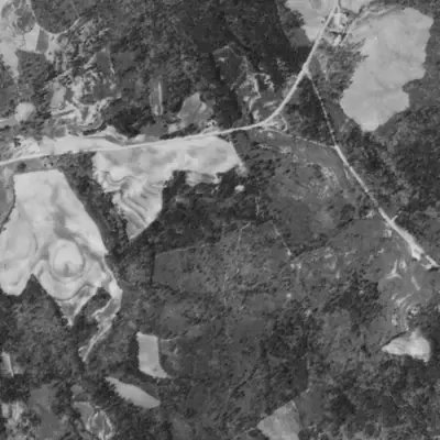
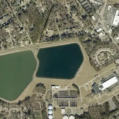
Scott Candler Reservoir #2 was about 60% of today's size in 1955. The county enlarged it by roughly half between 1972 and 1981, flooding a marshy north cove and eastern forest.
- First seen
- No water in the 1940 aerial; a full pond appears in 1955, in the western and central part of today's outline.
- Dam in the lidar
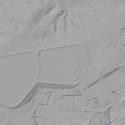
- Lidar shows a level, unbroken crest at about 1,056 ft, roughly 7 ft above the water and about 26 ft wide. The main dam is the south embankment. It stands about 55 ft above the old stream valley at its southwest corner, and about 12 ft above ground on the north road. No breach or spillway cut is visible.
Read from aerial photos taken between 1940 and 2026 and from DeKalb County 2024 lidar, then checked by a second reading. How the photos were read.
Depth
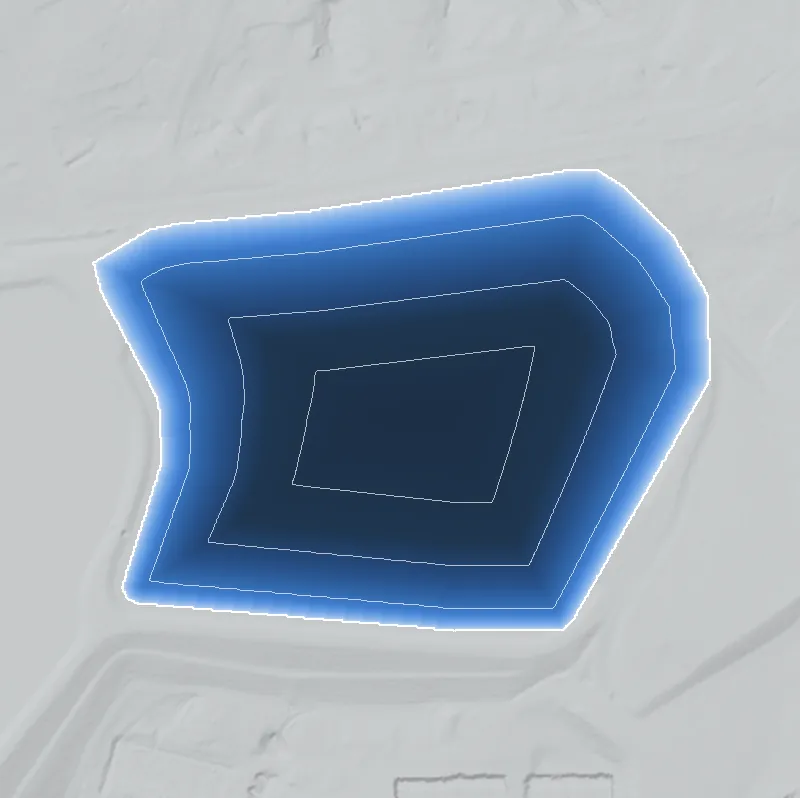
Modeled from the shoreline shape and the dam inventory’s average depth: deepest point about 39 ft. Treat it as an estimate; no survey of the lake bottom was found. How depth is estimated.
History
Reservoir #2 is one of the raw-water basins at the Scott Candler Water Treatment Plant, next to Reservoir #1. The NID gives a 59-foot dam and 839 acre-feet of storage (about 273 million gallons) but leaves the completion year, dam type, stream, primary use and surface area blank. Rough Draft Atlanta says one reservoir dates to 1942 and another to 1953, with expansion in 2004; the record does not say which is #2. Georgia's Safe Dams Program rates it High hazard and Satisfactory as of February 2021. It is working county utility infrastructure, not a park. 12
Who built it
Built by DeKalb County as raw-water storage for the Scott Candler waterworks, whose construction began in 1941. The NID leaves the year, dam type, stream and primary use blank. Whether it was the 1942 basin, the 1953 basin or part of the 2002-04 rebuild is not documented in the sources found. 1324
Timeline
- 1941Construction of the DeKalb waterworks served by the Scott Candler plant begins. 3
- 1942 and 1953Rough Draft Atlanta dates one reservoir dam to 1942 and another to 1953; which is #2 is not stated. Uncertain 2
- 2002-2004A third reservoir is added and the existing reservoirs redesigned in a $48 million Stratus project; raw-water storage rises from about 200 million to about 1 billion gallons. 54
- February 4, 2021Latest NID-recorded state inspection; condition Satisfactory, hazard High. 1
Names
- Scott Candler Reservoir #2 (NID name, no 'Dam' in the title)
- Official NID name; state dam record number 044-108-05350. No other names found. 1
The dam
NID: dam 59 ft high, maximum storage 839 acre-feet (about 273 million gallons), surface area not recorded, uncontrolled spillway and outlet, owner DeKalb County, regulated by the Georgia Safe Dams Program. Hazard: High. Condition: Satisfactory, last inspected and assessed February 4, 2021 (2-year cycle). The 2004 Stratus project provided a new reservoir and a redesign of the existing reservoirs; no per-dam engineering detail was found. 14
- Dam height
- 59 ft
- Owner type
- Local Government
Figures from the U.S. Army Corps of Engineers’ National Inventory of Dams. Its “year” is often a rebuild or survey date, and average depth is storage divided by area.
Around the lake
Water
DeKalb's drinking water comes from the Chattahoochee River, pumped from a raw-water station in north Fulton County; the county page does not describe how it reaches each basin.
Visiting
Getting there
County-owned working water-plant infrastructure; no public access program was found in the sources reviewed.
What you can see
Embankments are part of the plant complex; no marker was found in the sources reviewed. Ongoing plant projects, including demolition of the old filter facility, mean the site continues to change.
Look, don’t dig. Parks, cemeteries and preserves are off limits to digging and collecting, and private land needs the owner’s permission to enter.
Open questions
- Year built, and whether this is the 1942 or 1953 basin.
- Surface area and normal pool, which the NID leaves at zero.
- Whether this dam was raised or rebuilt in the 2002-04 project.
- Which stream valley the basin occupies.
Know something? Write to hello@historyunderfoot.org. Family papers, photos and deeds often settle these.
Where to look next
- Georgia Safe Dams file for dam 044-108-05350 (inspection reports, drawings) (Georgia EPD Safe Dams Program open records request)
- 1930s-40s aerials and USGS topo editions from before and after 1953 to see which basin appears when (UGA Libraries / USGS TopoView)
- DeKalb New Era coverage of the 1953 reservoir work (Microfilm at the Decatur Library, per the DeKalb History Center)
Sources
- National Inventory of Dams records GA01311, GA00227, GA00063 (ArcGIS feature service mirror of USACE NID) U.S. Army Corps of Engineers (NID)
- State monitors 'high-hazard' dams Rough Draft Atlanta
- Single-Family Residential Development in DeKalb County, 1945-1970 DeKalb History Center
- DeKalb County Scott Candler Reservoir and Waterlines Stratus Engineering
- Dekalb County (GA) $152 million Water Plant Construction Nears Beginning Wastewater Digest